

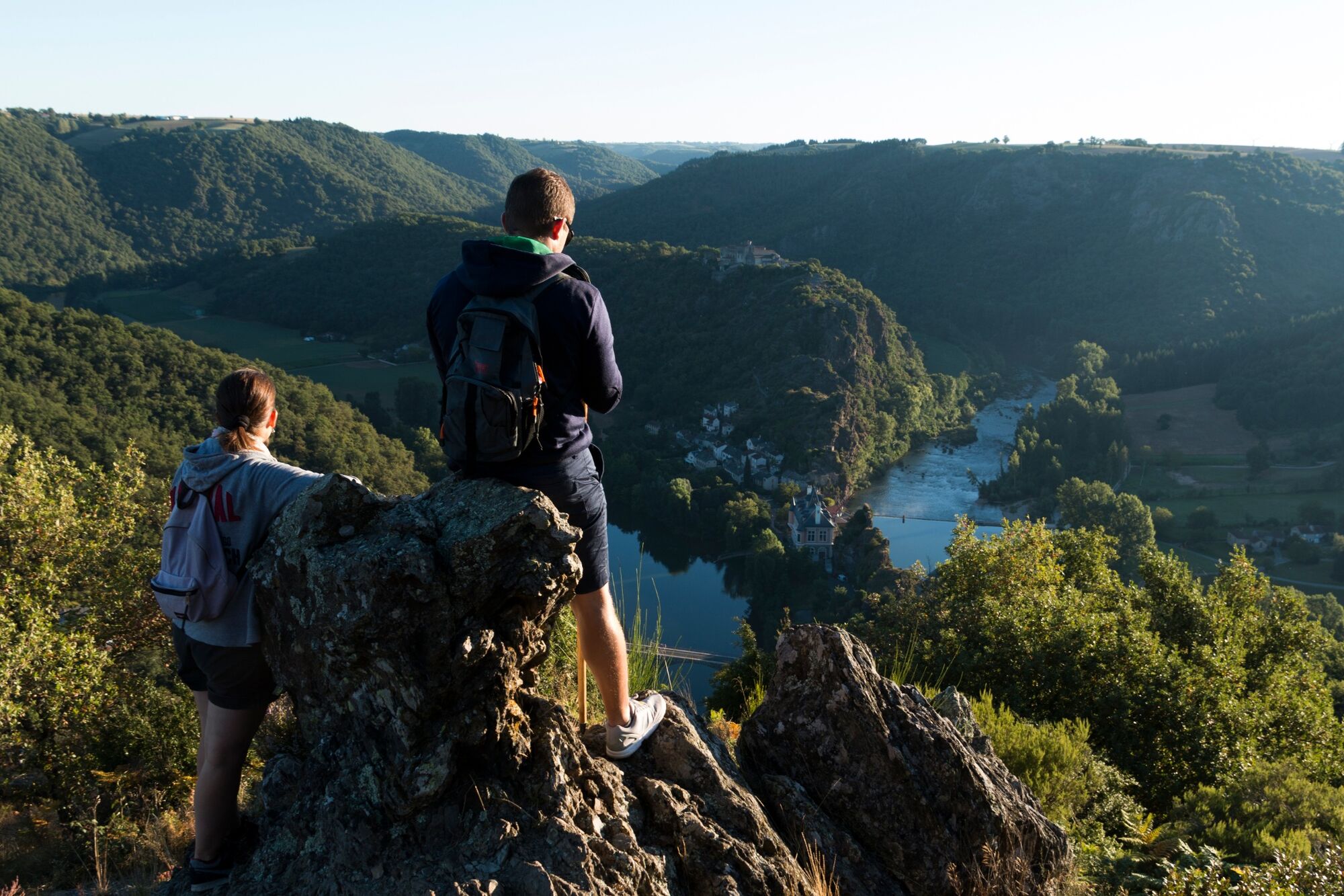
© Pascale Walter

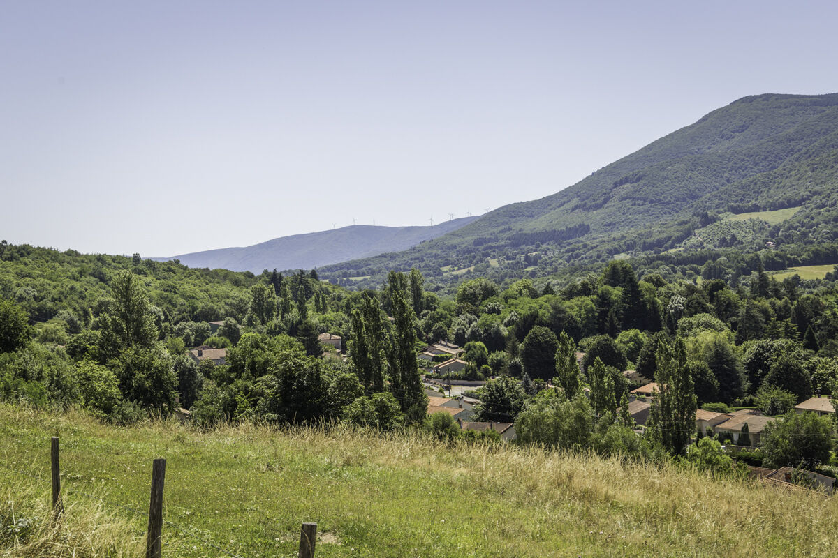
© Vent d'Autan

© Pascale Walter
- Brief description
-
This 232km trail offers hikers a formidable walk through Tarn’s patchwork landscapes.
- Difficulty
-
difficult
- Rating
-
- Route
-
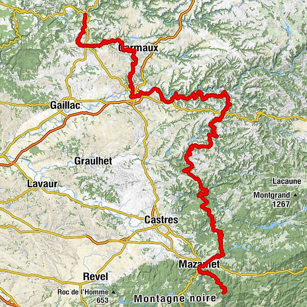
Saint-Martin-LaguépieLaguépieLe Fraysse1.5 kmLes Cabannes10.8 kmÉglise Saint-Michel12.1 kmCordes-sur-Ciel13.3 kmÉglise Saint-Sauveur21.1 kmSalles sur Cérou21.3 kmLOU PAÏDOL21.3 kmLe Petit Napoli27.8 kmMonestiés27.8 kmAuberge Occitane27.9 kmLe Barry28.4 kmPouilhounac30.9 kmSaint-Benoît-de-Carmaux34.0 kmLe Bourg34.2 kmÉglise Saint-Benoît34.3 kmFontgrande35.0 kmCarmaux35.8 kmLa Frayssinette Basse41.7 kmL’Auberge de Cap’Découverte43.0 kmCagnac-les-Mines47.0 kmÉglise Saint-Dalmazy48.9 kmTables48.9 kmAlbi58.0 kmLe Domaine de la Mouline59.3 kmÉglise Saint-Antoine62.8 kmLes Bordes64.3 kmSaint-Juéry65.8 kmRousset67.0 kmLes Avalats69.3 kmPuech Moutou72.0 kmMasse72.3 kmMarsal76.9 kmMaillebrac77.5 kmLe Gougeac79.9 kmCaudaval81.4 kmLous Cambous81.5 kmLa Resso81.5 kmFabas81.6 kmLa Sieurarié88.1 kmAmbialet92.1 kmPIZZA VALLEE92.2 kmBonneval99.5 kmSaint-André104.7 kmVilleneuve-sur-Tarn106.9 kmAlban117.9 kmÉglise Notre-Dame118.2 kmNotre-Dame d'Ourtiguet124.7 kmPaulinet128.8 kmÉglise Saint-Projet de Paulin129.1 kmRayssac137.8 kmÉglise Saint-Michel144.5 kmMont-Roc144.6 kmSaysses147.6 kmLa Grabasse147.9 kmÉglise Saint-Pierre154.6 kmSalclas157.8 kmPradel169.1 kmLaslagues Basses182.5 kmLe Lac184.2 kmGabaude186.6 kmVialavert187.8 kmOms190.4 kmLa Sabatarié191.0 kmFontbelle193.6 kmCambounès196.1 kmLe Vintrou208.1 kmMontlédier214.3 kmÉglise Saint-Jean-Baptiste215.0 kmPont-de-l'Arn215.2 kmBout-du-Pont-de-l'Arn215.5 kmLagarrigue216.2 kmMazamet218.6 kmMoulin de l'Oule220.6 kmHautpoul220.9 kmCastaunouze221.4 kmCol del Tap (1,135 m)234.1 kmPortail de Nore234.5 kmPic de Nore (1,211 m)236.3 km
- Best season
-
JanFebMarAprMayJunJulAugSepOctNovDec
- Description
-
This Grande Randonnée circuit, which covers a distance of approximately 232 kilometres, is a wonderful getaway to discover all the splendours that characterise the Tarn department. All sorts of natural and heritage landscapes will be offered to your delighted and amazed eyes. We can mention the Causses in the north-west of the department, the medieval bastides, the plain of the Tarn with the isthmus of Ambialet, the granite plateau of Sidobre as well as the Montagne Noire in the south...
This long journey will undoubtedly give you the desire to get to know the Tarn in its every corner, in search of the authentic. - Highest point
- 1,205 m
- Endpoint
-
Pic de Nore
- Height profile
-
 © outdooractive.com
 - Additional information
-
APIDAE tourism data updated on 06/01/2023 by "Tarn Tourisme".
Spotted an error? Write to the owner with the following information:
File name: GR®36, la Traversée du Tarn du Nord au Sud | Record identifier: 848640 | URL (link) for this Outdooractive page.

- Author
-
The tour GR®36, the Tarn Crossing from North to South is used by outdooractive.com provided.
GPS Downloads


Other tours in the regions
-
Tarn
331
-
Centre Tarn
170