

© Sidobre Tourisme

© Sidobre tourisme

© Sidobre Tourisme
- Brief description
-
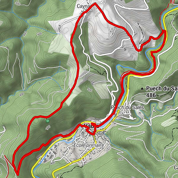
Time 3 hours - Distance 10km
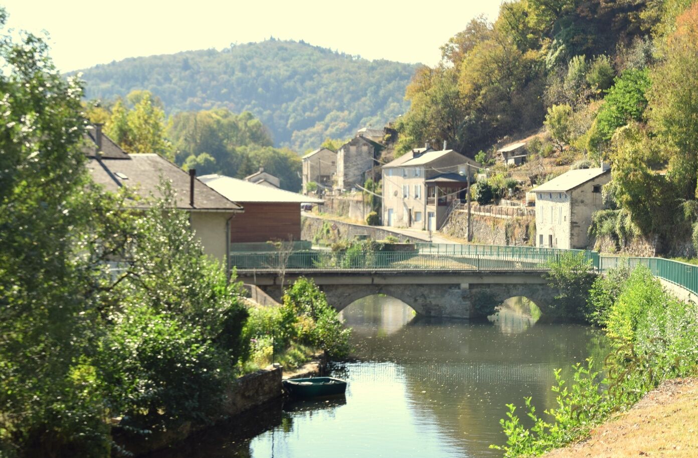
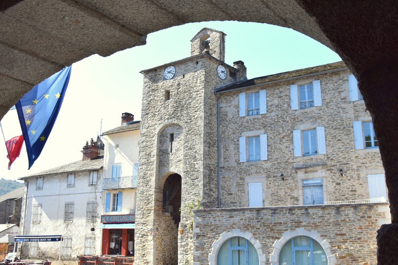
Hiking trail with a lot of nature, mostly shady, a few steep climbs but magnificent views. Also enjoy a visit of the village of Vabre. - Difficulty
-
easy
- Rating
-
- Route
-
Église Sainte-AnneLe Grillon de l'Horloge0.1 kmVabre0.3 kmCaynac4.3 kmTemple9.1 kmVabre9.1 kmLe Grillon de l'Horloge9.2 kmÉglise Sainte-Anne9.2 km
- Description
-
It’s possible to go for a shorter walk: Time 2.5 hours - distance 9km
max. altitude: 540 m - Highest point
- 563 m
- Height profile
-
 © outdooractive.com
 - Additional information
-
APIDAE tourism data updated on 20/07/2021 by "Office de Tourisme Sidobre Vals et Plateaux".
Spotted an error? Write to the owner with the following information:
File name: Randonnée des crêtes du Bau del Poun | Record identifier: 4803844 | URL (link) for this Outdooractive page.

- Author
-
The tour Path of the crests of Bau del Poun is used by outdooractive.com provided.
GPS Downloads


Other tours in the regions
-
Tarn
331
-
Sidobre Vals et Plateaux
137