
- Brief description
-
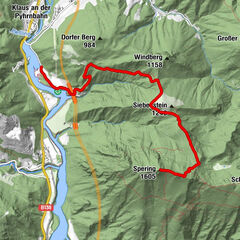
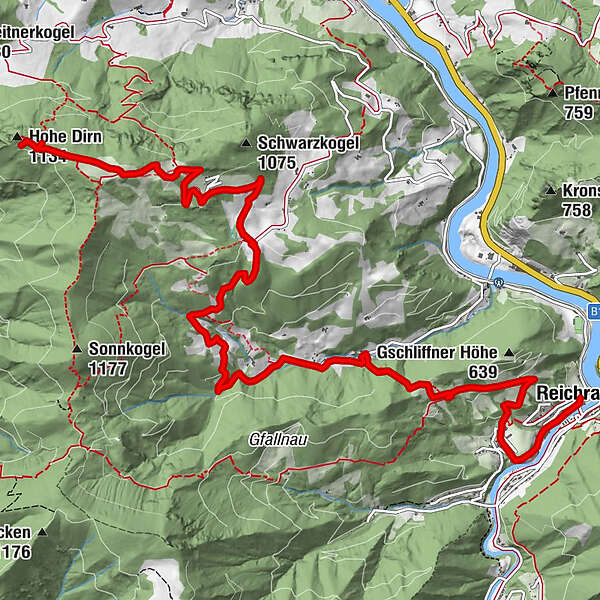
Summit and hut hike from the center of Reichraming over the Rohrbachgraben to the Hohe Dirn and to the Anton Schosser Hütte
- Difficulty
-
medium
- Rating
-
- Starting point
-
Reichraming/center of the village
- Route
-
ReichramingPfarrkirche Reichraming0.0 kmHohe Dirn (1,134 m)11.4 km
- Best season
-
JanFebMarAprMayJunJulAugSepOctNovDec
- Description
-
The trail leads from the center of Reichraming over the Gschliffner-Höhe to the Forellenwirt Damhofer, further to the farmhouse Hamberg and from there to the Anton Schosser Hütte and to the Hohe Dirn.
Trail number: HD3
- Directions
-
From the center of Reichraming the trail leads at the Ortbauerngut inn up to the Gschliff. Continue right into the Rohrbachgraben to the Gasthaus Damhofer and Hamberg farm, from where the HD4 hiking trail leads to the Anton Schosser Hütte and up to the Hohe Dirn.
- Highest point
- 1,131 m
- Endpoint
-
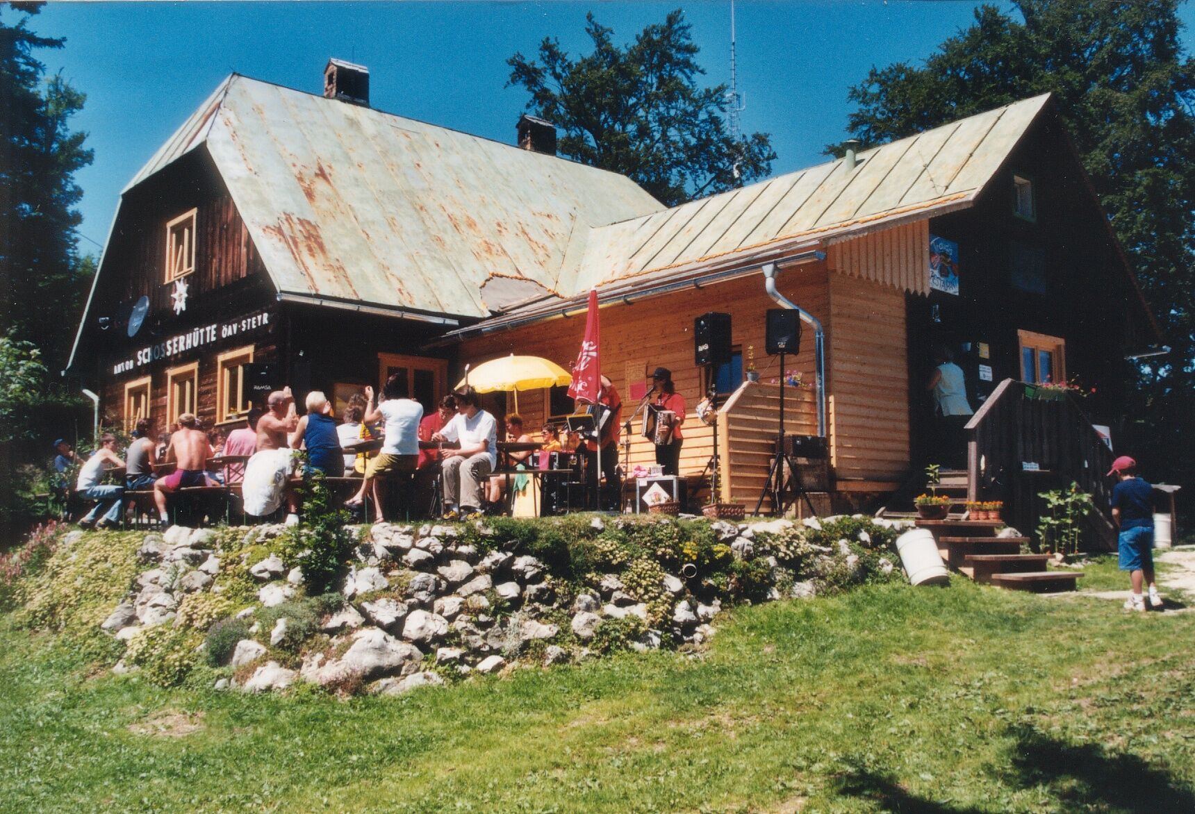
Anton Schosser Hütte
- Height profile
-

- Arrival
-
From Salzburg/Linz: A1 motorway exit Enns-Steyr > B115 into the Enns Valley
From Vienna: A1 motorway exit Haag > B42 > B122 > B115 into the Enns Valley
From Passau: A8 Passau > Wels > A1 motorway exit Enns-Steyr > B115 into the Enns Valley
From Graz: A9 Pyhrnautobahn > motorway exit Klaus > Grünburg > into the Ennstal Valley
- Public transportation
-
The Ennstalbahn runs between Linz and Weißenbach-St. Gallen.
Details at www.ooevv.at
Railway Stations are located in Steyr, Garsten, Lahrndorf, Dürnbach, Ternberg, Trattenbach, Losenstein, Reichraming, Großraming, Gaflenz, Weyer, Küpfern, Kastenreith, Kleinreifling and Weißenbach-St. Gallen.
- Parking
-
Reichraming/parking near the center of the village
- Author
-
The tour Anton Schosser Hütte via Rohrbachgraben is used by outdooractive.com provided.


General info
-
Traunviertel
1939
-
Steyr und die Nationalpark Region
1369
-
Losenstein
396