

© TV Nationalpark Region Ennstal - Martin Weymayer

© TV Nationalpark Region Ennstal

- Brief description
-
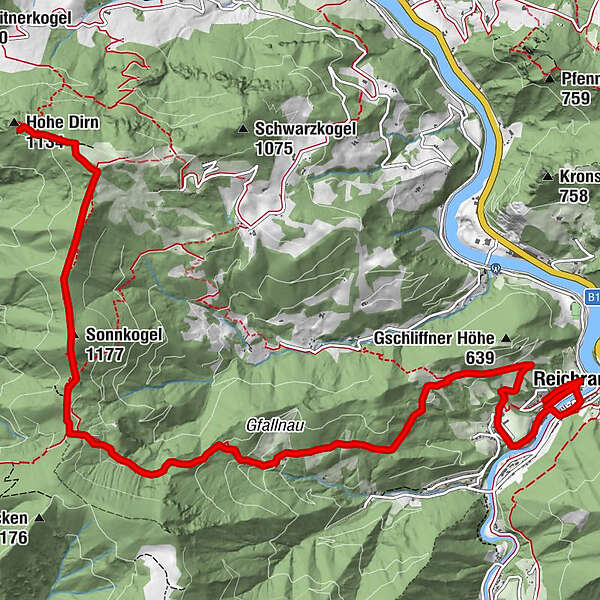
Summit and hut tour from the center of Reichraming to the Hohe Dirn and Anton Schosser Hütte
- Difficulty
-
easy
- Rating
-
- Starting point
-
Reichraming/center of the village
- Route
-
Reichraming0.2 kmPfarrkirche Reichraming1.0 kmSonnkogel (1,177 m)9.0 kmAnton-Schosser-Hütte (1,157 m)10.4 kmHohe Dirn (1,134 m)11.5 km
- Best season
-
JanFebMarAprMayJunJulAugSepOctNovDec
- Description
-
Steadily ascending in the direction of Gschliffner Höhe or Gfallnau, the trail continues in the direction of Mösern and then with different possibilities to the Hohe Dirn and to the Anton Schosser Hütte.
Trail number: HD2
- Directions
-
From the center of Reichraming, the trail leads steadily uphill in the direction of Gschliffner Höhe or Gfallnau, continues in the direction of Mösern and then branches off to the right onto the AV-467 hiking trail.
At the next fork in the road, you have the option of hiking
over the Sonnkogel, on the ridge hiking trail via the Anton Schosser Hut or on an almost level route via the forest road to the summit of the Hohe Dirn. - Highest point
- 1,169 m
- Endpoint
-
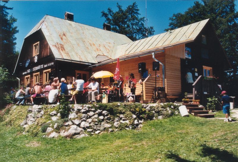
Anton Schosser Hütte
- Height profile
-

- Directions
-
From Salzburg/Linz: A1 motorway exit Enns-Steyr > B115 into the Enns Valley
From Vienna: A1 motorway exit Haag > B42 > B122 > B115 into the Enns Valley
From Passau: A8 Passau > Wels > A1 motorway exit Enns-Steyr > B115 into the Enns Valley
From Graz: A9 Pyhrnautobahn > motorway exit Klaus > Grünburg > into the Ennstal Valley
- Public transportation
-
The Ennstalbahn runs between Linz and Weißenbach-St. Gallen.
Details at www.ooevv.at
Railway Stations are located in Steyr, Garsten, Lahrndorf, Dürnbach, Ternberg, Trattenbach, Losenstein, Reichraming, Großraming, Gaflenz, Weyer, Küpfern, Kastenreith, Kleinreifling and Weißenbach-St. Gallen.
- Parking
-
Reichraming/parking near the center
- Author
-
The tour Anton Schosser Hütte via Gfallnau - Hohe Dirn path is used by outdooractive.com provided.
GPS Downloads


General info
Refreshment stop
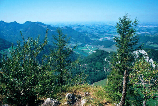
A lot of view
Other tours in the regions
-
Traunviertel
1943
-
Steyr und die Nationalpark Region
1374
-
Reichraming
363


