
- Brief description
-
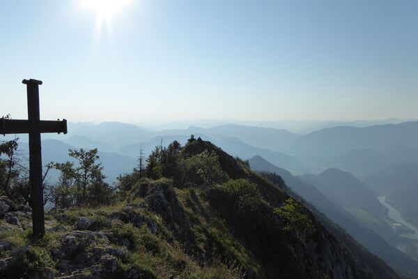
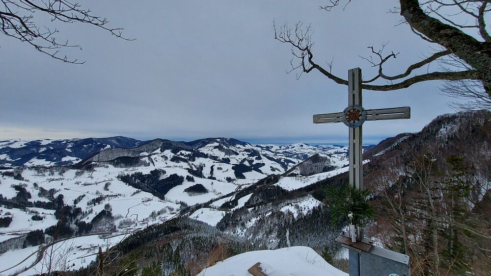
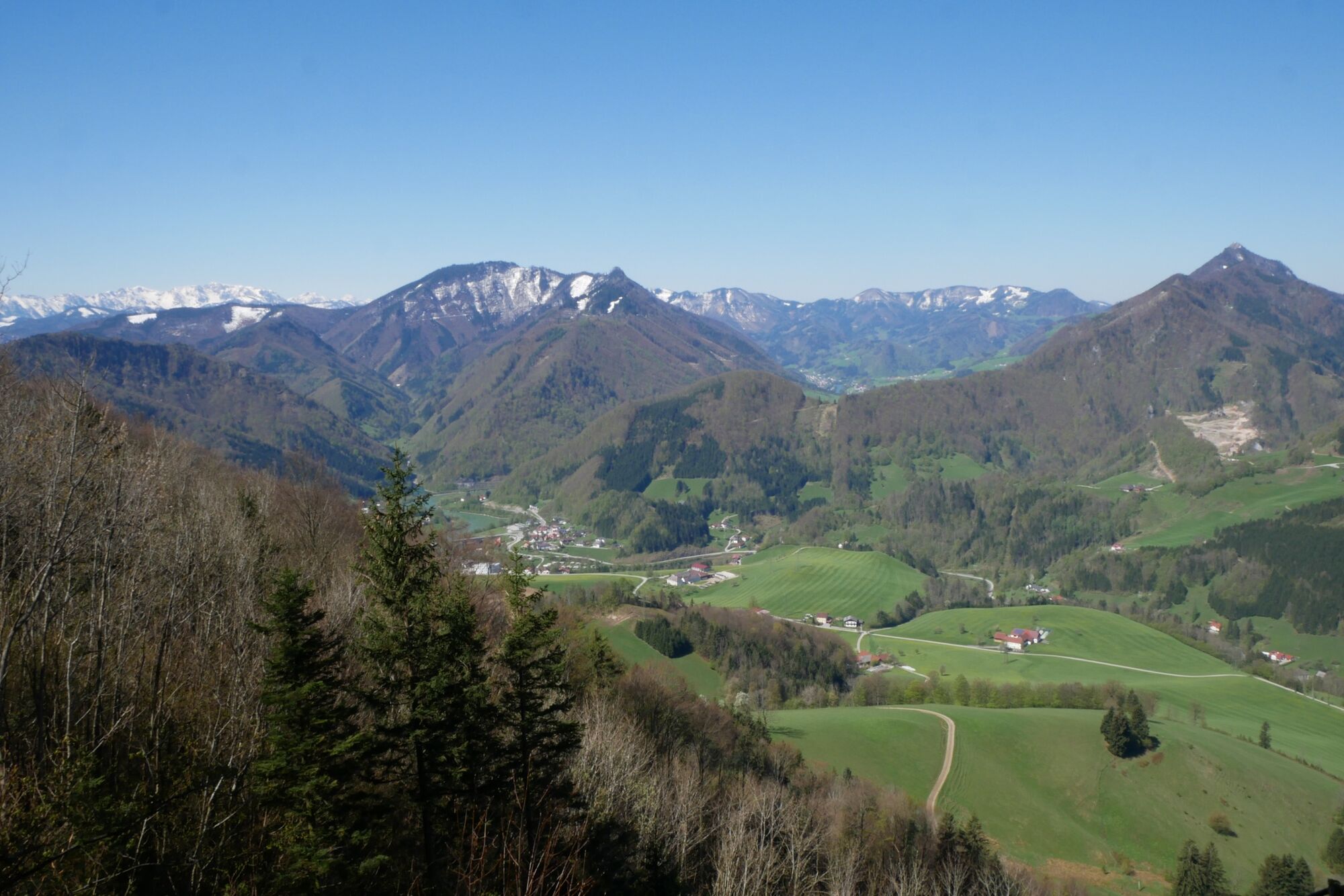
On the traces of the nature lover Ludwig Lirscher "Guck Naz" to the most beautiful view places. View to Großraming from the Schartenmauer and to the Voralpenland from the Haingrabeneck
- Difficulty
-
medium
- Rating
-
- Starting point
-
Großraming/Church Square
- Route
-
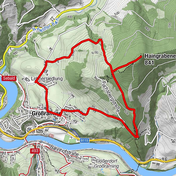
Landgasthof KirchenwirtPfarrkirche GroßramingGroßraming0.0 kmHaingrabeneck (841 m)3.1 kmLehnersiedlung5.7 kmPfarrkirche Großraming6.0 kmLandgasthof Kirchenwirt6.1 kmGroßraming6.1 km
- Best season
-
JanFebMarAprMayJunJulAugSepOctNovDec
- Description
-
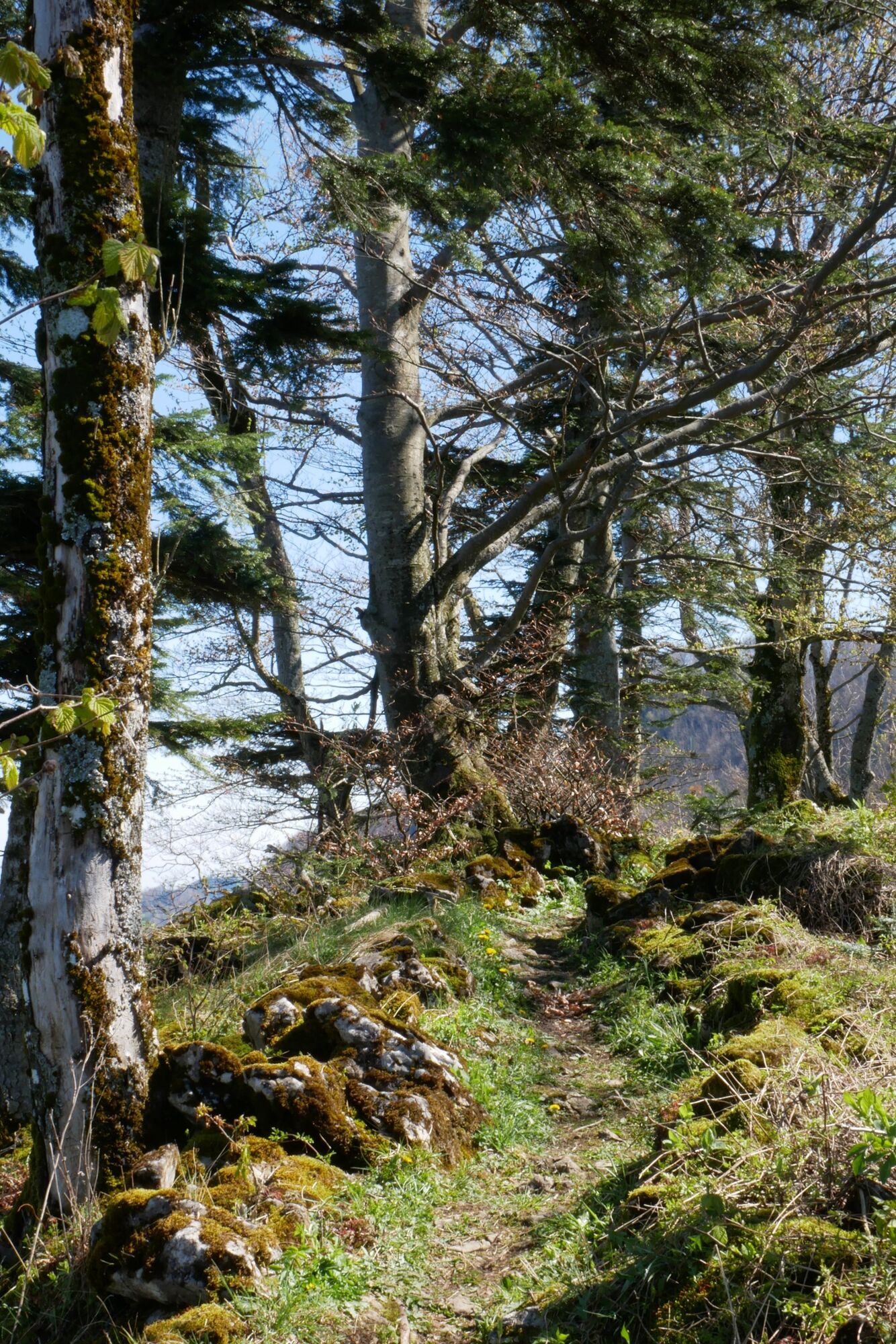
From the church in Großraming you start in an easterly direction and up to the left in the direction of Fuchsberg, then through the forest to the Schartenmauer and on a beautifully laid out path the trail continues up to the Haingrabeneck summit (841 m). The way back is on a forest road and the Planetenweg.
Trail number: E42a
- Directions
-
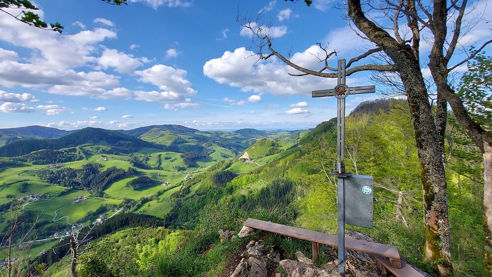
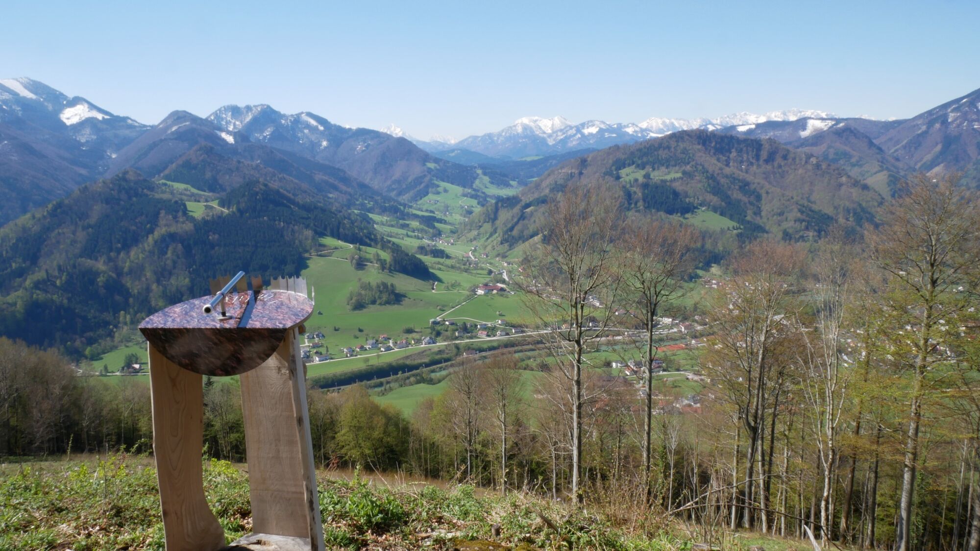
Starting at the church in Großraming the trail first leads east on the road up towards Fuchsberg, then through the forest to the Schartenmauer, from where there is a great view of Großraming.
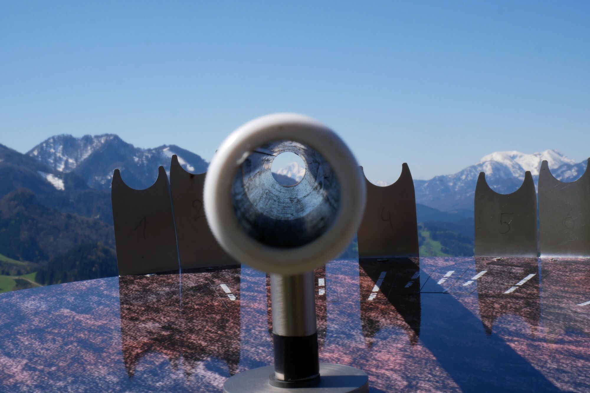
On a beautifully laid out path you quickly gain altitude in a zigzag. Halfway to the Haingrabeneck summit, the "lookout" rewards you with an incredible panorama of the surrounding mountains and the Kalkalpen National Park. A little later, from the summit itself, you can see into the hilly Alpine foothills.
The way back is on a forest road and the Planet Trail.
- Highest point
- 832 m
- Endpoint
-
Großraming/Church Square
- Height profile
-

- Tips
-
Climate-friendly to the National Park Region - railway station Großraming: By train you can reach the starting point for this hike in about 2 hours from Linz and in about 2.5 hours from Vienna.
- Additional information
-
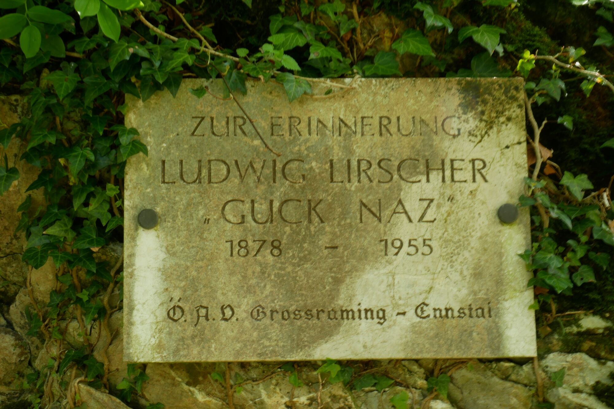
Why Guck Naz?
Today, Ludwig Lirscher (1878-1955), who lived in Großraming, would be called a "true original". The perky letter carrier was often on his way to one of the surrounding peaks early in the morning to watch the sunrise from there. For this purpose he fixed his binoculars (=Gucker) on a tripod.
At the sight of the red, rising sun, the "Guck Naz" is said to have gone almost into ecstasy and sent a loud "Juhu" from happiness into the valley. He then hurried down to deliver the mail on foot over mountain and valley in all weathers. He covered endless kilometers on his way to Oberplaißa, Hintstein or to Brunnbach.
It was not unusual for Guck Naz to ask for a postcard that had just been delivered and was still missing in his collection. And to numerous weddings in Großraming he invited himself with a humorous poem for the bride and groom.
Even today, fun-loving stories and anecdotes are told around this modest and God-fearing mountaineer.
- Directions
-
From Salzburg/Linz: A1 motorway exit Enns-Steyr > B115 into the Enns Valley.
From Vienna: A1 motorway exit Haag > B42 > B122 > B115 into the Enns Valley
From Passau: A8 Passau > Wels > A1 motorway exit Enns-Steyr > B115 into the Enns Valley
From Graz: A9 Pyhrnautobahn > motorway exit Klaus > Grünburg > into the Ennstal valley
- Public transportation
- Parking
-
Parking near the church

- Author
-
The tour Guck Naz Circular Trail is used by outdooractive.com provided.


General info
-
Traunviertel
1940
-
Steyr und die Nationalpark Region
1371
-
Großraming
334