
- Brief description
-
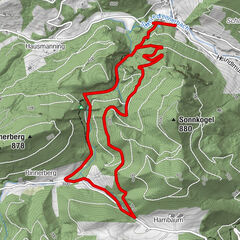
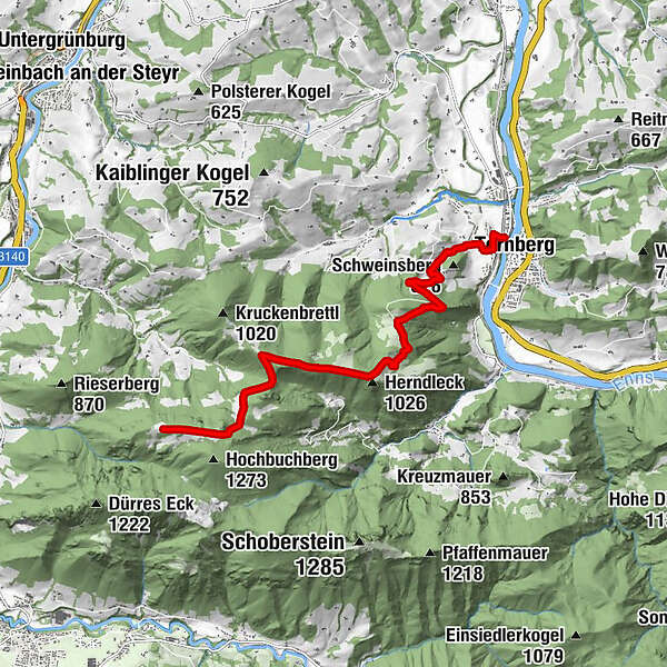
On the long-distance hiking trail 404 from Ternberg to Grünburger Hütte
- Difficulty
-
medium
- Rating
-
- Starting point
-
Ternberg/railway station
- Route
-
TernbergHerndleck (1,026 m)5.2 kmTeufelskirche (1,080 m)6.5 kmGrünburger Hütte9.6 km
- Best season
-
JanFebMarAprMayJunJulAugSepOctNovDec
- Description
-
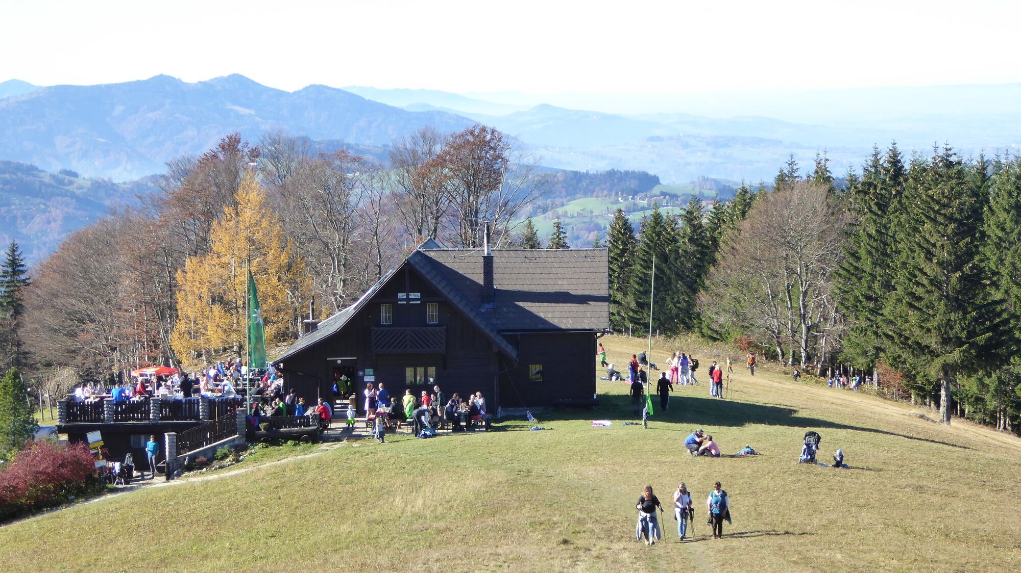
From the railway station, the long-distance trail 404 leads up to the Brandkogel and Herndleck and over the Gscheid to the Grünburger Hütte (1,080 m).
Trail number: 404
- Directions
-
From the railway station, the long-distance hiking trail 404 leads up to the Brandkogel and Herndleck. Continue via the Rehböden and Teufelskirche to the junction where hiking trail no. 13 branches off to the right to the Kruckenbrettl (1,020m), turn left via the Gscheid and Sulzboden to the Grünburger Hütte (1,080m).
- Highest point
- 1,127 m
- Endpoint
-
Ternberg/railway station
- Height profile
-

- Tips
-
Climate-friendly to the National Park Region - railway station Ternberg: By train you can reach the starting point for this hike in about 1 hour from Linz and in about 2.5 hours from Vienna.
- Additional information
-
Alternative: The trail can be shortened by approx. 1.5 hours if you start from the Herndleck car park.
- Directions
-
From Salzburg/Linz: A1 motorway exit Enns-Steyr > B115 into the Enns Valley.
From Vienna: A1 motorway exit Haag > B42 > B122 > B115 into the Enns Valley
From Passau: A8 Passau > Wels > A1 motorway exit Enns-Steyr > B115 into the Enns Valley
From Graz: A9 Pyhrnautobahn > motorway exit Klaus > Grünburg > into the Ennstal valley
- Public transportation
- Parking
-
Ternberg/railway station or shorter variation via parking Herndleck
- Author
-
The tour Grünburger Hütte (via Ternberg and Herndleck) is used by outdooractive.com provided.


General info
-
Traunviertel
1940
-
Steyr und die Nationalpark Region
1371
-
Ternberg
376