
- Brief description
-
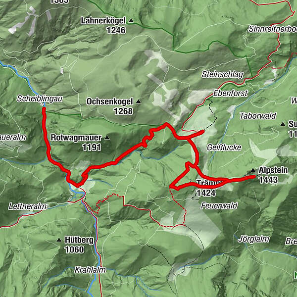
Summit tour from the Bodinggraben to the Ebenforst and to the two peaks Trämpl and Alpstein
- Difficulty
-
difficult
- Rating
-
- Starting point
-
Molln/parking Scheiblingau in Bodinggraben
- Route
-
Jagahäusl1.7 kmEbenforstalm4.8 kmTrämpl (1,424 m)6.9 kmAlpstein (1,443 m)8.0 kmLuchsboden8.0 km
- Best season
-
JanFebMarAprMayJunJulAugSepOctNovDec
- Description
-
The hike leads from the parking lot Scheiblingau along the Krummen Steyrling to the Jagahäusl, through the forest to the Ebenforstalm and across the alpine pasture up to the Trämpl and further to the Alpstein.
Trail number: 472
- Directions
-
From the Scheiblingau parking lot, walk along the Krummen Steyrling on the forest road to the Jagahäusl. (approx. 20 minutes)
Already the starting point Bodinggraben is worth a trip. The water-spouting "Maul-auf-Loch", the former hermitage, the stately forester's lodge and the romantic Anna chapel lend this valley a special charm.
On the ascent (left) to the Ebenforstalm on trail no. 472 you can see where this ditch got its name: Washouts in the rock caused by the water - so-called vats (vernacular "Bodinge") - characterize the gorge landscape.
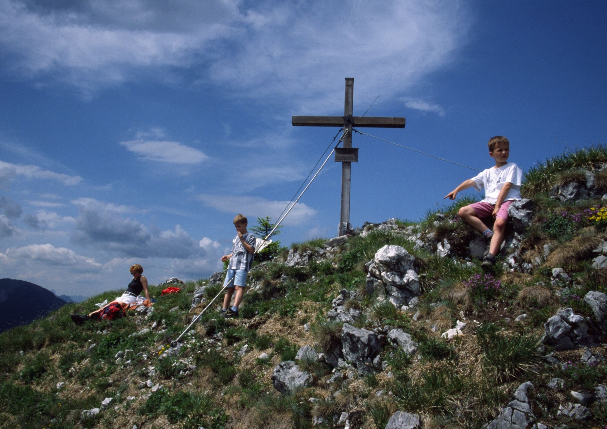
The Ebenforstalm is reached after about 1.5 hours. The path then leads from the Ebenforstalm across the alpine pastures up to the ridge and continues uphill to the summit (Trämpl 1,424 m, Alpstein 1,443 m) with a magnificent panoramic view of the Reichraminger Hintergebirge and Sengsengebirge. The descent follows the same path.
- Highest point
- 1,400 m
- Endpoint
-
Reichraming/Alpstein
- Height profile
-

- Directions
-
From the west: A1 exit Sattledt > via Kremsmünster > Bad Hall > Steinbach an der Steyr
From the east: A1 exit Haag > Steyr > B140 into the Steyr valley
From the north: A3 Passau > Wels > A9 exit Sattledt > Kremsmünster > Bad Hall > Steinbach
From the south: A9 exit Klaus > into the Steyr valley
- Public transportation
-
The Steyrtal is served by bus lines 452 (Rohr-Bad Hall-Steinbach a. d. Steyr) and 433 (Steyr-Molln-Kirchdorf).
Details at www.ooevv.at
With the Steyrtal Museum Railway www.steyrtalbahn.at
- Parking
-
Molln/parking Scheiblingau in Bodinggraben
- Author
-
The tour Alpstein-Trämpl is used by outdooractive.com provided.