© Sulzbacher
Tour data
6.72km
587
- 2,088m
1,480hm
10:00h
- Brief description
-
Schwierigkeitsgrad: Schwarz - alpiner Steig
- Rating
-
- Starting point
-
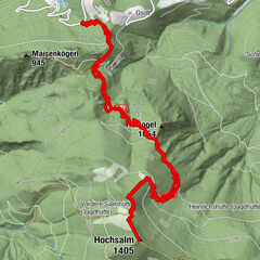
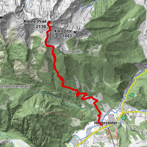
Hinterstoder Ortszentrum
- Route
-
HinterstoderKessenspitz (1,810 m)5.7 kmKleiner Priel (2,136 m)6.6 km
- Highest point
- 2,088 m
- Rest/Retreat
-
Gastronomie in Hinterstoder
- Ticket material
-
Wanderkarte Pyhrn-Priel erhältlich in allen Pyhrn-Priel Tourismusbüros!

GPS Downloads


Trail conditions
Asphalt
Gravel
Meadow
Forest
Rock
Exposed
Other tours in the regions
-
Traunviertel
1940
-
Urlaubsregion Pyhrn - Priel
1440
-
Hinterstoder
395