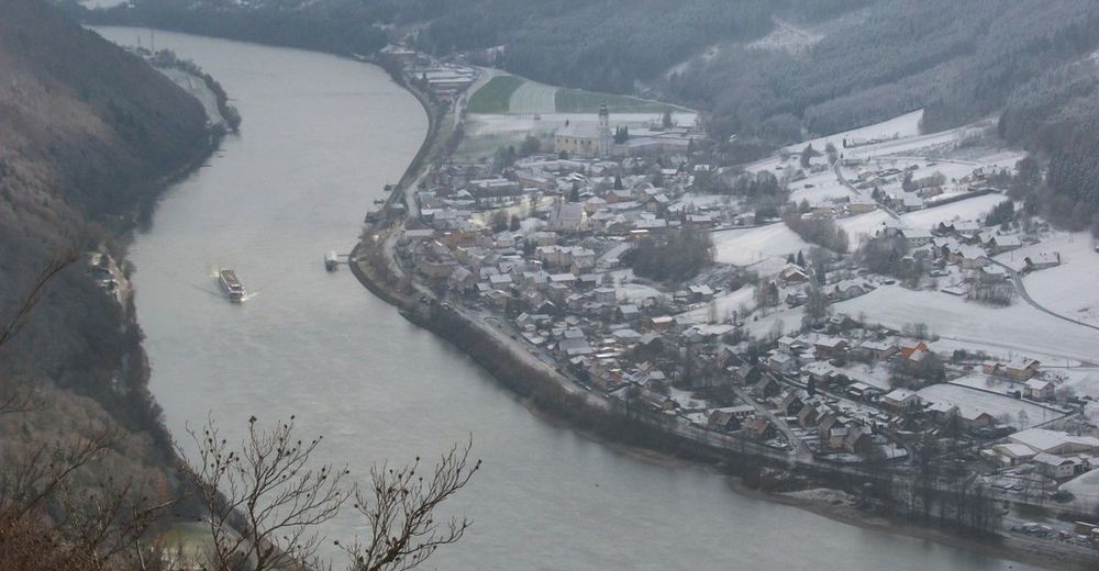
© Wandermagazin - Thorsten Hoyer

- Brief description
-
Eine kurze Rundwanderung voller Abwechslung und Überraschungen.
- Difficulty
-
medium
- Rating
-
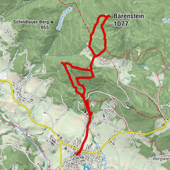
- Route
-
BistroSchiffsanlegestelle0.1 kmEbenstein (586 m)5.0 kmRiedl5.5 kmÖttl-Hütte6.1 kmJochenstein8.6 kmGasthaus-Pension Kornexl8.9 kmJochensteinblick (Fernrohr)8.9 kmKapelle9.2 kmBistro9.4 km
- Best season
-
JanFebMarAprMayJunJulAugSepOctNovDec
- Highest point
- 632 m
- Endpoint
-
Haus am Strom in Jochenstein
- Height profile
-
 © outdooractive.com
- Author
-
The tour Die Donauleiten Runde is used by outdooractive.com provided.
GPS Downloads


General info
Refreshment stop
Cultural/Historical
A lot of view
Other tours in the regions