
- Brief description
-
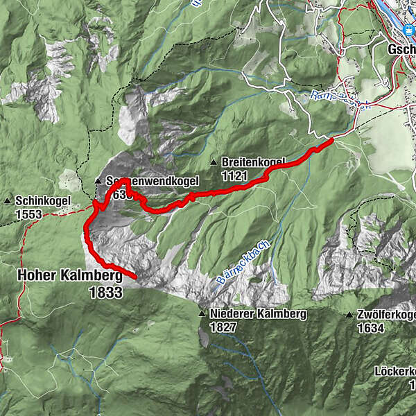
This three-hour high alpine tour takes you through the Ramsau mountain range past some places of happiness to the Goiserer hut and on to the summit of the Kalmberg. The summit not only impresses with its shape, especially the overwhelming view let you hold your breath.
- Difficulty
-
difficult
- Rating
-
- Route
-
Goiserer Hütte4.5 kmKalmooskirche5.0 kmHoher Kalmberg (1,833 m)5.9 km
- Best season
-
JanFebMarAprMayJunJulAugSepOctNovDec
- Description
-
Hike to the Goiserer hut and the Kalmberg
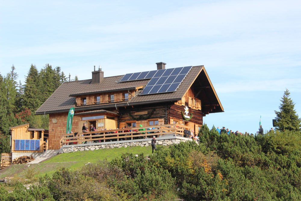
The Goiserer hut is located at 1,592 m above sea level between the Sonnenwendkogel and the Kalmberg. It can be reached from both Gosau and Bad Goisern. The route described here leads from Bad Goisern over the “Trockentann”.
Places of Happiness in the Dachstein Salzkammergut holiday region
The high alpine tour to the Goiserer hut and the Kalmberg requires stamina and sure-footedness.
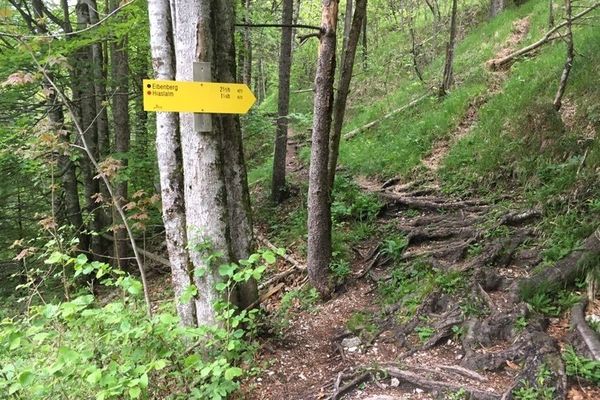
Starting from the Trockentann toboggan run parking lot (NOT in the Nordic center), follow the marking, along the steadily increasing forest road to the Trockentannalm. we follow the marking along the steadily increasing forest track to the “Trockentann-Alm”. In serpentines you hike up increasingly steep terrain, past the "Wallman-Poldl-Rast", a rest hut that mountain friends made from larches. From here you can already see up to the mountain range called “Totes Gebirge” and down to Bad Goisern. It continues through magnificent larch fields past the “Dichtlerin”, a water source that is about 15 minutes away from the Goiserer hut.
After the first goal, the Goiserer hut, has been reached and you are strengthened with food and drinks, we continue up to the summit of the Kalmberg. The approx. 60-minute path winds up through rocks, past the Kalmoos church. This interesting mountain cave is known for the secret church services held during the time of the Counter-Reformation. Then you reach the summit of the Kalmberg, which is also called Native American’s Head because of its shape. From here there is a breathtaking view over the Goiserer valley, Gosau, to the Gosaukamm up to the Dachstein. With a clear view you can even see the Großglockner.
Back at the Goiserer hut, choose the descent towards Hochmuth. This approx. 2.5 to 3-hour trail leads over the striking “Knie” hilltop to the north in a wide arc into the valley via the village of Steinach to Bad Goisern.The places of happiness in the Salzkammergut are divided into three types: cultural and sacred places, legend places and nature places. Nowadays the cultural and sacred places are mostly Christian monuments, where the knowledge of the power of these places has been continuously transferred and used for architectural monuments. One of these special places is the Kalmoos church on the Kalmberg.
Additionally hiking opportunities
Legend places do not seem very special at first, only the knowledge of the old stories that belong to these places reveals the strength and mysticism of these places. This includes, for example, the Schwarzenbachloch cave along the tolerance trail.
In the case of natural sites, it is the extraordinary visual landscape experiences and the balanced interplay of the four elements that create a special feeling of harmony with and for these places. One of these natural places includes the so-called Native American’s Head, i.e. the summit of the Kalmberg.The Goiserer hut can also be reached from Gosau. The approx. 3-hour hike is a bit longer, but also flatter. The hiking trail (No. 880) follows the forest road from the parking lot in Gosau / Ramsau towards the Iglmoosalm. Then it goes past the Schartenalm to the Goiserer hut. On this hike you will also experience wonderful impressions and magnificent views.
More recommendations for hiking trails you can find in our overview of all hiking trails in the Holiday Region Dachstein Salzkammergut.
In emergency call the mountain rescue 140
Hike already now online through Bad Goisern in the 360 ° panorama tour... - Highest point
- 1,812 m
- Height profile
-

- Additional information
- Directions
-
Starting from the B 145, turn towards the center of Bad Goisern and drive, following the road, past the Protestant church over the Goiserer bridge. After the bridge, turn right towards Ramsau / Steinach. Follow the road to the hut where tobogganing is given out for the Trockentann ride in winter. (NOT Nordic center!) You can park for free on the gravel parking lot.

- Author
-
The tour Hiking trail to the Goisern Hut and the summit of the Kalmberg is used by outdooractive.com provided.


General info
-
Salzkammergut Oberösterreich
3082
-
Dachstein Salzkammergut
1702
-
Bad Goisern
390