© OÖ Tourismus Hochhauser

- Brief description
-
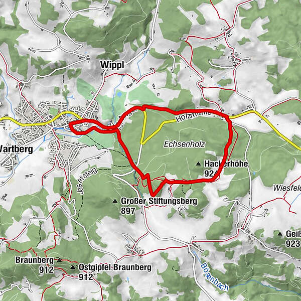
Raphaelshöhenweg
- Difficulty
-
medium
- Rating
-
- Route
-
Sankt Oswald bei FreistadtGasthof Zur PostGasthof zur Holzmühle2.7 kmHolzmühle2.8 kmRaphaelshöhe5.4 kmMaria Bründl Kapelle5.8 kmGasthof Zur Post7.5 kmSankt Oswald bei Freistadt7.5 km
- Best season
-
JanFebMarAprMayJunJulAugSepOctNovDec
- Highest point
- 886 m
- Height profile
-

- Additional information

- Author
-
The tour O2 Raphaelshöhenweg is used by outdooractive.com provided.
GPS Downloads


Other tours in the regions
-
Mühlviertel
1784
-
Mühlviertler Alm Freistadt
1067
-
St. Oswald bei Freistadt
328