
- Brief description
-
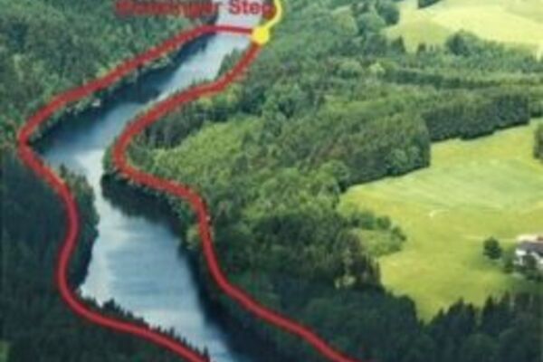
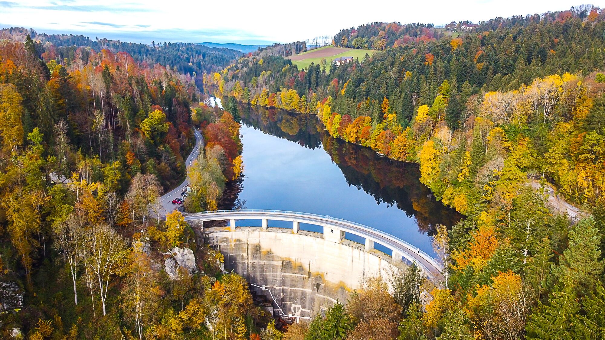
The trail links the two lakes in our municipality: Ranna swimming lake and Ranna reservoir with the dam wall
- Difficulty
-
medium
- Rating
-
- Starting point
-
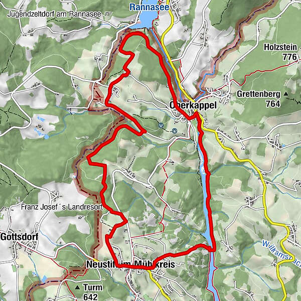
Local square Neustift i.M.
- Route
-
Neustift im MühlkreisGasthaus Wundsam0.0 kmHubertuskapelle1.1 kmHochreut4.8 kmDittmannsdorf5.6 kmKappel8.0 kmOberkappel8.6 kmNeustift im Mühlkreis12.7 kmGasthaus Wundsam12.7 km
- Best season
-
JanFebMarAprMayJunJulAugSepOctNovDec
- Description
-
This leisurely day trip starts at the village square in Neustift in direction of Oberaschenberg. The hiking trail leads along a forest track to Hoöllmühle farm, Dittmannsdorf and on to Ranna swimming lake, in the village of Oberkappel. Continue along the Kneipp path to Konzinger footbridge leading across Ranna reservoir. Via the Ranna slope, the trail leads back to Neustift again and offers wonderful panoramic views. Plenty of benches can be found along the trail to take a rest on.
- Highest point
- 640 m
- Endpoint
-
Local square Neustift i.M.
- Height profile
-

- Equipment
-
sturdy shoes
- Tips
-
Hiking trail around Ranna reservoir to Konzinger footbridge featuring various fitness equipment. Pram-friendly, popular walking and jogging routes, new motor skills stations will be added from 2022
- Public transportation
- Parking
-
Neustift local square
- Author
-
The tour Lake trail- combines Ranna swimming lake and Ranna reservoir is used by outdooractive.com provided.


General info
-
Innviertel
797
-
Ferienregion Böhmerwald
479
-
Oberkappel
163