
- Brief description
-
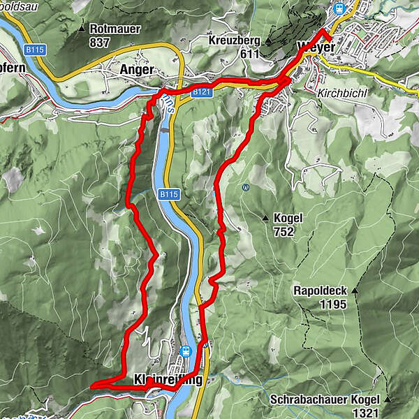
Circular trail from market place Weyer via Loiben to Kleinreifling and left of the river Enns back to Weyer
- Difficulty
-
difficult
- Rating
-
- Starting point
-
Weyer market place
- Route
-
Weyer0.3 kmPfarrkirche Kleinreifling5.9 kmKleinreifling5.9 kmAnger11.6 kmWeyer13.7 km
- Best season
-
JanFebMarAprMayJunJulAugSepOctNovDec
- Description
-
Follow the traces of trade and traffic.
The Ennstal has been characterised by trade and traffic for centuries. Iron from the Erzberg, the products of the iron processing industry and necessary food were transported on the Eisenstraße and on the river Enns. In the past, goods were transported by wagons, rafts and Enns ships, but later by rail and road. The Enns transport route became an energy supplier.
- Directions
-
The themed path starts at the historic market place, leads downstream along the Gaflenz past the Schmidbergerwehr. Then you cross the Gaflenz and hike up over the Rapoldeck to Kleinloiben. The view to Kleinreifling shows the way. The trail leads downhill, crosses the main road and then turns right towards the centre of Kleinreifling. Above the cemetery, the path leads to Kastenreith and via the promenade back to the market place of Weyer.
- Highest point
- 648 m
- Endpoint
-
Weyer market place
- Height profile
-

- Tips
-
Climate-friendly to the National Park Region - railway station Weyer, railway station Kastenreith, railway station Kleinreifling: By train you can reach the starting point for this hike in about 2 hours from Linz and in about 2.5 hours from Vienna.
- Directions
-
From Salzburg/Linz: A1 motorway exit Enns-Steyr > B115 into the Enns Valley.
From Vienna: A1 motorway exit Haag > B42 > B122 > B115 into the Enns Valley
From Passau: A8 Passau > Wels > A1 motorway exit Enns-Steyr > B115 into the Enns Valley
From Graz: A9 Pyhrnautobahn > motorway exit Klaus > Grünburg > into the Ennstal valley
- Public transportation
- Parking
-
at the Kreuzberg
along the railway promenade

- Author
-
The tour Trade and transport on the Enns is used by outdooractive.com provided.


General info
-
Gesäuse
2228
-
Melker Alpenvorland
798
-
Weyer
312