
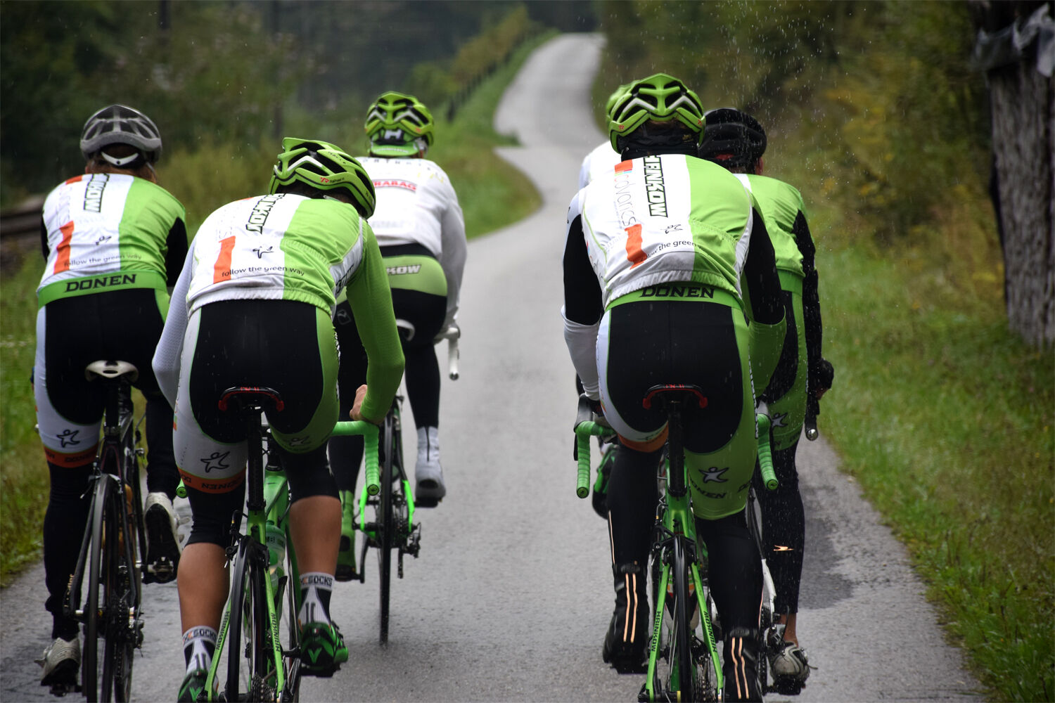
- Brief description
-
The tour starts at Steyr train station.
- Difficulty
-
medium
- Rating
-
- Starting point
-
Steyr
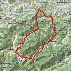
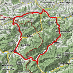
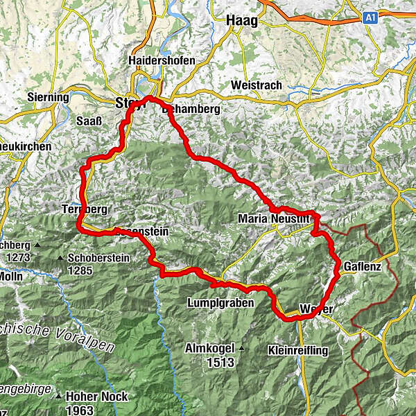
- Route
-
TrattenbachLosenstein6.0 kmBlasl6.4 kmGasthaus Aglas11.5 kmReichraming11.7 kmPfarrkirche Reichraming11.8 kmHeinzl18.4 kmGroßraming23.3 kmRialto23.4 kmFlößerstube24.5 kmKüpfern30.8 kmAnger32.8 kmWeyer35.7 kmWeyer an der Enns36.4 kmPizzeria Valentino36.4 kmObsweyer37.2 kmGroßgschnaidt46.2 kmOber Hinterleiten46.8 kmGschnaidtsteiner kapelle47.7 kmGasthaus Derfler61.2 kmSulzbach61.4 kmHausmann68.2 kmLandgasthof Froschauer70.5 kmKleinraming70.5 kmPenz71.8 kmGasthof zur Linde72.2 kmFischhub77.6 kmEnnsdorf79.0 kmZwischenbrücken79.5 kmSteyr (310 m)79.9 kmMarienkirche80.0 kmNeutor80.1 kmInnere Stadt80.2 kmNeuschönau81.7 kmPyrach82.3 kmKraxental82.4 kmBuchholz82.8 kmSarning83.0 kmPizzaria La Fontana83.4 kmGarsten83.5 kmGarstnerfeld84.3 kmSand86.3 kmLahrndorf89.1 kmFaller Wasserfall92.9 kmTernberg96.6 kmTrattenbach99.4 km
- Best season
-
JanFebMarAprMayJunJulAugSepOctNovDec
- Description
-
Starting from Steyr.
- Directions
-
The tour starts in Steyr and leads from there via Bahnhofstraße to the Ennskai, which you follow to the lower Schiffweg. Along the Enns you go to the power station Garsten. From there the tour leads to the Ennsradweg (Lahrndorfer Straße), which you follow via Ternberg/Trattenbach, Losenstein and Großraming to Weyer (Kastenreith).
After the Ennsmuseum (currently closed) and the Katzensteinermühle, the route continues along the railroad promenade through Weyer. Shortly after the climbing hall 6a you turn left to Lindau and drive via Großgschnaidt in the direction of Konradsheim. After the turnoff Maria Neustift - Gaflenz you turn left over the Kreuzgruberhöhe. The tour continues through the Ramingtal valley to Kleinraming and from there via Seitenstettner Straße and Haratzmüllerstraße back to Steyr station.
- Highest point
- 746 m
- Endpoint
-
Steyr
- Height profile
-

- Equipment
-
Sun and rain protection, repair kid for minor bike breakdowns.
- Safety instructions
-
Inquire in advance about any trail or road closures along the route.
- Additional information
-
You can obtain up-to-date map material at www.steyr-nationalpark.at
- Author
-
The tour Rennradtour Kreuzgruberhöhe is used by outdooractive.com provided.