© Erwin Haiden Bikeboard.at

© Erwin Haiden bikeboard.at

© Erwin Haiden bikeboard.at

© Erwin Haiden bikeboard.at

- Brief description
-
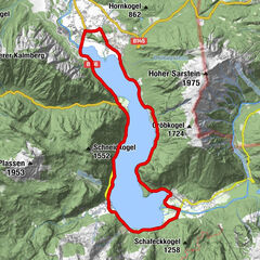
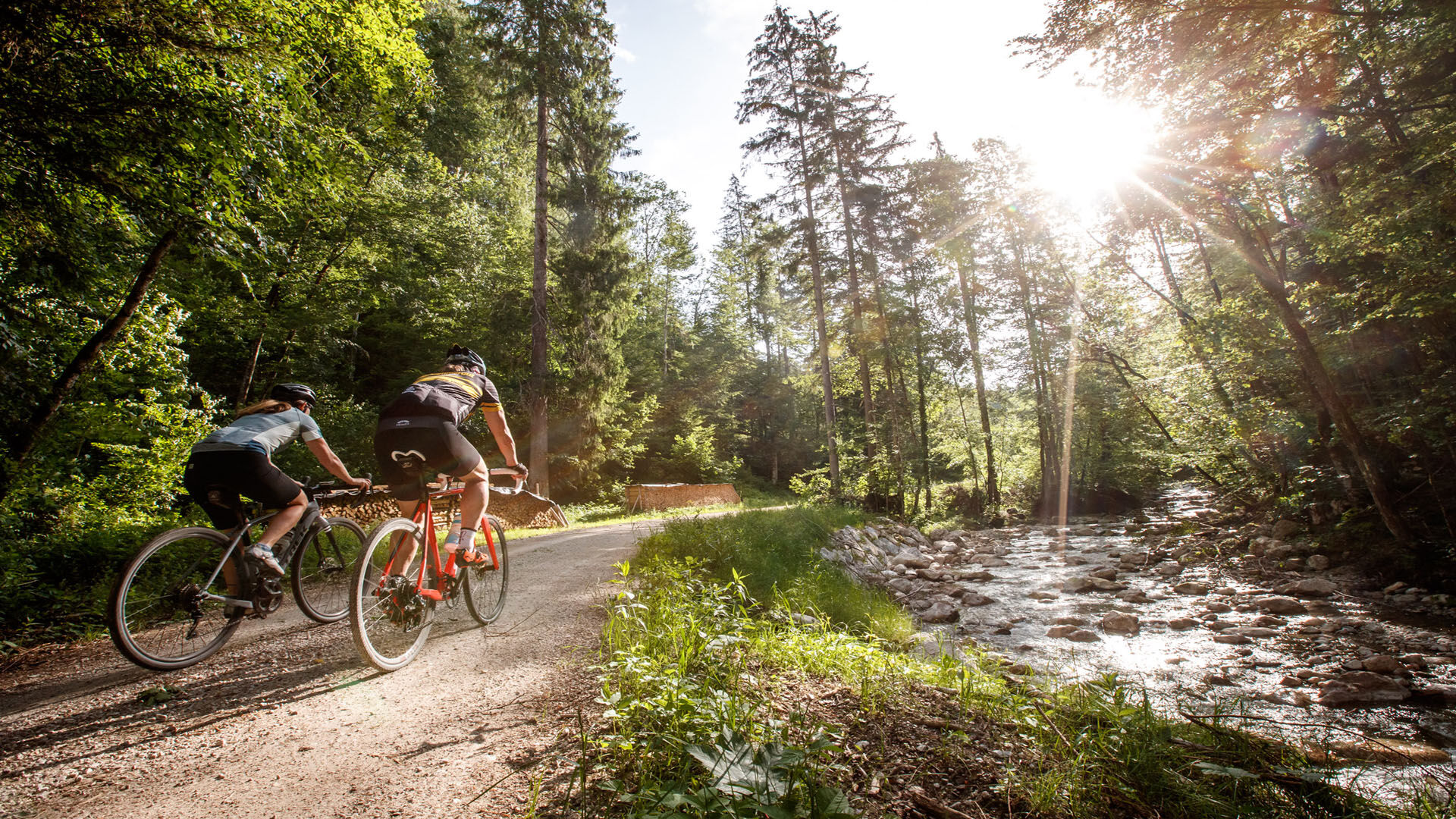
The gravel bike tour around the Sarstein leads you along streams through romantic forests to dramatic kitschy views of mountains and lakes. Along pure waters you ride your gravel bike through the Dachstein Salzkammergut and the Ausseerland.
- Difficulty
-
medium
- Rating
-
- Route
-
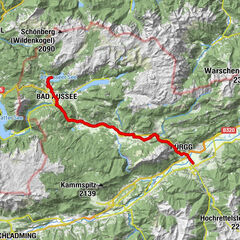
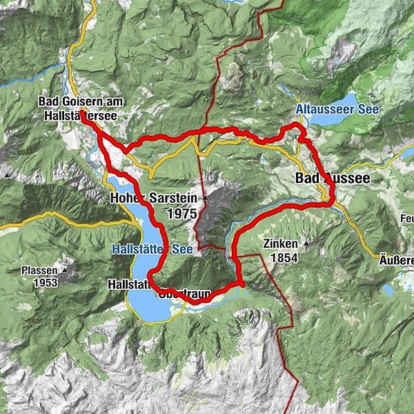
Bad Goisern am HallstätterseeÖBF AG - Forstbetriebe Inneres Salzkammergut0.0 kmPizzeria Pepone0.1 kmGschwandt0.4 kmWiesen1.1 kmStambach1.6 kmKirchenwirt2.9 kmSankt Agatha3.4 kmOberlupitsch10.0 kmSalomepüchel10.6 kmKlammeck10.7 kmLupitsch11.0 kmUnterlupitsch11.2 kmHauserbichl11.7 kmLichtersberg12.6 kmKesselgrube13.8 kmPuchen14.0 kmKendl14.0 kmIm Graben15.5 kmWald16.0 kmPraunfalk16.6 kmBad Aussee (659 m)17.9 kmKrautberg18.1 kmUnterkainisch19.0 kmSportstüberl, Pizzeria19.0 kmBad Aussee (641 m)19.5 kmKoppenpass (690 m)25.6 kmKoppenrast27.2 kmReith28.5 kmBrand29.1 kmGasthof Höllwirt29.7 kmObertraun30.4 kmKatholische Kirche Obertraun30.5 kmPanoramablick auf Hallstatt32.5 kmSeeraunzn36.1 kmGasthaus zur Post40.5 kmDas Deli40.6 kmStambach42.1 kmWiesen42.3 kmGschwandt43.3 kmPizzeria Pepone43.5 kmÖBF AG - Forstbetriebe Inneres Salzkammergut43.6 kmBad Goisern am Hallstättersee43.7 km
- Best season
-
JanFebMarAprMayJunJulAugSepOctNovDec
- Description
-
The water, which accompanies you on the gravel bike round constantly, whether as brook, river or lake.The Holiday Region Dachstein Salzkammergut and the Ausseerland create the ideal connection for gravel bikers in the Salzkammergut. On forest and municipal roads, you pass through part of the Inner Salzkammergut, always accompanied by water, most of which comes from the Dachstein glacier. On the gravel bike tour around the Sarstein, you make good kilometres and metres in altitude on your personal gravel bike account and enjoy the federal states of Styria and Upper Austria from their most beautiful sides.
About the tour:
Start at the market square in Bad Goisern at Lake Hallstatt in the direction south. On the sidewalk and bike path you reach St. Agatha after crossing the B 166. At the intersection after the Agathawirt Country Hotel, turn left in the direction of Halleralm. Passing the shooting club house, you will soon turn right into the "Leislingstraße" along the Zlambach. On this forest road you already master a few meters of altitude. In the Ausseerland it leads you past meadows, which bloom in spring in full beauty - daffodils as far as the eye can see. Enjoy this sight during a short detour to the Ruin Pflindsberg.
The path continues along the signs down to Altaussee. On the right you would reach the Lake Altaussee after a few minutes of driving. A short break on the water, in view of the beautiful mountain scenery with the Trisselwand on the opposite side of the lake, would also offer itself here.
However, the gravel bike tour around the Sarstein leads you to the right along the "Altausseer Straße" to Bad Aussee. Here you turn left into the center and keep right again at the next intersection (post office) in the direction of railway station Bad Aussee. You will pass the geographical center of Austria. This is located in the park of Bad Aussee.
Shortly after the railway station Bad Aussee, you will again master a few meters of altitude at the beginning of the "Koppenstraße". Follow this road for a few kilometers before turning right onto the bike trail "Koppentalradweg". Alternatively you can follow the road to Obertraun.
A small detour to the Lake Koppenwinkl with its impressive fauna and flora and a short break at the Inn Koppenrast are highly recommended.
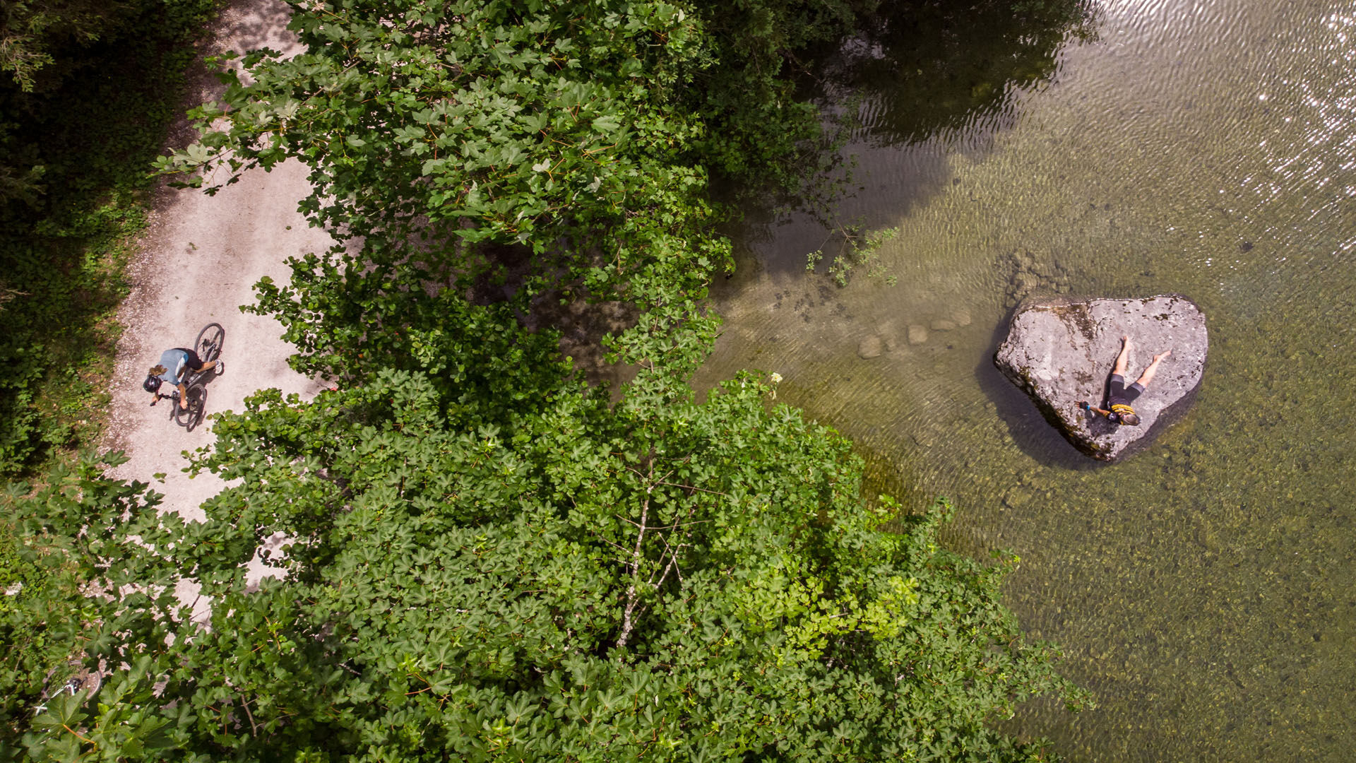
Then you follow the road to the beach resort. On hot summer days a jump into the lake will bring you the desired cooling.
Afterwards, you continue along the east bank bike trail along the shores of Lake Hallstatt. This trail is used by cyclists and hikers - please be considerate!
After a few minutes you will reach the railway station Hallstatt. Afterwards, another highlight of the tour awaits you. On the suspension bridge you will cross the deepest point of Lake Hallstatt with approx. 125 m. There must be time for a little memory photo here!
Shortly after the suspension bridge, the bike path separates from the hiking trail and continues above to the Uferwirt Seeraunzn. The sunny terrace invites you to rest and strengthen yourself. Afterwards, the path continues again for cyclists and hikers together. Via the villages Obersee and Untersee the road leads you further to Au. From here you follow the sidewalk and bike path along the B 166 to the entrance Bad Goisern South and cycle on the "Obere Marktstraße" back to the starting point.
Here you will find a lot more information about gravel biking.
Experience the 360 degree live panorama of Bad Goisern.... - Highest point
- 915 m
- Height profile
-

- Additional information
- Directions
-
The start is at the market square Bad Goisern. We therefore recommend the free parking lot Stampfl, parking train station Bad Goisern or parking "Mitte".
by car
from Salzburg:
Exit Thalgau via federal road B158 towards Bad Ischl, in Bad Ischl drive onto Salzkammergut Street B145 towards Bad Goisern
from Linz:
Exit Regau via federal road Salzkammergut street B145 towards Gmunden and Bad Ischl to Bad Goisern
from Vienna/Graz:
Exit Liezen via federal road B320, in Trautenfels drive onto Salzkammergut street B145 towards Bad Goisern
from Villach:
Tauern motorway to exit "Eben im Pongau", via B166 Pass Gschütt federal road through Gosau, at the Gosaumühle junction turn towards Bad Goisern
by train
Attnang-Puchheim - Stainach-Irdning lines
stop train station Bad Goisern
by bus
Bus 542 (Bad Ischl - Gosausee)
stop Bad Goisern Mitte/B145
Detailed information on the respective train and bus times can be found at https://www.oebb.at/en/ (train) and https://www.postbus.at/en (bus).

- Author
-
The tour Gravel bike tour around the Sarstein is used by outdooractive.com provided.
GPS Downloads


Other tours in the regions