


- Brief description
-
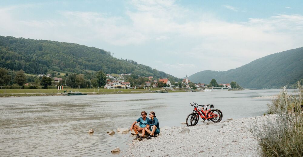
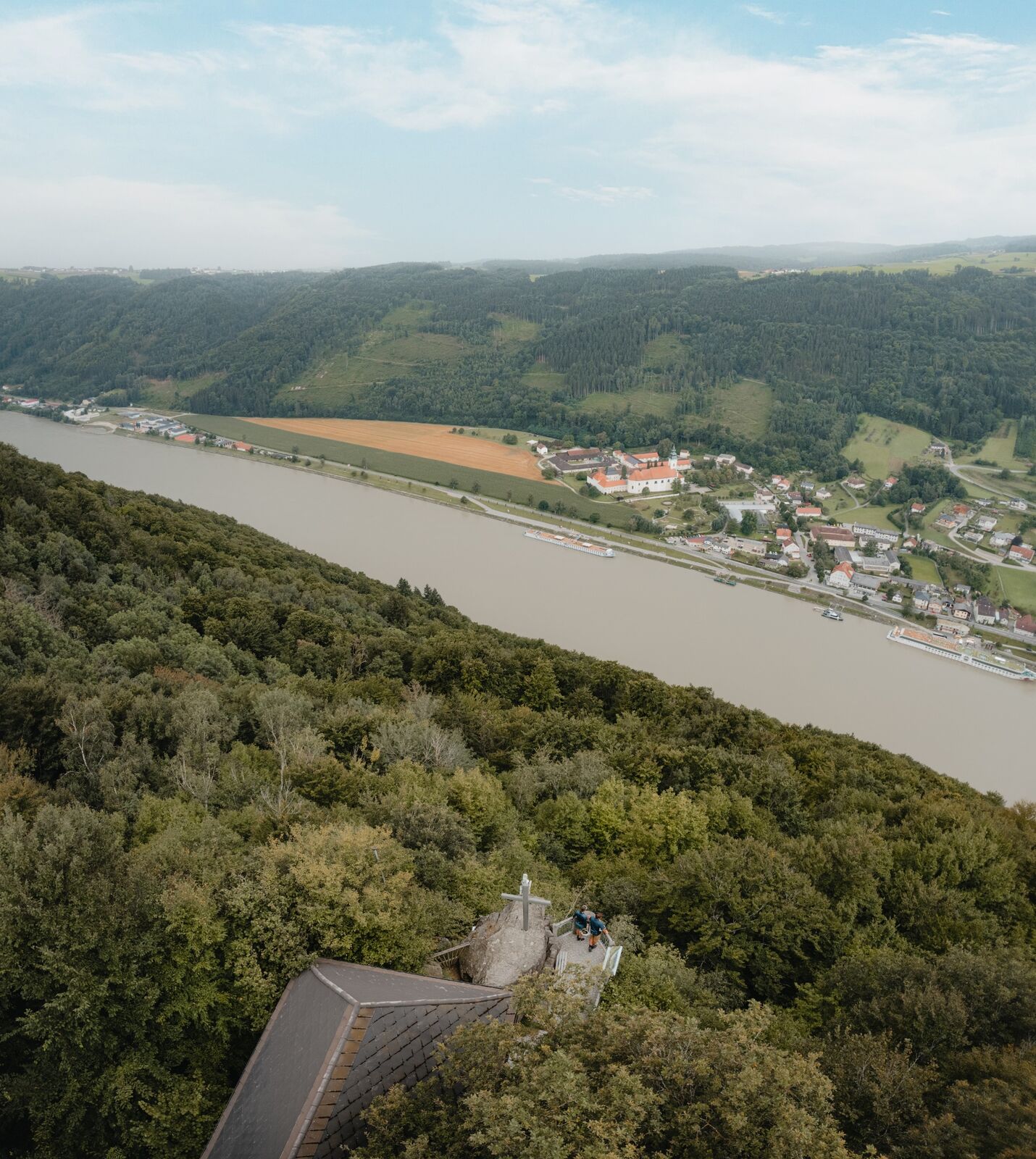
'Close to the skies above – with a perpendicular view into the Danube Valley'
- Difficulty
-
medium
- Rating
-
- Starting point
-
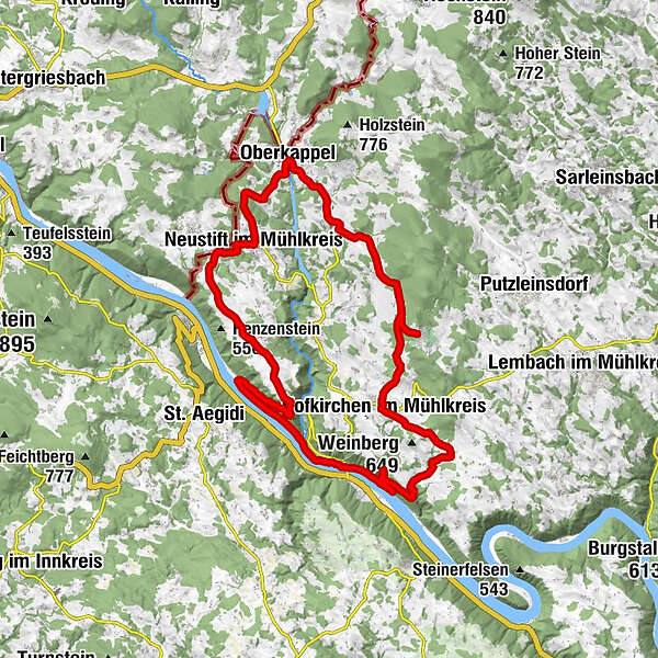
Rannamühl / Hofkirchen in Mühlkreis – The Danube Cycle Path circuit starting point is at the big car park at the point where the River Ranna flows into the Danube.
- Route
-
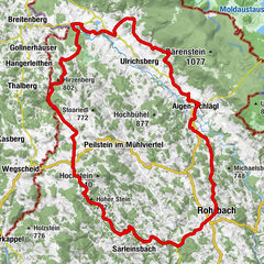
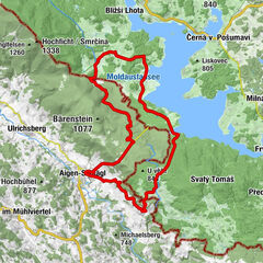
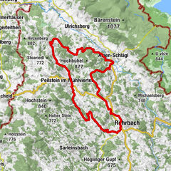
Niederranna1.0 kmPfarrkirche Niederranna1.0 kmKling2.8 kmWesenufer3.2 kmBockbach Wasserfall4.4 kmMarsbach6.6 kmWiesen7.1 kmEmmerstorf9.6 kmHofkirchen im Mühlkreis10.8 kmel toro10.9 kmBarth Sepp11.1 kmDantlesbach11.7 kmHamet13.3 kmPfarrkirchen im Mühlkreis15.1 kmPfarrkirche Pfarrkirchen15.1 kmSchlag16.4 kmKarlsbach19.7 kmWirt` z`Karlsbach - GAsthof Elke Pröll20.0 kmGrettenbach21.9 kmOberkappel22.9 kmOberaschenberg25.0 kmHubertuskapelle25.9 kmGasthaus Wundsam26.9 kmNeustift im Mühlkreis26.9 kmTurm (642 m)28.0 kmHaitzendorf28.8 kmKleinmollsberg29.9 kmGroßmollsberg30.4 kmPühret31.6 kmDorf33.2 kmRannariedl34.5 kmKramesau36.8 km
- Best season
-
JanFebMarAprMayJunJulAugSepOctNovDec
- Description
-
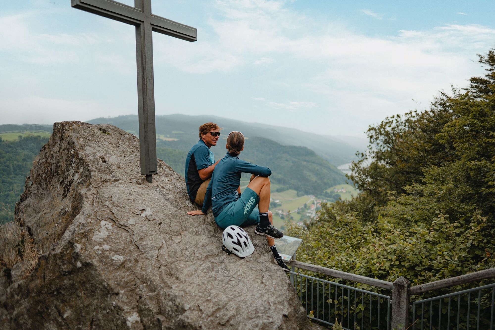
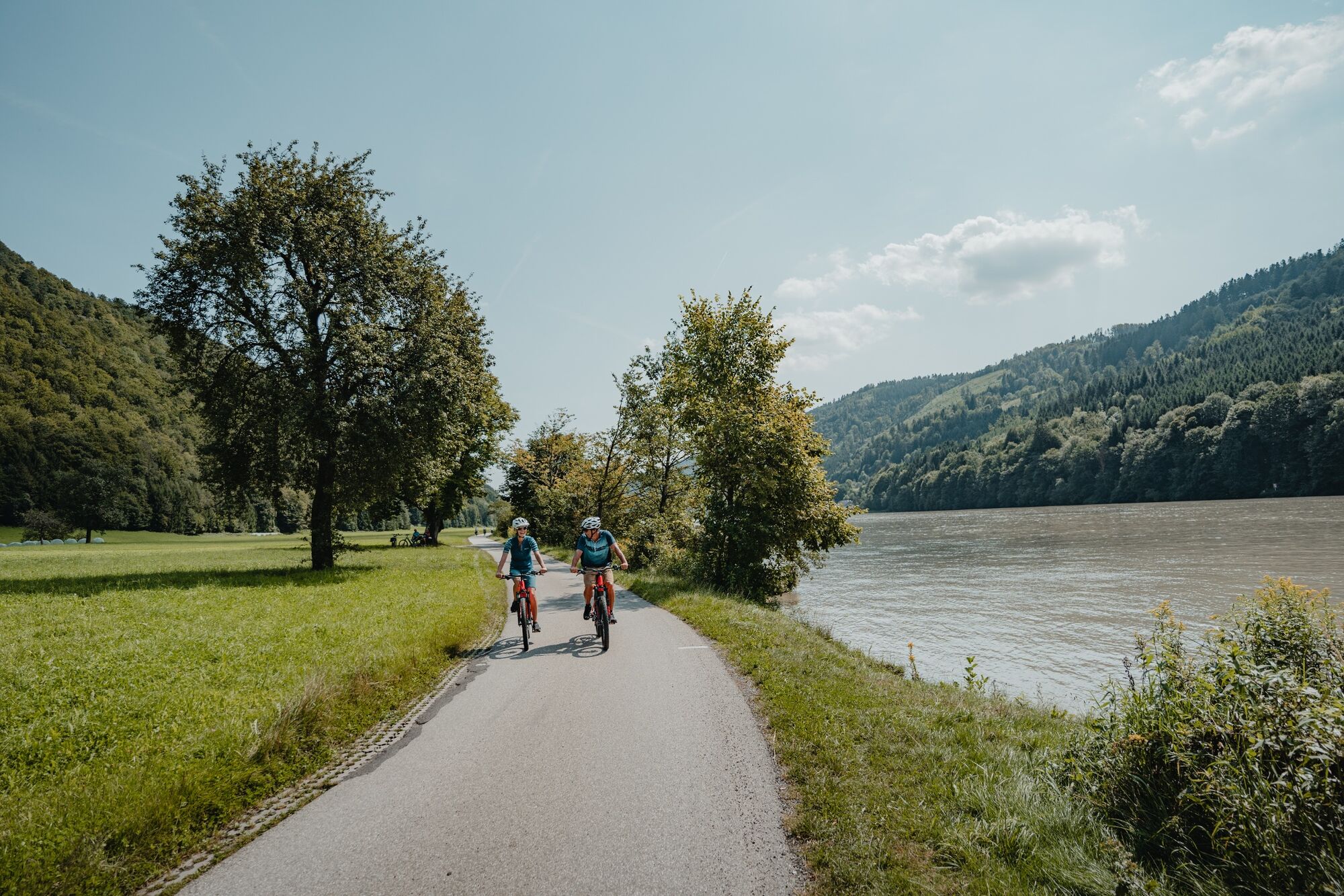
Fantastic summit cycle tour from the Upper Danube Valley to the parish church in Mühlkreis (840 m) which provides panoramic views – the highest point of all the Danube cycle routes! The reward: breath-taking views far into the Alps, a pleasure-filled descent across the landscape balcony into Pühret, .... Final highlight: perpendicular view into the Danube from the Penzenstein.
Highlights:
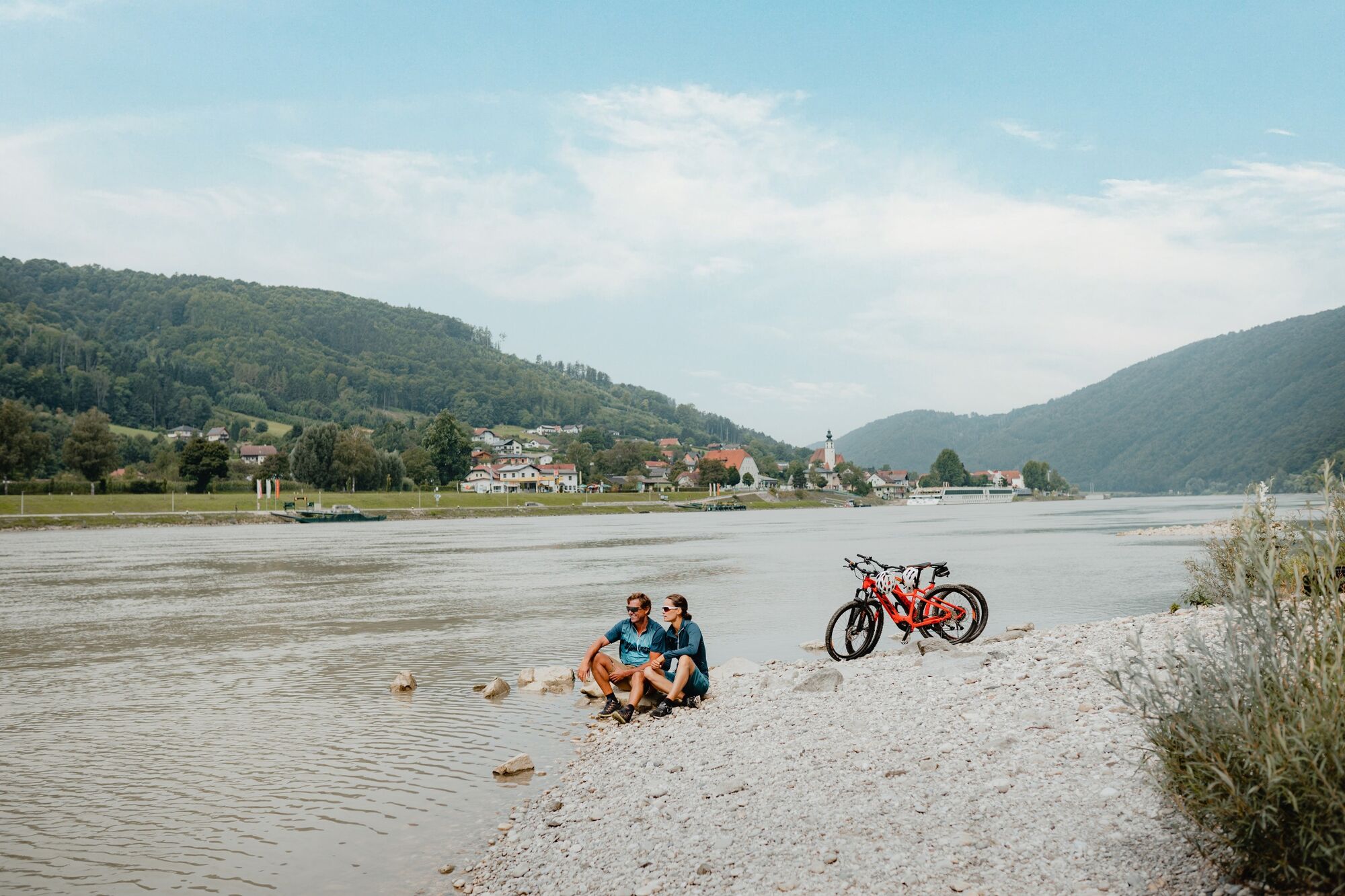
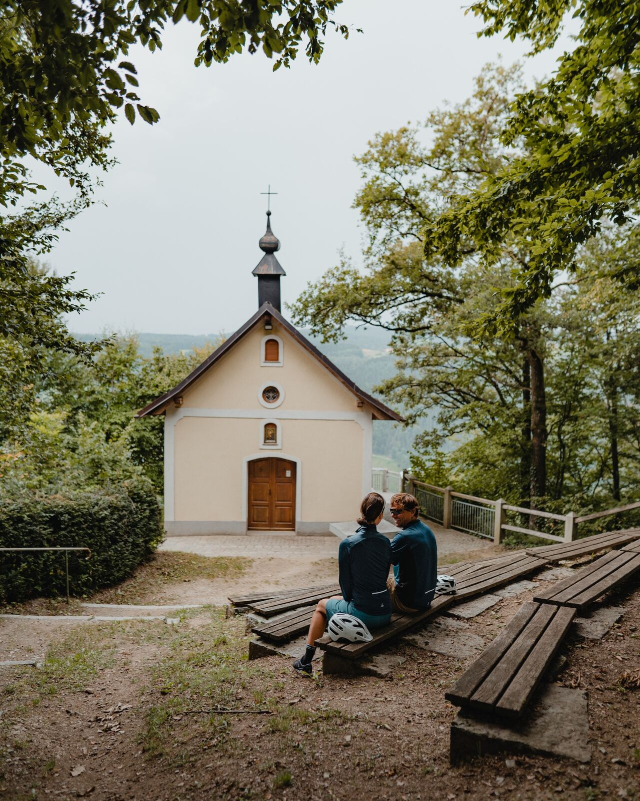
Parish church in Mühlkreis (highest point of the Danube Cycle Path circuits, panoramic viewing point) Penzenstein (pilgrimage church and views down to the depths of the Danube) - Directions
-
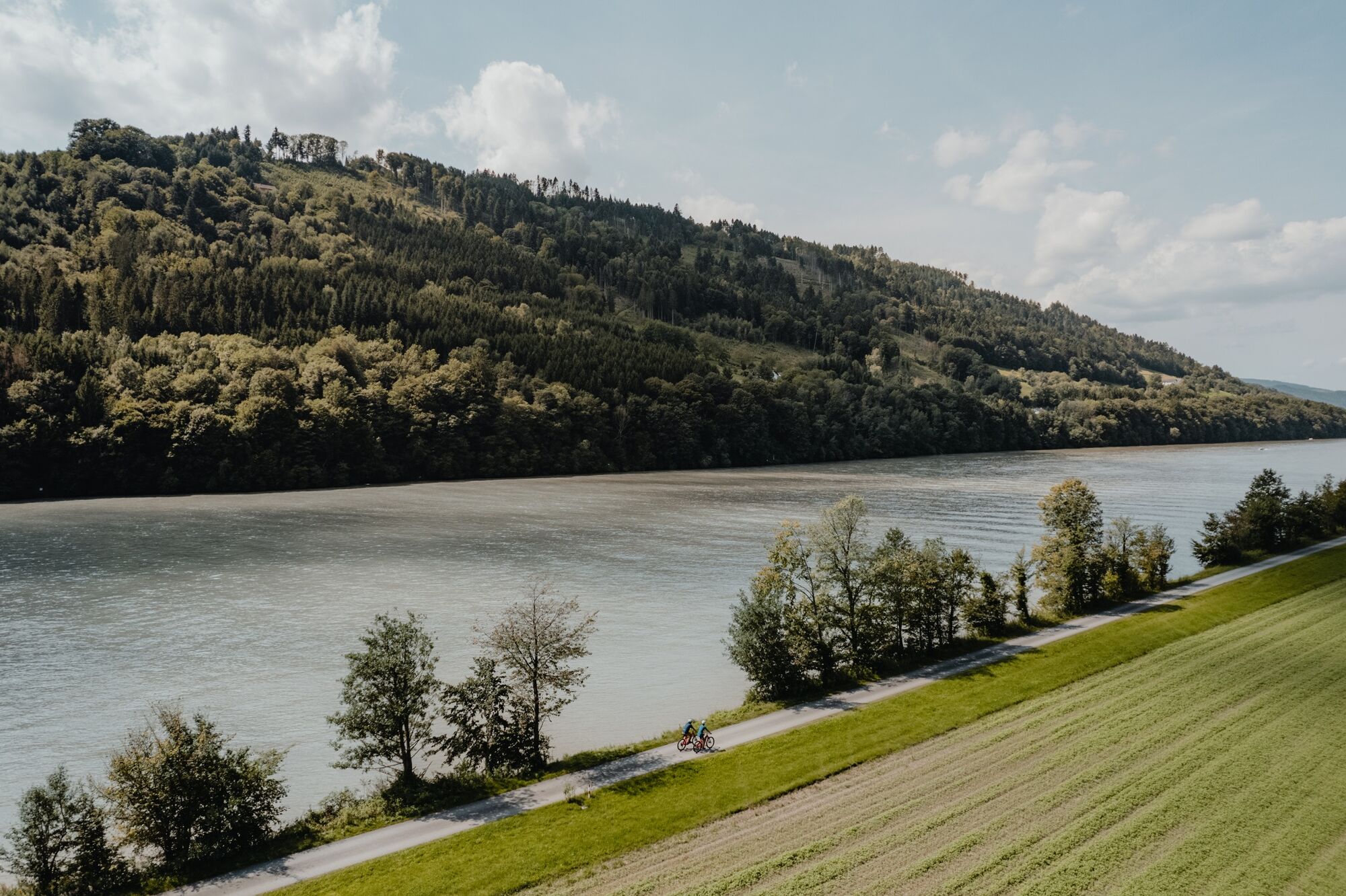
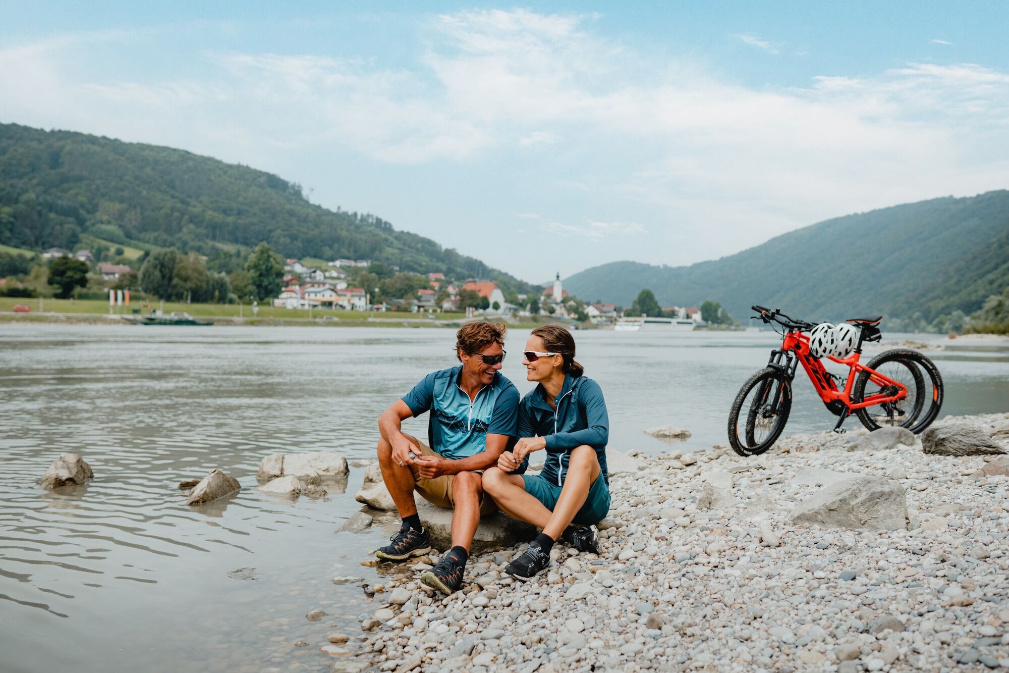
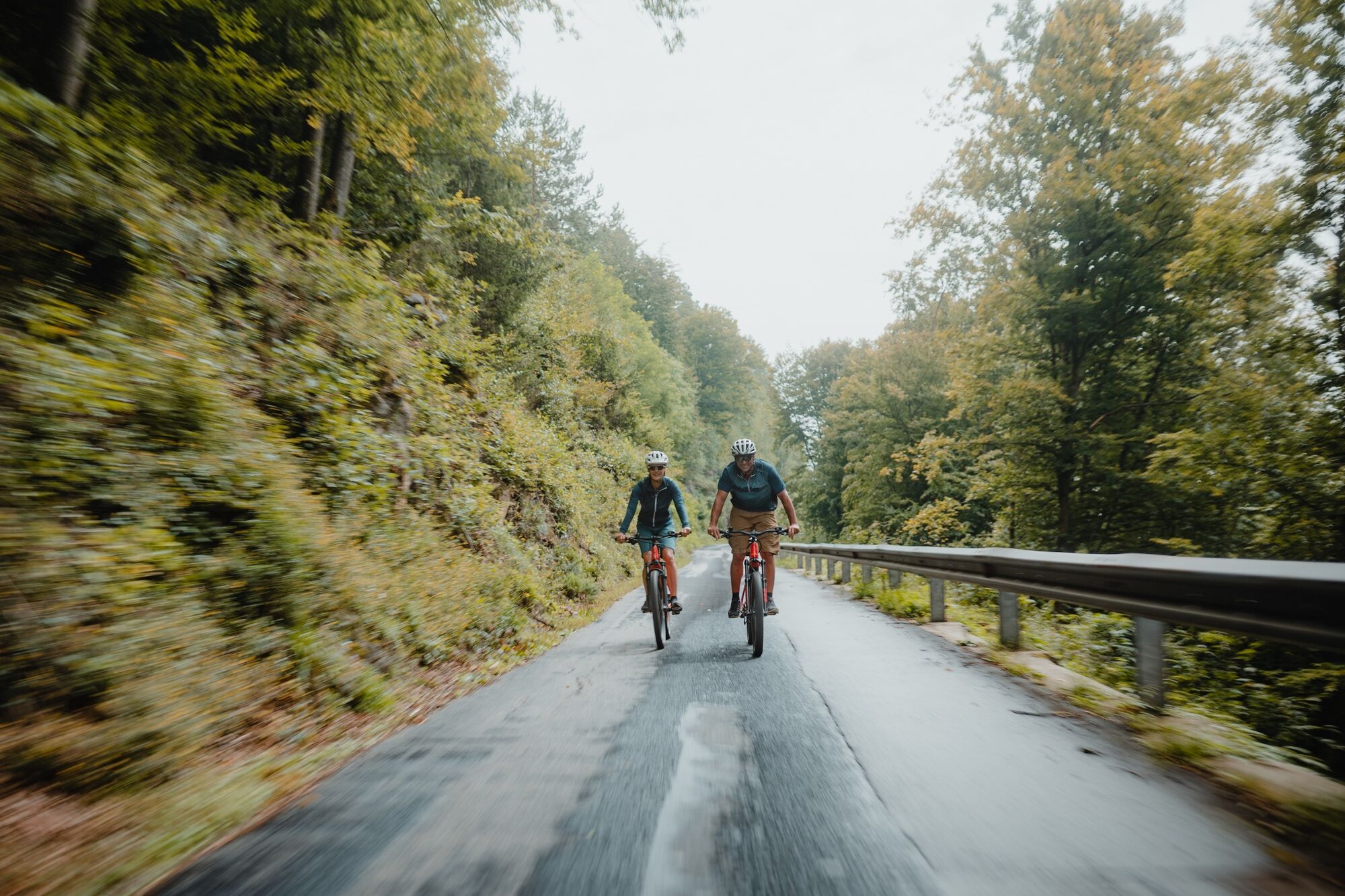
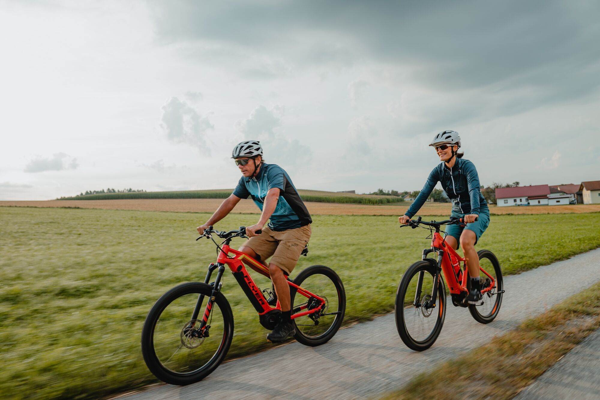
Located in the deep gorge of the Upper Danube Valley – at the mouth of the Ranna on the Danube -, secluded Rannamühl is the starting point for this superb summit cycle tour. To start with you warm up with a cycle downstream along the wide Danube river on peaceful side roads. Around 1.7 km after Niederranna the 550 metre summit climb starts! The first third proceeds in serpentines, in the shady mixed woodland area through the steep flanks of the Donauengtal. At mysterious Marsbach Castle, at one time a feared lair for robber barons, the hardest section is over. Continue to climb through the narrow Marsbachgraben, where the landscape then opens up – a feeling of elation provides a welcome sense of achievement. Now lush pastures, fertile fields, scattered farming hamlets, little areas of woodland provide inspiration... - A pure rural idyll in Mühlviertel! Proceed up on ridge terrain in Emmerstorf via favourable agricultural roads. It is here that those first views to the village of Hofkirchen, in the centre of an undulating high plateau, open up. What first springs to mind – a hidden paradise. The relaxing ride with easy up and downhill sections to the village helps you recover. In the lovely centre of the village the large parish church, houses, the village fountain, pillories ... recount an extensive history in the market square. Highlight: the plant labyrinth just above the town. An ancient energy-filled space which took centre-stage with its symbolism and which inspires with its sublime views! Via a country lane the route proceeds – somewhat more steeply – up to the next balcony section. There you enjoy a relaxing ride on rural roads to Hamet. The final ride proceeds through a traditional area of mixed mountain woodland, providing a panoramic view to the village parish church. At the edge of the woodland above the parish church is the 'Gipfel' - a fantastic panoramic viewing point (840 m). Congratulations, you are now at the highest point
of all
the Danube Cycle Path sections! Superb views down below enable you to get a sense of the elevation and enjoy dreamy Alpine views which seem to go on forever. Simply legendary! Another reward: 2.3 km of pure descending fun – intoxicating speed through natural mountain woodland, peppered with superb views into the distance! The remainder of the 5.4 km down to Oberkappel, with four small counter climbs, provides a wonderful cinematic style scenery experience. In the market at Oberkappel it is worth enjoying a short visit to the town square style market place ensemble. After crossing the river Ranna, the final big ascent begins. Ride for around 3 km, with some steep, uphill sections. Natural sections of mountain woodland encourage inner reflection, while the rural cultural area provides feelings of elation. Just above the mountain, you come to the rural one-street village of Neustift. After a short descent to the Stöcklbach Graben, a climb through a shaded forest follows, taking you to the Bavarian border. Congratulations! You are now at the gentle landscape balcony area of Pühret, directly above the Danube Gorge. Enjoy a lovely cycle through a rural cultural landscape, downhill on the long, slightly truncated altitude ridge. The final highlight: a short detour to the myth-enshrouded Penzenstein viewing point, which provides fantastic views down to the depths of the Danube and to Engelhartszell with its well-known abbey! Just after the village the speedy down woodland section begins, passing Rannariedl Castle, through the steep flanks of the Donauengtal. Once you reach the banks of the Danube, cycle down along the wide mysterious river at the legendary Treppelweg. A superb summit cycle tour providing a cinematic landscape experience!
- Highest point
- 820 m
- Endpoint
-
End location = Start location (circular route)
- Height profile
-

- Safety instructions
-
The main section of this superb cycle route uses tranquil, asphalt (side) roads. Between Hofkirchen and Hamet there is a 1.3 km section via a steeper agricultural road. Basic command of gears is necessary for the long climb sections. Basic braking technique is necessary for the long descent. Not suitable for traditional style road bikes.
Signage:
To make orientation easier, the Danube Cycle Path has been signposted with its own cycle guidance system. This circuit follows the "R1.06 Penzenstein Runde" signposts.
- Public transportation
- Parking
-
Rannamühle parking lot

- Author
-
The tour R1.06 Penzenstein circuit is used by outdooractive.com provided.