- Brief description
-
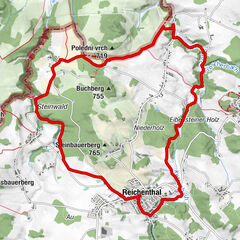
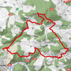
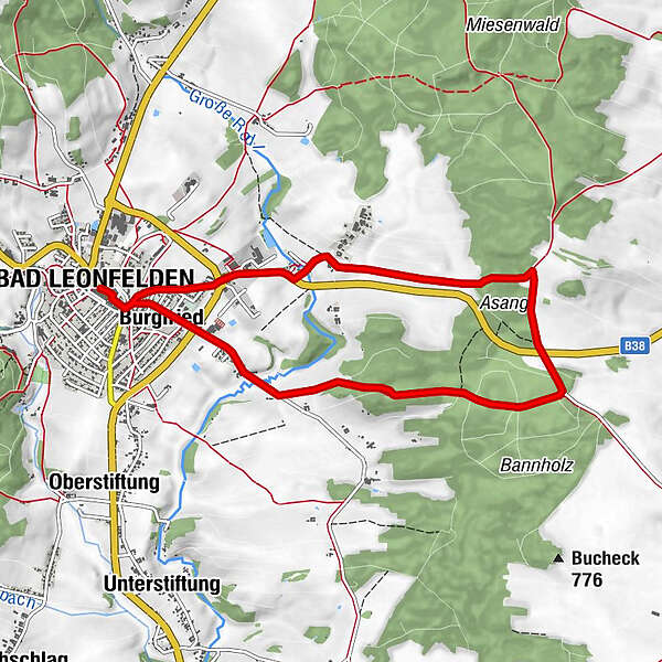
Route: Bad Leonfelden town square - Weinzierl - Asang - Bad Leonfelden town square
- Difficulty
-
easy
- Rating
-
- Route
-
Bad LeonfeldenHewalLeonfeldner Hof0.0 kmSpitalkirche0.1 kmPizza & Kebap Haus0.2 kmBurgfried0.6 kmKühbachl-Kreuzstöckl0.7 kmWeinzierl2.0 kmGrasböck Kreuzstöckl2.6 kmBurgfried7.9 kmPizza & Kebap Haus8.1 kmSpitalkirche8.3 kmBad Leonfelden8.5 kmHewal8.5 kmLeonfeldner Hof8.5 km
- Best season
-
JanFebMarAprMayJunJulAugSepOctNovDec
- Description
-
Underground: 60% asphalt, 40% gravel / natural soil
Map download: 5 Pannholz Round
Refreshments:
Gastronomy on the town square - Highest point
- 787 m
- Height profile
-

- Additional information
- Author
-
The tour 5 Pannholz Round is used by outdooractive.com provided.
GPS Downloads


Other tours in the regions
-
Mühlviertel
1785
-
Mühlviertler Sterngartl
1065
-
Bad Leonfelden
268