- Brief description
-
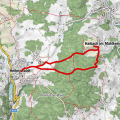
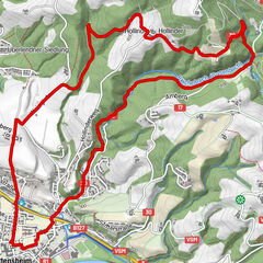
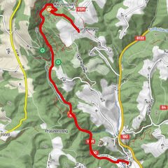
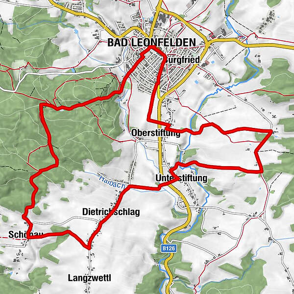
Route: Bad Leonfelden town square - Knight's Cross - Steinwald - Schönau - Langzwettl - Elmegg - Langbruck - Hagau - Oberstiftung - Bad Leonfelden town square
- Difficulty
-
medium
- Rating
-
- Route
-
Leonfeldner HofHewal0.1 kmBad Leonfelden0.1 kmPfarrkirche Bad Leonfelden0.1 kmEremiten Gedenkstätte1.0 kmAlpenblick1.1 kmJoachimsquelle1.4 kmSchönau5.4 kmDietrichschlag7.3 kmUnterstiftung8.5 kmOberstiftung13.4 kmBurgfried14.9 kmBad Leonfelden15.1 kmPizza & Kebap Haus15.1 kmSpitalkirche15.2 kmHewal15.2 kmLeonfeldner Hof15.2 km
- Best season
-
JanFebMarAprMayJunJulAugSepOctNovDec
- Description
-
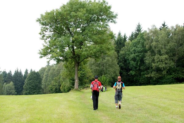
Underground: 40% asphalt, 60% gravel / natural soil
Map download: 4 Rodl Round
Refreshments:
Gastronomy on the town square
Helga´s Jausenstüberl - Highest point
- 791 m
- Height profile
-

- Additional information

- Author
-
The tour 4 Rodl Round is used by outdooractive.com provided.
GPS Downloads


Other tours in the regions
-
Mühlviertel
1785
-
Mühlviertler Sterngartl
1065
-
Bad Leonfelden
268