
- Brief description
-
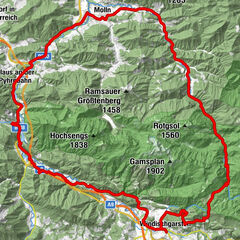
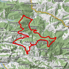
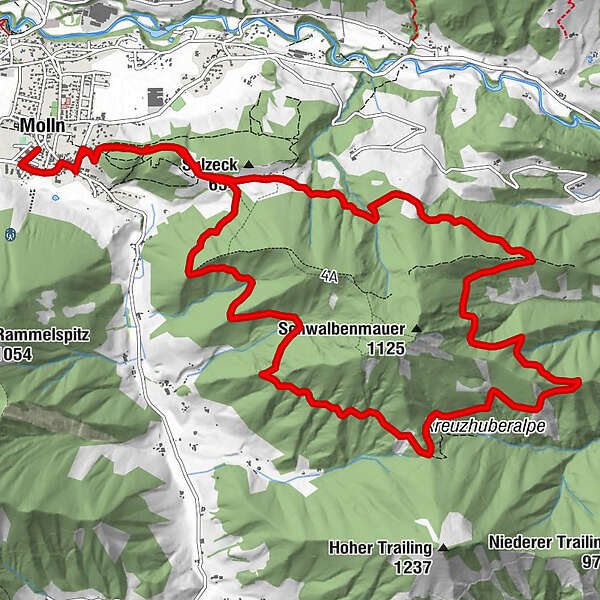
The tour starts at the National Park Center Molln.
- Difficulty
-
medium
- Rating
-
- Starting point
-
Nationalpark Zentrum Molln
- Route
-
Molln (442 m)Wirt im Dorf0.6 kmWirt im Dorf17.7 kmMolln (442 m)18.1 km
- Best season
-
JanFebMarAprMayJunJulAugSepOctNovDec
- Description
-
The Steyrtal village of Molln is the world's last production site of Jew's harps.
- Directions
-
Start at the National Park Center Molln. You cycle along the park road to the crossroads at the inn Wirt im Dorf. There you turn left. Soon the road forks, you follow it to the left towards Breitenau until the Denk Güterweg turns right. Here begins a good 1 km long climb to Steinköpfl. Pass a single farmhouse on the left, and shortly thereafter a forest road begins to the right, which runs gently but steadily uphill around the Annasberg. At km 6,1 we keep left uphill and arrive at the trailing crossroads. There we continue on the forest road in alternating ups and downs through dense forest to its end. After a few hundred meters on a dirt road, the asphalt road begins again at the Denkengut farmhouse. From now on it goes quickly downhill and back to the center of Molln.Variants: Variant Denkengut: From Denkengut past the Holzstadel on the dirt road steep and winding downhill to Breitenau. After the Krummen Steyrling we turn left and ride on the Breitenauer Bezirksstraße back to the village center.Variante Hoher Trailing:At the Trailing junction there is the possibility to circle the Hoher Trailing on an approx. 4.5 km long route.
- Highest point
- 857 m
- Endpoint
-
Nationalpark Zentrum Molln
- Height profile
-

- Equipment
-
Sun and rain protection, repair kid for minor bike breakdowns.
- Safety instructions
-
Inquire in advance about any road or trail closures along the route.
- Tips
-
Enjoy the wonderful natural bathing places at the Krummen Steyrling.
- Additional information
-
You can obtain map material at www.steyr-nationalpark.at

- Author
-
The tour Mollner Maultrommel round is used by outdooractive.com provided.


General info
-
Traunviertel
141
-
Steyr und die Nationalpark Region
116
-
Molln
44