

- Brief description
-
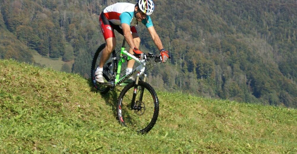
This round is for experienced mountain bikers. Athletes who take on this tour will be rewarded with invigorating refreshment stops at the Grünburger Hütte, Gasthaus Steiner-Kraml, and Berggasthof Windhager-Kores.
- Difficulty
-
difficult
- Rating
-
- Starting point
-
Molln
- Route
-
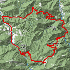
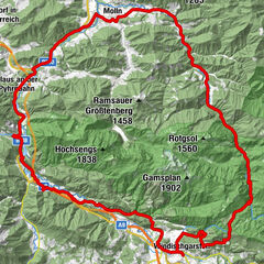
Pfarrkirche Molln0.1 kmMolln (442 m)0.2 kmristorante dal Siciliano0.2 kmLandgasthof Klausner0.8 kmBrettmaisalm13.7 kmGrünburger Hütte14.1 kmSchreibachfall18.8 kmMitterhumer´s Mostheuriger21.8 kmMösern28.3 kmBreitenau40.0 kmBerggasthof Windhager-Kores40.2 km
- Best season
-
JanFebMarAprMayJunJulAugSepOctNovDec
- Description
-
Very demanding tour between the Steyr and Enns valleys, with two tough climbs, hut stops and very steep downhill sections.
- Directions
-
Molln - Gstadt - Gradau - forest road Dorngraben - Pfaffenboden - Grünburger hut (1080 m) and back - Schreibach waterfall - Trattenbach - Kienberg - In den Mösern (992 m) - Rosenegger Alm (Bilderstadeln) - Hausbach - Breitenau - Molln.
The start is in Molln. The route leads you through the districts of Gstadt and then Gradau in an alternating up and down until you reach a chapel. At this chapel you turn right and reach the forest road into the Dorngraben. From now on it gets strenuous. You cycle up a few meters in altitude to Pfaffenboden (1,032 m). Here you can visit the Grünburger Hütte on the left or you can choose the forest road on the right, which leads you to the Gaisberg (1,267 m).
Alternative: At Pfaffenboden, continue straight ahead in the direction of Trattenbach and pass the Scheibach waterfall. There you can turn right over Trattenbach and Kienberg and then take trail no. 5 to the area "In der Mösern". Continue until you reach the Bilderstadeln. There you can fully enjoy the quiet valley at a hay barn with very beautiful pictures of saints. Continue past the remains of the Rosenegg estate, along lush meadows and pastures. In spring, a sea of daffodils and troll flowers awaits you there. On the following stretch you can quench your thirst at the Windhager-Kores inn or a little later at the Steiner Kraml inn. Well refreshed, you will finally return to Molln via the Rabach district.
Translated with www.DeepL.com/Translator (free version)
- Highest point
- 1,076 m
- Endpoint
-
Molln
- Height profile
-

- Equipment
-
Sun and rain protection, repair kid for minor bike breakdowns
- Safety instructions
-
Check in advance for any road or trail closures along the route.
- Additional information
-
You can obtain map material at www.steyr-nationalpark.at

- Author
-
The tour Gaisberg-Runde (ab Molln) is used by outdooractive.com provided.


-
Traunviertel
141
-
Steyr und die Nationalpark Region
116
-
Molln
44