© OÖ Tourismus/Erber - HERMANN ERBER
- Brief description
-
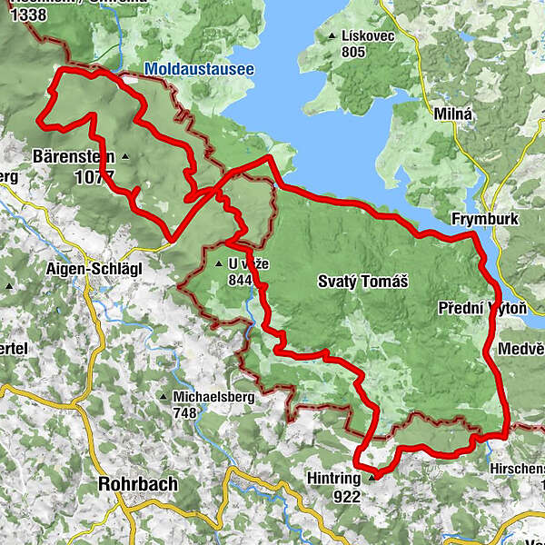
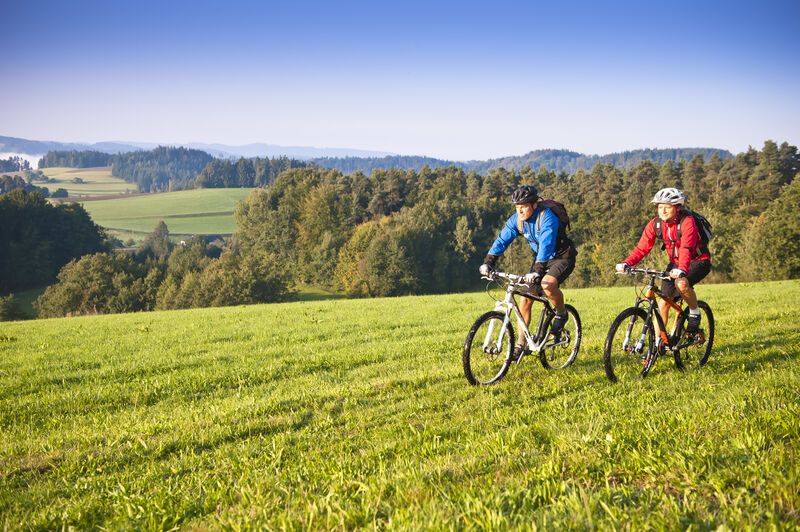
The bike and mountain bike route "Bohemian Dream" is demanding - but fantastic - because everything from romantic forest routes, relaxing sea routes to breathtaking viewpoints is included.
- Difficulty
-
difficult
- Rating
-
- Route
-
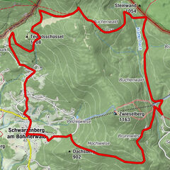
Guglwald5.9 kmehemalige Kapellner Waldhäuser6.4 kmRestaurace & Penzion Výtoň10.9 kmVorder Heuraffl11.0 kmSankt Philipp und Jakob11.4 kmFriedau14.6 kmSonnenwald33.7 kmJausenstation Blauer Hirsch33.9 kmHeimatvertriebenenkirche35.9 kmInn's Holz37.0 kmRosstauscherberg (999 m)41.4 kmGasthaus Panyhaus44.0 kmGrünwald44.5 kmRosenhügel55.8 kmehemaliges Ottenschlag57.2 kmehemaliges Asang58.4 kmehemaliges Deutsch Reichenau60.8 kmPernecká zatáčka61.9 kmehemaliges Bernek62.7 kmehemaliges Multerberg65.9 kmInnenschlag67.6 km
- Best season
-
JanFebMarAprMayJunJulAugSepOctNovDec
- Description
-
The Bohemian Dream takes you across the Bohemian Forest, a little way along the 'Schwarzenberger Schwemmkananals', up to the 'Alpenblick' viewing platform and on to the beautiful lake and bank landscape of the Vltava River. In addition, this route connects four of the 7 TOP.HOTELS Mühlviertel.
- Highest point
- 1,013 m
- Height profile
-

- Additional information
- Directions
-
coming from LINZ: B126 to “Bad Leonfelden” - further in the direction of “Rohrbach” on the B38 - turn right after “Vorderweißenbach” onto the L1544 (the TraumArena is well-marked) - after 8 km (Hotel Bergergut), you will arrive at one of the entry points.
Coming from PASSAU: on the B338 towards Austria / “Rohrbach” - (turns into the B38 on the Austrian side) - further on in the direction of “Freistadt” - turn left after “Haslach a.d. Mühl” onto the L1544 towards “St. Stefan a. Walde” (the TraumArena is well marked) - after 7 km (Hotel Bergergut), you will arrive at one of the entry points.
- Author
-
The tour Bohemian dream is used by outdooractive.com provided.
GPS Downloads


General info
Refreshment stop
Other tours in the regions