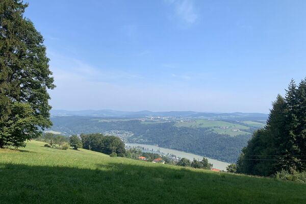
© Baumkronenweg - Manfred Rauscher
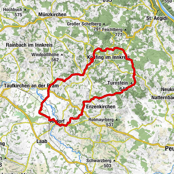
Tour data
37.27km
332
- 632m
557hm
535hm
02:30h
WGD Donau Oberösterreich Tourismus
- Brief description
-
Eine Tour vom Pramtal in den Sauwald
- Difficulty
-
difficult
- Rating
-
- Route
-
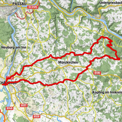
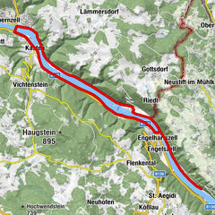
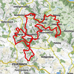
Beharding0.3 kmMitterndorf3.4 kmRaad4.4 kmBrunnern5.3 kmBernolden6.9 kmDiersbach8.0 kmGasthaus Stiegenwirt8.1 kmKalling8.9 kmInding10.0 kmSchärdingerau12.2 kmWinertshamerau12.6 kmLohstampf14.1 kmAndorf (346 m)15.1 kmKirchenwirt15.1 kmPfarrkirche Andorf15.2 kmLichtegg16.7 kmOberndorf17.9 kmOberhaigen19.3 kmUnterhaigen19.9 kmMühlwitraun22.1 kmRuprechtsberg23.6 kmAufleck26.8 kmBerndorf29.3 kmHochfilz30.0 kmHochholding30.8 kmGrafendorf32.3 kmKnechtelsdorf34.5 kmWollmannsdorf35.1 kmDobl35.9 kmRuholding36.4 km
- Best season
-
JanFebMarAprMayJunJulAugSepOctNovDec
- Highest point
- 632 m
- Height profile
-

- Additional information

- Author
-
WGD Donau Oberösterreich TourismusThe tour R8 "Vom Pramtaler Knödelweg zum Baumkronenweg" is used by outdooractive.com provided.
GPS Downloads


Other tours in the regions