© GREEN SPORTS - RUNNERSFUN Consulting GmbH - Felix Ettinger

- Difficulty
-
easy
- Rating
-
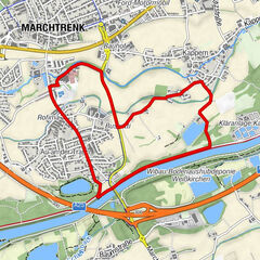
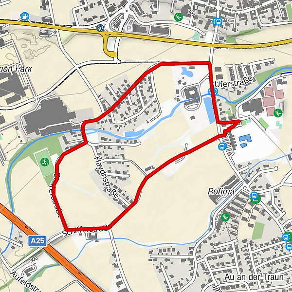
- Route
-
Marchtrenk2.1 km
- Highest point
- 304 m
- Height profile
-


- Author
-
The tour Runnersfun Runde is used by outdooractive.com provided.
GPS Downloads


Other tours in the regions
-
Traunviertel
122
-
Tourismusregion Wels
41
-
Marchtrenk
10