Danube Cycle Path Stage 2 South Bank: Schlögen - Linz


- Brief description
-
Shipbuilders & cathedrals – Culture on the wayside
- Difficulty
-
easy
- Rating
-
- Starting point
-
Schlögen
- Route
-
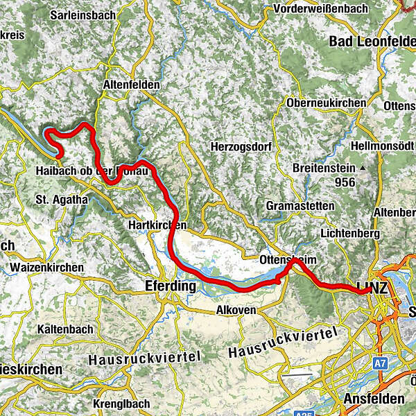
SchlögenInzell3.8 kmKobling8.8 kmSommerberg24.2 kmAschach an der Donau26.4 kmLandgasthaus Dieplinger29.2 kmSchiffsanlegestelle29.2 kmBrandstatt29.3 kmGasthaus und Café Lackner29.4 kmSchiffanlegestelle29.5 kmFall40.8 kmWilhering Ufer42.9 kmOttensheimer Drahtseilbrücke43.3 kmOttensheim43.3 kmDonaubus43.5 kmGasthaus Dürnberg44.7 kmPuchenau West48.0 kmPuchenau49.4 kmSankt Andreas49.4 kmUrfahrwänd50.8 kmAlt-Urfahr52.5 kmNikolaikapelle52.7 kmDonaubus Anlegestelle52.8 kmLinz (266 m)52.9 km
- Best season
-
JanFebMarAprMayJunJulAugSepOctNovDec
- Description
-
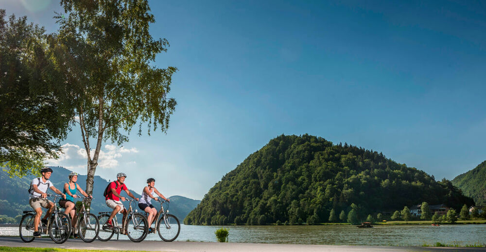
Before you start this stage on the south bank of the Danube, you should walk up to the prospect known as the Schlögener Blick, located 30 minutes above the village of Schlögen. From there you can enjoy a wonderful view of this famous meander in the Danube. Following this overview, you have a chance to explore the forested slopes of this free meander at close range in the nature reserve Donauleiten. A bit further long you reach the town of Aschach. In the center of town are beautiful old buildings with facades and inner courtyards from the Gothic, Renaissance and Baroque eras. In a modern museum (Schoppermuseum) you can pick up interesting and quaint facts about the old handcraft of ship construction. And in the old church you can find out about the alleged healing powers of the “Danube Cross.”
From Aschach it is not long until you reach Eferding. The history of this little city a short ways away from the Danube Bike Path starts back in Roman Times. Its main square is considered one of one of the most beautiful in Upper Austria, as the houses have not really been altered since the Middle Ages. Despite its size, the city’s church is nicknamed Eferding Cathedral. This church is definitely worth a visit, as is the magnificent Starhemberg Castle with its museums and exhibitions.
For even more culture along the way, visit the Cistercian monastery in Wilhering (founded in 1146) with its Rococo church, picture gallery and abbey museum.
After your fleeting visit to this abbey, hop on a ferry in Ottensheim to return to the north banks of the river, where you can cover the final stretch to Linz.
- Directions
-
Schlögen - Aschach - Wilhering - Ottensheim - Linz
Route description
You start your tour in Schlögen and bike along the south bank through a stretch of romantic Danube Valley wilderness (Natura 2000 area) that extends to Aschach. After about 10 km, the path forks just behind the Kobling-Obermühl ferry and you bear left. From a distance, you can admire Neuhaus Castle, which sits on the opposite bank of the Danube.
After a while you pass Aschach, which is known for its Baroque houses- There you can stop for a break and visit the historical center with the old parish church and the museum on fishermen and shipbuilders before continuing south into the Erferding Basin. This basin is the vegetable garden of Upper Austria and extends all the way to Wilhering. Here, the slopes to the left and right of the river slowly give way to flatter landscapes. In Brandstatt it would be worth your while to take a side trip to Eferding to visit Starhemberg Castle and the renowned town square.
You follow the Danube until you arrive at Wilhering. A visit to Wilhering Abbey is recommended. Afterwards, take the ferry to Ottensheim and bike to the Linz, the Cathedral City.
TIP: At the end of this stage, enjoy a train ride on the Mühlkreisbahn from Ottensheim to Linz.
- Highest point
- 322 m
- Endpoint
-
Linz
- Height profile
-

- Arrival
-
Follow the Nibelungen Straße (B130) to Schlögen.
- Public transportation
-
Take the bus to the stop Schlögen-Inzell junction.
- Parking
-
There are parking lots at the Hotel Donauschlinge.
- Author
-
The tour Danube Cycle Path Stage 2 South Bank: Schlögen - Linz is used by outdooractive.com provided.