Tour: Schlögen-Linz-Schlögen Cycle Route| Pleasure & chill on the Danube Cycle Path


- Brief description
-
From the natural wonder Schlögener Schlinge (Danube loop) to the modern cultural capital Linz.
- Difficulty
-
easy
- Rating
-
- Starting point
-
Schlögen
- Route
-
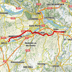
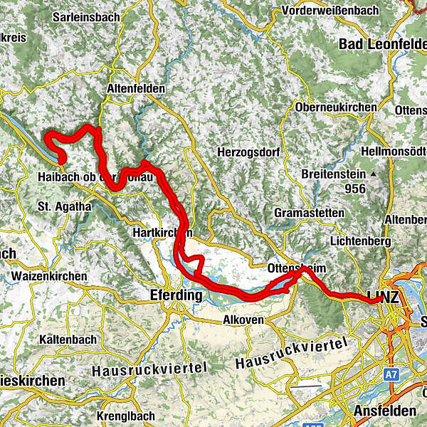
SchlögenInzell3.8 kmKobling8.9 kmSommerberg24.4 kmAschach an der Donau26.4 kmBrandstatt29.1 kmSchiffsanlegestelle29.2 kmLandgasthaus Dieplinger29.4 kmGasthaus und Café Lackner29.4 kmSchiffanlegestelle29.6 kmFall40.8 kmWilhering Ufer42.9 kmOttensheimer Drahtseilbrücke43.3 kmOttensheim43.4 kmDonaubus43.5 kmGasthaus Dürnberg44.7 kmPuchenau West48.0 kmIL MARE Restaurant49.0 kmPuchenau49.5 kmSankt Andreas49.5 kmUrfahrwänd51.0 kmAlt-Urfahr52.6 kmDonaubus Anlegestelle52.9 kmLinz (266 m)53.0 kmNikolaikapelle53.0 kmUrfahrwänd54.4 kmPuchenau56.4 kmSankt Andreas56.5 kmIL MARE Restaurant57.1 kmPuchenau West57.5 kmGasthaus Dürnberg61.2 kmDonaubus62.5 kmOttensheim62.7 kmRegatta64.3 kmWeidet75.2 kmFeldkirchen an der Donau76.4 kmUnterlandshaag79.7 kmOberlandshaag80.6 kmBremsberg87.6 kmSchiffsanlegestelle Untermühl89.1 kmGasthof Ernst89.1 kmUntermühl89.4 kmPoint90.0 kmExlau92.1 kmGasthof in der Exlau92.6 kmRastplatz97.2 kmSchiffsanlegestelle99.3 kmFischgasthaus Aumüller99.4 kmFilialkirche Obermühl an der Donau99.4 kmObermühl an der Donau99.5 kmDonauparadies Gasthof Gierlinger100.3 kmGrafenau103.4 kmInzell105.0 kmAu108.3 kmSchlögen109.3 km
- Best season
-
JanFebMarAprMayJunJulAugSepOctNovDec
- Description
-
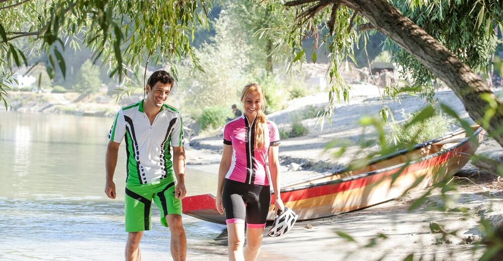
Discover the forest gorges of the Danube valley, the leisure paradise in Feldkirchen and modern city of Linz.
- Directions
-
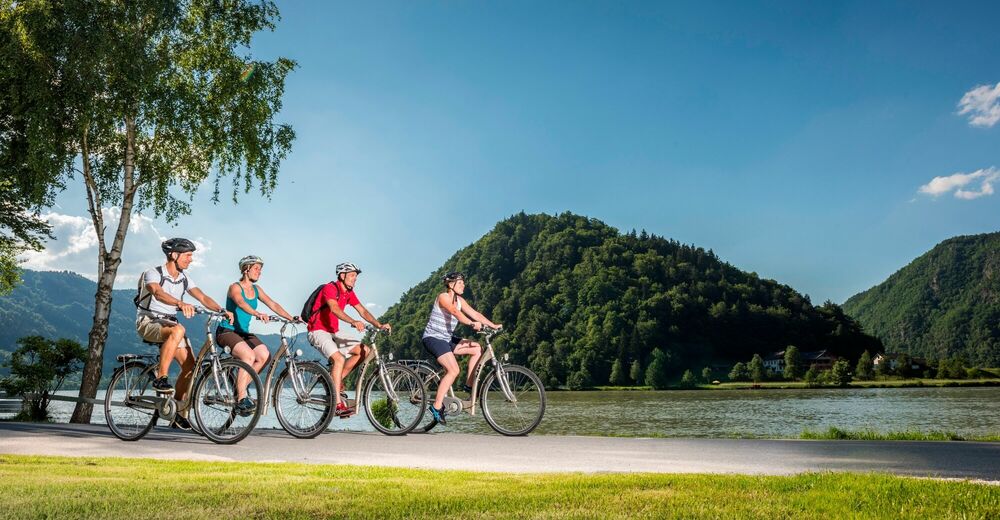
You start this tour in Schlögen and always drive along the south bank, through the wild and romantic Danube valley, which extends to Aschach. After about ten kilometers, shortly after the ferry Kobling-Obermühl, the path forks and you keep left. From a distance you can admire Neuhaus Castle, which towers over the Danube on the opposite bank.
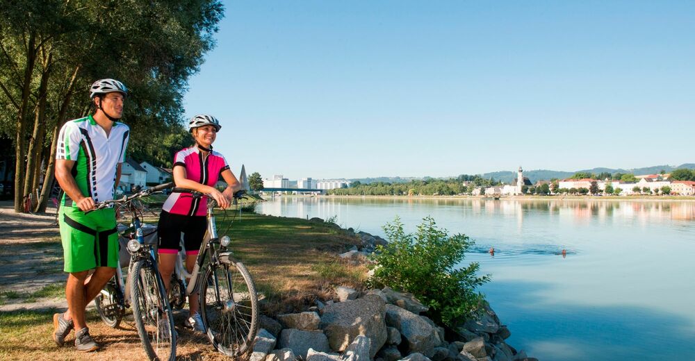
After some time you will pass Aschach, which is known for its baroque row of houses. Here you can take a short rest and visit the old town center, the old parish church and the fishing and boat building museum. You can also visit the barrier-free culture trail in Aschach and learn more about the history of the Danube market. Continue in a southerly direction on the long-distance cycle path through the Eferding Basin - the vegetable-growing region of Upper Austria, which extends as far as Wilhering. Here the slopes to the left and right of the river slowly disappear and the terrain becomes increasingly flat. In Brandstatt, it is worth taking a detour to Eferding and visiting Starhemberg Castle and the Eferding town square.
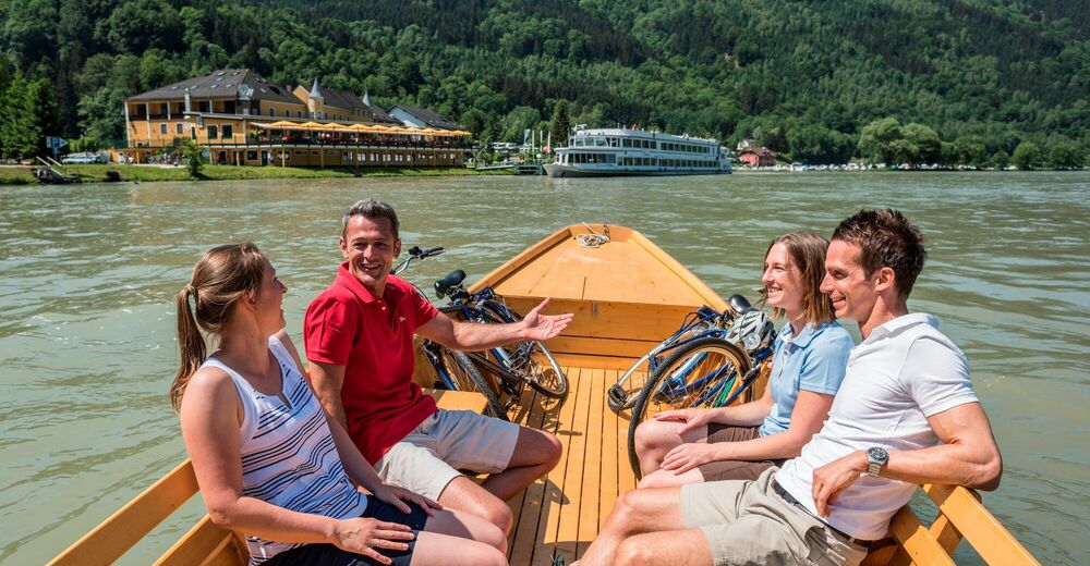
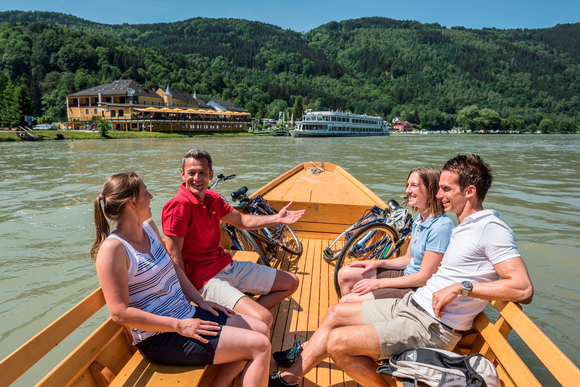
You follow the Danube until you arrive in Wilhering. Here you can take the opportunity to visit the Wilhering Monastery. Afterwards you will take the ferry to Ottensheim and continue to the cathedral city of Linz.
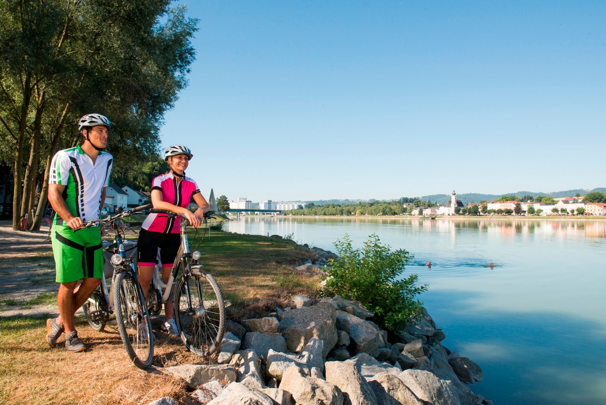
From Linz you will now return to Ottensheim on the northern bank of the Danube. The Danube cycle path now leads past the Feldkirchen bathing lakes, where it is worth stopping and jumping into the cool water (water skiing, diving, wakeboarding, etc.). Now we say goodbye to the Danube for a short distance and cycle through Feldkirchen, a rural cultural landscape and an important region for fruit and vegetable growing. Here, too, we have the opportunity to marvel at a magnificent medieval building. However, Mühldorf Castle (a hotel) is privately owned, which is why it can only be visited from the outside. At Unterlandshaag, opposite the Danube market of Aschach, you will return to the banks of the Danube.
Now continue on the Danube cycle path in the direction of Schlögen. You have to bridge a short stretch with the longitudinal ferry to get to Untermühl. After you have passed the small village of Obermühl, two more ferry rides are on the program to conclude the stage. The longitudinal ferry takes you from Grafenau through the Schlögener Schlinge to Au. Here you take the bike ferry again to the stage destination Schlögen.
- Highest point
- 308 m
- Endpoint
-
Schlögen
- Height profile
-

- Tips
-
It is recommended to plan the tour for two days with an overnight stay. You can find bike-friendly establishments along the Danube Cycle Path here.
Stop for a bite to eat: Fischgasthof Aumüller in Obermühl on the Danube. You can enjoy tasty dishes from bream to pikeperch or even fiery red crayfish here.

- Author
-
The tour Tour: Schlögen-Linz-Schlögen Cycle Route| Pleasure & chill on the Danube Cycle Path is used by outdooractive.com provided.