
- Brief description
-
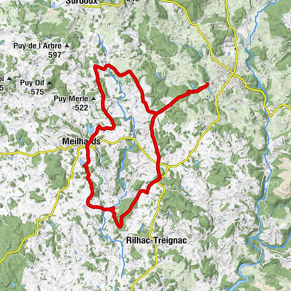
Ce parcours de 21 km est un trait d’union entre les communes de Chamberet et de Meilhards. Il est dédié aux vététistes qui aiment rouler vite et parfait pour les débutants.
- Difficulty
-
medium
- Rating
-
- Route
-
Chapelle Saint-Dulcet1.1 kmVieillemard5.5 kmLes Pins6.1 kmLe Moulin de Bissol8.7 kmLe Mavaleix9.5 kmLes Ages10.0 kmMeilhards12.0 kmChivialle16.4 kmMortefonds17.3 kmMarliangeas19.3 kmChapelle Saint-Dulcet20.8 km
- Best season
-
JanFebMarAprMayJunJulAugSepOctNovDec
- Highest point
- 535 m
- Endpoint
-
Chamberet
- Height profile
-
 © outdooractive.com
-

-
AuthorThe tour De Chamberet à Meilhards is used by outdooractive.com provided.
GPS Downloads

General info
Cultural/Historical
Flora
Fauna
A lot of view