- Brief description
-
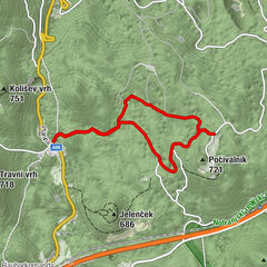
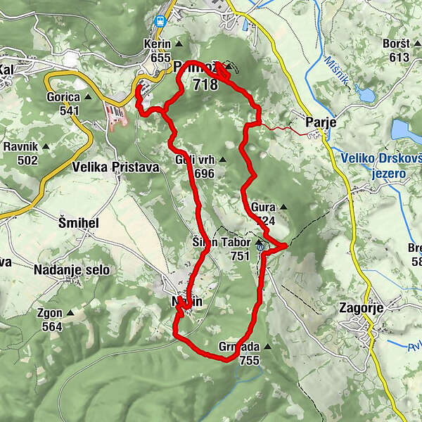
Circular Trail of Military History connects the Park of Military History, the Alpine Wall fortification, Šilentabor nad Zagorjem hill, and the village of Narin.
- Difficulty
-
medium
- Rating
-
- Starting point
-
Pivka Military Museum
- Route
-
Primož (718 m)2.4 kmŠilentabor5.8 kmŽorč5.9 kmNarin9.1 km
- Best season
-
JanFebMarAprMayJunJulAugSepOctNovDec
- Description
-
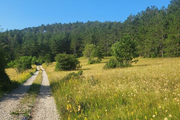
The Pivka Basin, at the intersection of the Inner region (Notranjska), the Littoral region (Primorska), and the Karst, invites curious travelers to meet its unspoiled nature. Recently, the Circular Trail of Military History has become an important hiking destination among locals and tourists, because of diverse content, attractive landscape, and good infrastructure of signposts, blazes and information signboards. With its picturesque landscape and interesting stories, the hike along the Circular Trail of Military History, which follows the footsteps of the thousands of years of military-historical heritage of these regions, is a special experience. The thematic educational trail with its starting point in the Park of Military History, a museum with a rich collection of military heritage, visits the cavern from the First World War, the top of Primož hill, Šilentabor with its amazing panoramic view over Pivka and the village of Narin, before returning to the starting point.
- Directions
-
Thematic Path of Military History connects the Military History Park, the underground fortification of the Alpine Wall at Primož, Šilentabor above Zagorje and the village of Narin.
The journey begins at the Military History Park, a museum tourist center that offers visitors a unique insight into Slovenia's rich military history, with a particular focus on the 1991 War of Independence.
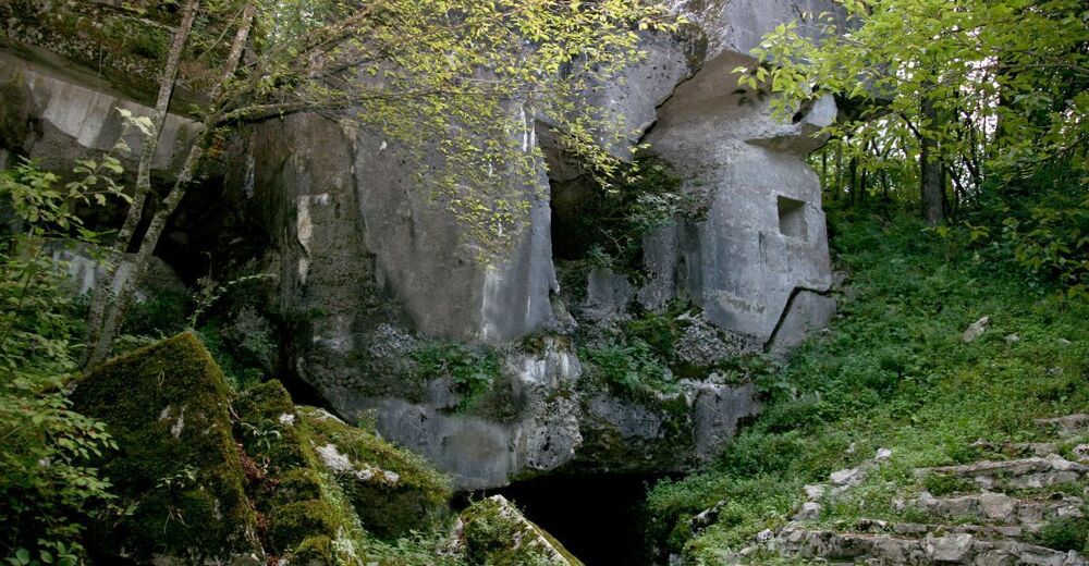
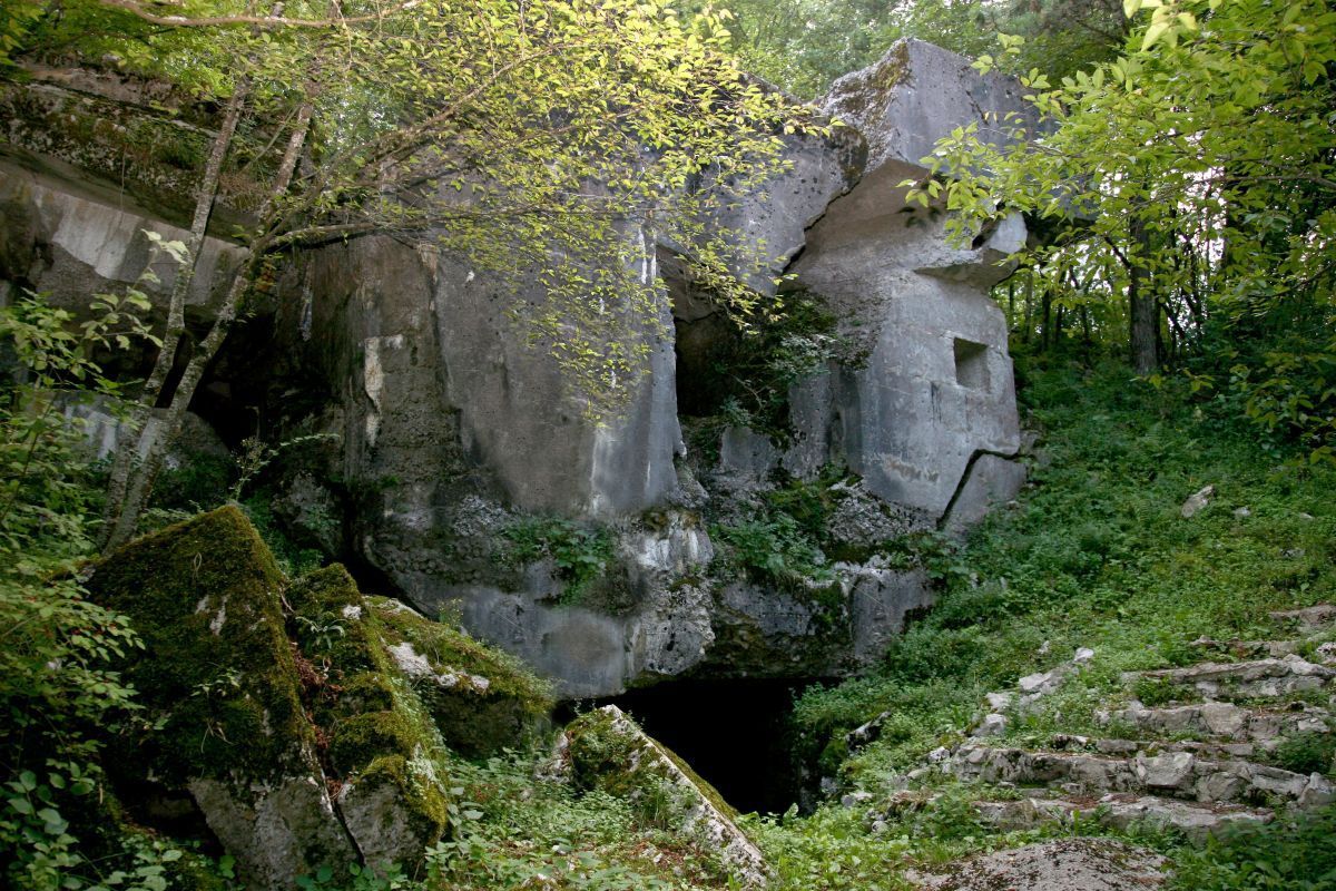
After a short climb, the trail leads you to the former military training ground at Kota 110 (613 m), where a system of shooting trenches was built during the First World War and a cavern was dug to train units preparing to fight on the Isonzo battlefield. From Kota 110 an old military road leads to the top of the nearby Primož hill (718 m), on which lies the mighty underground artillery fort of the Alpine Wall. Inside, approximately 500 m of underground tunnels are preserved along with fighting postions, ammunition depots and living quarters.
You can walk inside the fort with a guide by appointment.The hill has always had an important strategic position, as the entire Pivka basin is clearly visible from the top. An important fortified settlement stood on it in the pre-ancient times, and until the second half of the 18th century there was also the church of St. Primož and Felician. In recent years, Primož has been well visited especially because of the energy points located at the very top and right next to it.
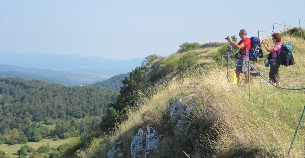
From Primož, the path descends to the Dule valley, where, according to tradition, the old Roman road is supposed to be followed by a gentle ascent to Šilentabor (751 m). From the summit, where once stood the largest fortified complex in Slovenia, there is a wonderful view of the surroundings. Šilentabor was inhabited in prehistoric and Roman times, and the mighty fort was built during the Turkish invasions. There is also an old church of Sv. Martin with the remains of a late antique apse and 15th century frescoes.
From here, the path descends towards the tourist village of Narin, where closed groups can take a look at some of the local farmers traditions and customs and taste the various local delicacies before continueing on to the Military History Park.
- Highest point
- 737 m
- Endpoint
-
Pivka Military Museum
- Height profile
-
 © outdooractive.com
 - Equipment
-
Proper hiking equipment
- Safety instructions
-
The trail will take you 4h, and includes ascend to a few hills, as well as underground tunnels, so the proper hiking equipment is essential.
- Tips
-
Twice a year, the Thematic Path of Military History Walk is organized along the route
- Additional information
-
You can visit just some of the parts of the trail, take a look at the brochure on the link bellow:
https://www.parkvojaskezgodovine.si/wp-content/uploads/2019/04/zlozenka_KROZNA-pot_A4_2017_PRESS-2.pdf
- Directions
-
Take highway Ljubljana -Koper, exit Postojna and head towards Ilirska Bistrica. The museum is located next to the main road, about 1km from Pivka.
- Public transportation
-
Pivka is accessible by local bus or with train. But you will have to walk or take a taxi to the museum, since it is located a bit out of the city itself.
- Parking
-
Free parking available, also payable places for mobile homes.

- Author
-
The tour Thematic Path of Military History is used by outdooractive.com provided.