
- Brief description
-
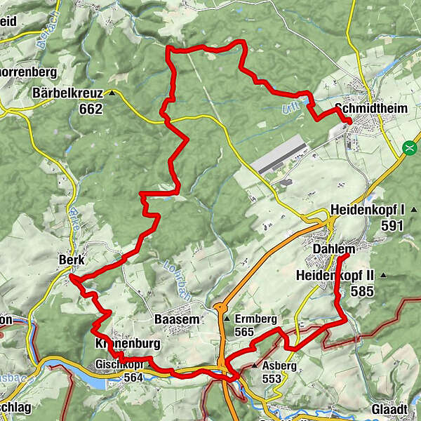
Diese Etappe geht entlang einsamer Weiher bis hin zum mittelalterliches Kronenburg, bergab zur Kyll-Aue und in die Höhenlandschaft über Dahlem.
- Difficulty
-
difficult
- Rating
-
- Route
-
Berk15.3 kmSt. Johann Baptist19.1 kmKronenburg19.2 kmGischkopf (564 m)19.8 kmHammerhütte22.2 kmDahlem28.1 km
- Best season
-
JanFebMarAprMayJunJulAugSepOctNovDec
- Highest point
- 595 m
- Endpoint
-
Bahnhof Dahlem
- Height profile
-
 © outdooractive.com

- Author
-
The tour GPS-Tour: EifelBahnSteig 9. Etappe: Von Schmidtheim nach Dahlem is used by outdooractive.com provided.
GPS Downloads


General info
Refreshment stop
Cultural/Historical
Fauna
A lot of view
Other tours in the regions
-
Eifel & Aachen
1423
-
Nordeifel
834
-
Dahlem
156