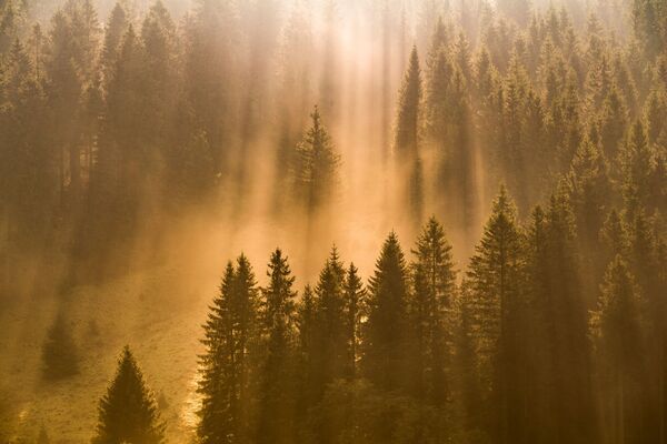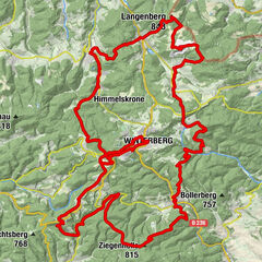

- Brief description
-
Together with its valley slopes, the wide, flat floodplain of the Nuhne is the largest contiguous hay meadows area in North Rhine-Westphalia, and also holds the state's largest breeding population of the Whinchat. This makes the Nuhne Meadows a particularly important module of the Medebacher Basin bird protection area and of the Natura 2000 network of European protected areas.
- Difficulty
-
easy
- Rating
-
- Starting point
-
car park "Am Friedhof"
- Best season
-
JanFebMarAprMayJunJulAugSepOctNovDec
- Description
-
In the Nuhne Meadows Nature Reserve, large core areas of land had been purchased by the North Rhine-Westphalia Foundation NRW-Stiftung, making it possible to again use the valuable hay meadows in an ecologically compatible manner. This is the reason why this area is one of the three distribution hotspots of the Whinchat in North Rhine-Westphalia. Especially the more contrastingly-coloured males on their elevated song perches can be observed well in the area.
Another ground-nesting bird that is becoming rare is the Meadow Pipit, which sings in flight like the Skylark but on a lower trajectory and for a shorter time.
In spring, the Nuhne Meadows come alive with colour and are a special experience. This is the flowering period of the Marsh Marigold, Ragged Robin and many other plants. Later, Wood Cranesbill, Black Devil's Claw and Devil's Bit Scabious can be seen. At the end of August the floodplain meadows shimmer with the large pink blooms of the Meadow Saffron, which are reminiscent of the spring Crocus.
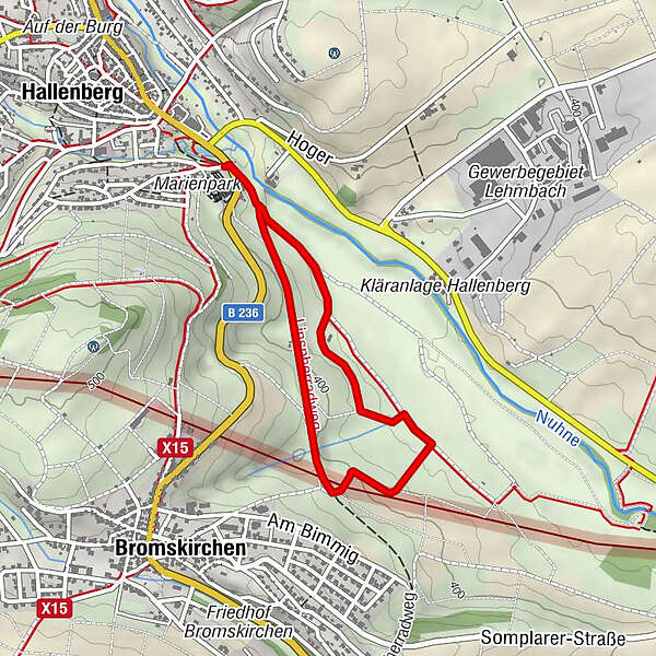
- Directions
-
Cross the road at the car park and follow the trail down into the valley. At the first fork in the trail, bear right and follow the trail until you see gardens on the left-hand side. At the first opportunity, turn left into the meadow path ("zum Gerichtsstein") and follow it until the next intersection. Turn left and follow the trail towards the town. At the next opportunity turn left again into a meadow path and follow the small loop until you meet the main trail again. Turn left and follow the trail until you are back at the car park.
- Highest point
- 408 m
- Endpoint
-
car park "Am Friedhof"
- Height profile
-
 © outdooractive.com
 - Equipment
-
You are recommended to wear turdy shoes and take a pair of binoculars for observing the birds.
Possibly the nature trail flyer (Download Flyer)
- Safety instructions
-
The observation tower located in the area is closed for safety reasons.
- Additional information
-
You can obtain the flyer published by the Biologische Station Hochsauerlandkreis about the "Naturweg Nuhnewiesen" from Touristik Hallenberg (Petrusstraße 2, limited opening times) or here as a download.
A new brochure has been published for all nature trails in the Medebach Basin region. It is also available from the Tourist Information Office in Hallenberg. You will find all relevant information under www.medebach-touristik.de.
A childrens' interactive game for the "Naturweg Nuhnewiesen" nature trail is available under: www.nuhnewiesen.mede-bucht-spiel.de.
LIFE Project MEDEBACH BASIN - MODULE FOR NATURA 2000 www.medebacher-bucht.de
- Directions
-
Drive south through the town of Hallenberg via the main road (Merklinghauser Straße). At the town exit you will see the car park which serves as the starting point of the trail to the right of the road.
Address for satnavs: Langeloh, Kreuzung Am Scheidt B236, 59969 Hallenberg
GPS (UTM): 32 U 473970, 5661811
Google coordinates: 51.107190, 8.628190
- Public transportation
- Parking
-
You can park your car at the gravel-surfaced car park called "Am Friedhof".


- Author
-
The tour Nuhnewiesen – Nuhne Meadows south-east of Hallenberg is used by outdooractive.com provided.


General info
-
GrimmHeimat NordHessen
789
-
Ederbergland
734
-
Hallenberg
217