© Sauerland-Tourismus e.V. - Michael Bahr


© Sauerland-Tourismus e.V. - Tim Tegetmeyer


- Brief description
-
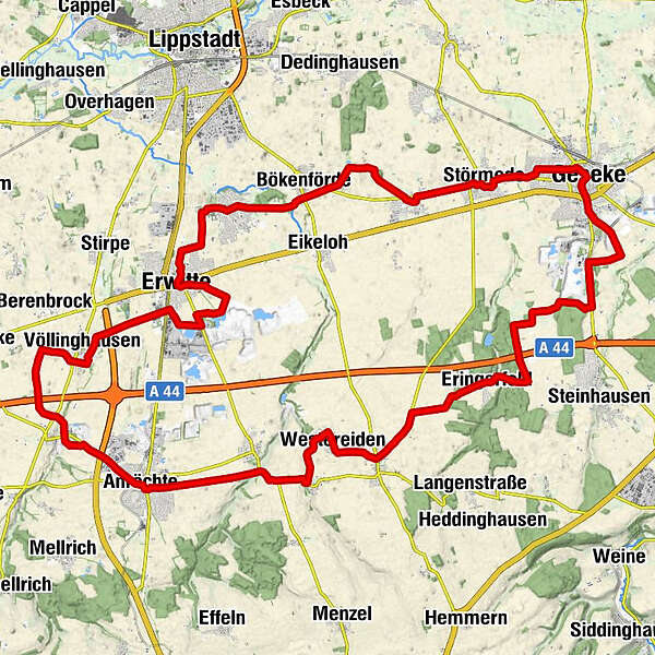
Mit dem Teilstück "Durch dei Hellwegbörde" der Radroute „Steine und Mehr“ wird die „Stein-alte“ Kultur- und Abbaulandschaft im wahrsten Sinne des Wortes „erfahrbar“ gemacht.
- Route
-
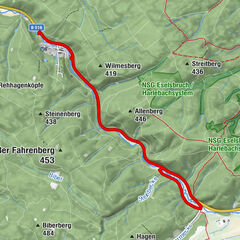
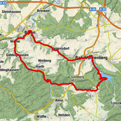
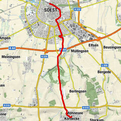
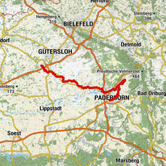
Stadtkirche St. Petri0.4 kmGeseke (105 m)0.6 kmKlosterkirche St. Johannes Baptist0.9 kmGeseker Spring1.0 kmEringerfeld12.0 kmOestereiden16.2 kmWestereiden17.6 kmKapelle St. Georg17.8 kmWeickede20.9 kmAnröchte24.5 kmSt. Pankratius25.3 kmGasthof Röper-Bolte25.5 kmKlieve28.5 kmSt. Katharina & St. Stephanus33.4 kmVöllinghausen33.6 kmErwitte (105 m)41.4 kmSchloss Erwitte41.6 kmLippstadt (79 m)43.7 kmMarien-Bildstock44.5 kmBad Westernkotten44.7 kmBökenförde47.3 kmGaststätte Steinhoff51.2 kmLangeneicke51.2 kmSt. Barbara51.5 kmStörmede52.5 kmSt. Pankratius53.8 kmLobekapelle Störmede54.5 kmKönigreichssaal56.3 kmGeseke (105 m)56.9 km
- Highest point
- 226 m
- Endpoint
-
Geseke
- Height profile
-
 © outdooractive.com
- Author
-
The tour Steine und Mehr "Durch die Hellwegbörde" is used by outdooractive.com provided.
GPS Downloads


Other tours in the regions