


- Brief description
-
We follow the Hill through the woods of Hertogenwald, over the plateau of the High Fens to the highest point in the country.
- Difficulty
-
medium
- Rating
-
- Starting point
-
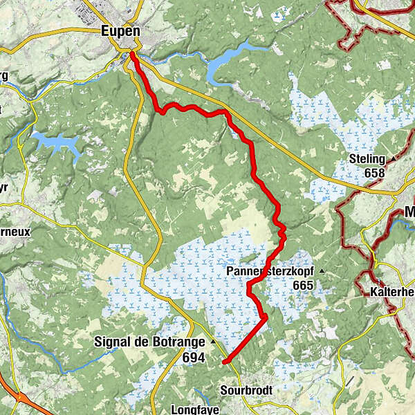
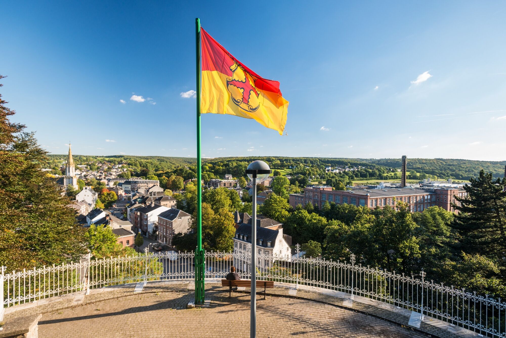
Eupen. GPS-Coordinates 50.622487,6.040388 (267 hm)
- Route
-
Unterstadt0.0 kmEupen0.0 km
- Best season
-
JanFebMarAprMayJunJulAugSepOctNovDec
- Description
-
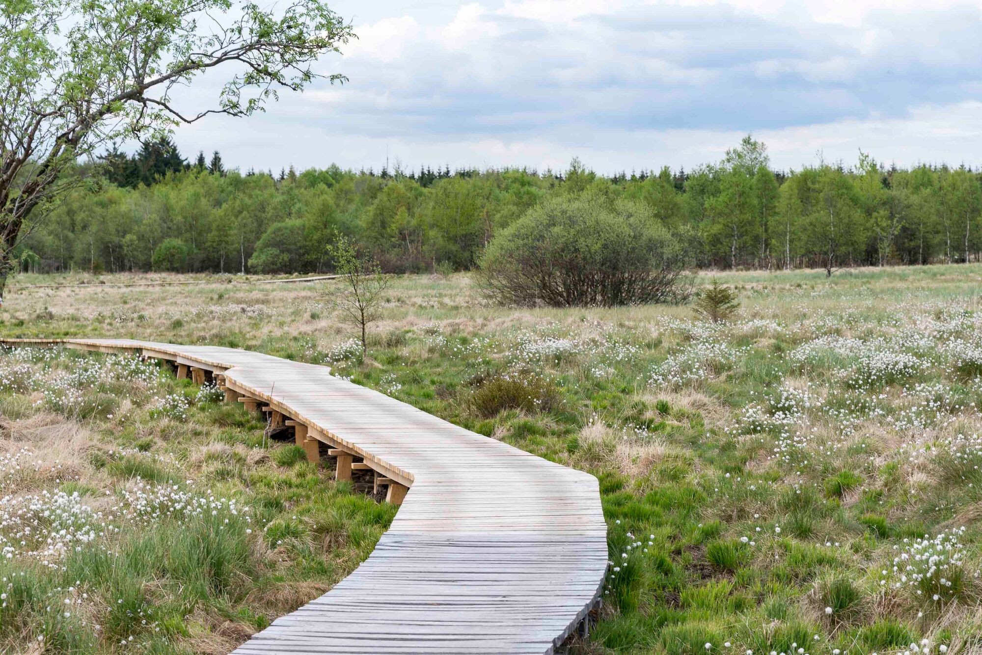
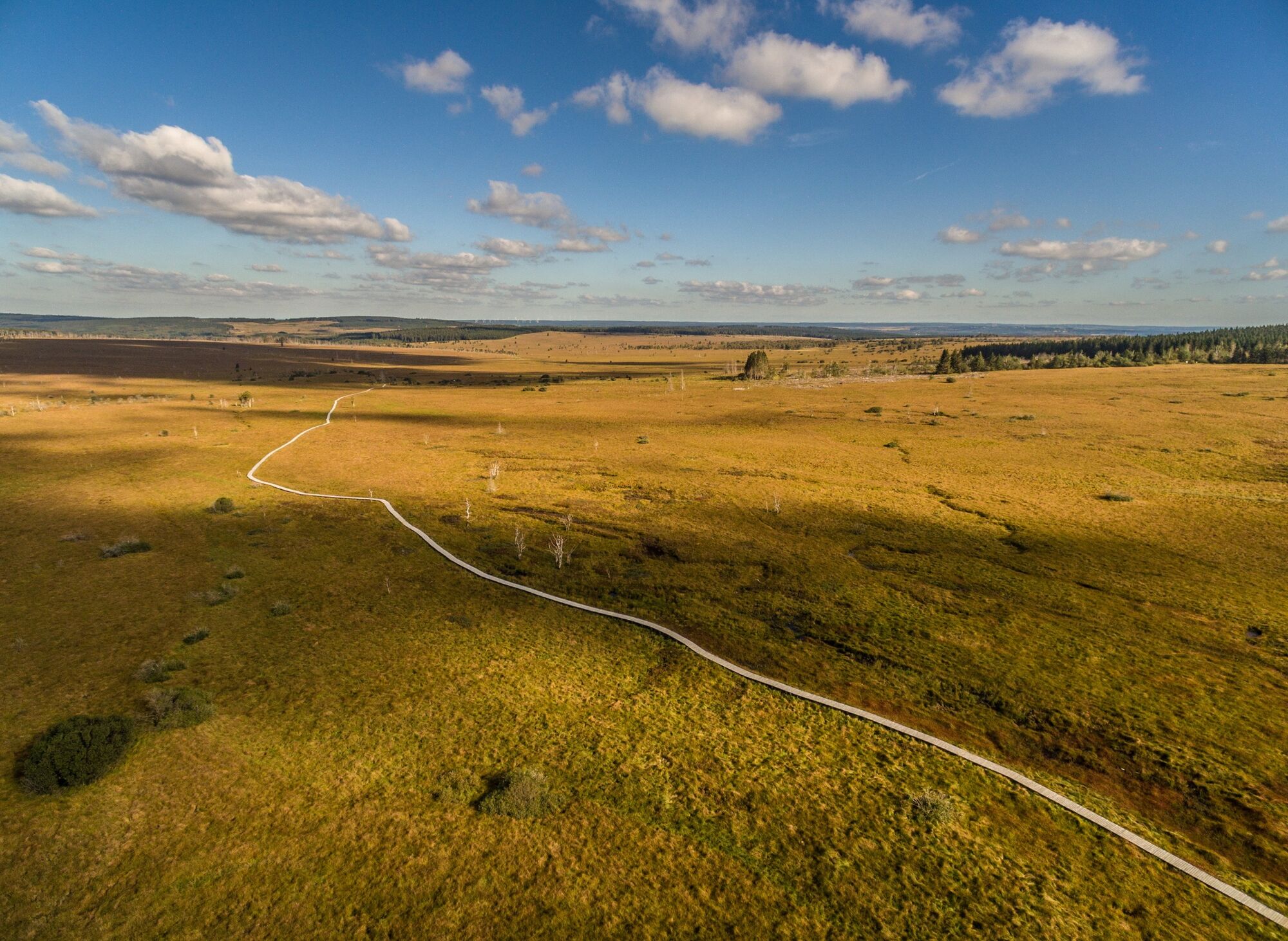
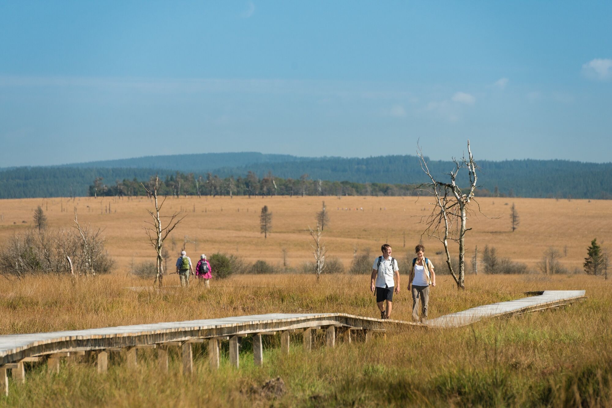
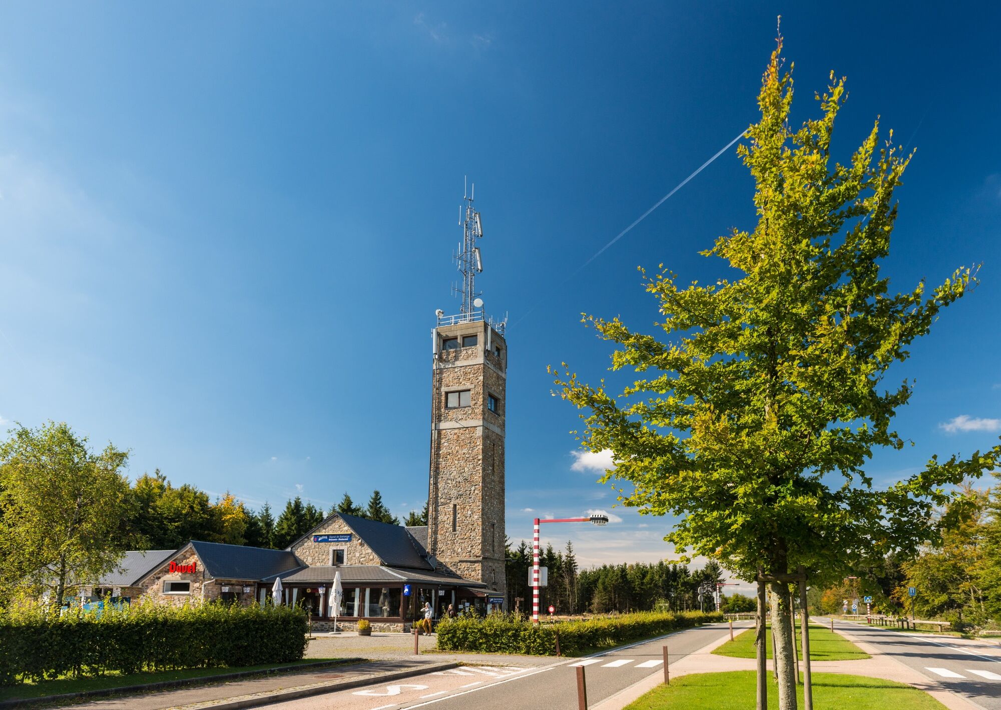
It takes some time before we have left Eupen behind us. The Hill is with us every step of the way. We enter the Hertogenwald. A little stream bubbles, babbles and finds its way down the jagged rocks. The sound of splashing water is never far from you. We follow a broad forest track until we reach the Black Bridge (Schwarzen Brücke). Suddenly, our path is lined with tree roots and stones, and our forest track widens again. We cross a few more streams before we leave the forest; we have reached the Duke’s Hill (Herzogenhügel). A stream, the Spohrbach, flows into the Hill, and then we enter the plateau of the High Fens. It is hilly. The vegetation is almost all peat grass, with only the occasional tree. The path through the High Fen is not easy. At Pont Marie-Anne Libert we cross the Hill one last time and continue further across the plateau. Our path is now wide, straight and grassy. Soon, we reached the highest point in Belgium: the Signal de Botrange, at 694 m.
This stage is just under 23 km long, almost all of it woods until reaching the edge of the Fen. Although there are no very steep climbs on this stage, it is uphill essentially the whole way.
- Directions
-
Signage: white and red rectangle.
EUPEN
We cross the old bridge over the River Weser. At the end of the bridge, we turn left into Selterschlag. This sets us on our general direction for the day: we will be hiking South. At the new bridge, we cross Malmedyer Straße and arrive at the place where the Hill meets the Weser. From here we follow the Hill, which will at our side for much of the day. We leave Eupen through the community known as Hütte, passing the swimming pool and tennis park, and soon arrive at the woods of Hertogenwald. Continuing straight ahead, we follow the wide forest path until we reach the “Schwarzen Brücke” (Black Bridge).
3.2 Km - SCHWARZE BRÜCKE
At the Black Bridge, the Soor (another Fen stream) flows into the Hill. Here we turn left and take the narrow black bridge; on the other side we immediately turn right down a narrow path. We follow a series of narrow paths through the spruce forest, and here our hiking becomes more demanding as the twisted roots underfoot demand all our attention. But after only a short time we are once again on a broad forest path, and after hiking seven full kilometres we have reached the Hill Valley dam. After we pass the dam, the path becomes narrower and more challenging again. The valley narrows, and the banks of the Hill become quite steep in places. After we have travelled a full 14 kilometres, we reach the hill known as “Herzogenhügel”.
11.3 Km - HERZOGENHÜGEL
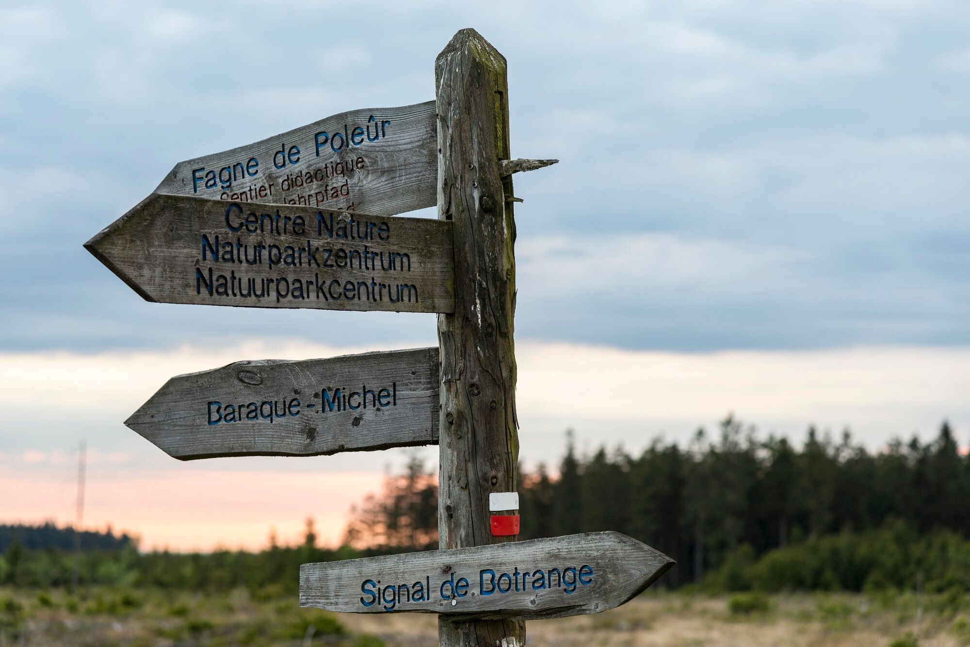
Here, our white/red trail signs tell us we need to cross the Hill. The forestry service built a new footbridge here just a few years ago, so crossing is easy. Before that, to cross the stream you needed a guide and would have to scramble over stones and mud; few made it to the other side with dry feet. When the Hill was carrying too much water, crossing was nearly impossible, which is why GR-Sentiers has long had an alternative route available that breaks off from here. To find it, look for the hiking route sign with the white crossbeam.
If at this point you don’t think you’ve got what it takes to manage Herzogenhügel, you may wish to choose the alternative route (variant) at this point. But if you are up to the challenge, you should definitely continue on, because this is certainly one of the highlights of the East Belgium route. So we keep to the plan and cross the bridge. Now we are following the left bank of the Hill (on our hike, the stream is always to our left), which leads us to a beautiful floodplain forest area. Our path takes us through Grand Bongard and Petit Bongard.
It is not easy hiking, and it can get quite muddy in wet weather. But after this little bit of adventure, we cross the Marie Anne Libert Bridge and leave the Hill Valley. On the other side, we take the path past some gnarled trees up a hill. At the top, we find ourselves on the edge of the Walloon Fen. Stop a while here to enjoy the spectacular landscape of the Fens stretching out ahead. Our trail will be taking us further south along the edge of the Fen, in-between the belt of trees on the left and the Fen on the right.
Look ahead and you will see, off in the distance slightly to the right, the tower at Signal de Botrange, the highest point in Belgium. After leaving the strip of High Fens landscape, we walk through a narrow strip of woods known as La Béôle. Emerging from it, we meet the GR 56 which we follow to the Nature Park Centre.
4 Km - LA BEOLE
We are now walking along the edge of the Walloon Fen. We descend into a hollow in the Fen landscape and then cross the Rur and continue along the edge of the Fen. When we reach the village called Haie du Souk we continue straight and cross the main road (N676). The Nature Park Centre is straight ahead of us.
- Highest point
- 659 m
- Endpoint
-
Nature Park Centre Botrange. GPS- Coordinates 50.492947,6.099772
- Height profile
-
 © outdooractive.com
 - Equipment
-
Hiking boots are recommended.
- Safety instructions
-
Sturdy footwear is a must, and be sure to take enough food and water!
- Tips
-
Be advised, there are no options for food along the way!
- Additional information
- Directions
-
Please use the route planner.
- Public transportation
- Parking
-
Eupen has 942 parking spaces close to the city centre.

- Author
-
The tour GR 573 - stage Eupen – Botrange is used by outdooractive.com provided.


General info
-
Hohes Venn
602
-
Eupen
108


