Rheinsteig Stage 21: Königswinter - Bonn (South - North)


- Brief description
-
On the trail of monks and state guests...
- Difficulty
-
medium
- Rating
-
- Starting point
-
Königswinter
- Route
-
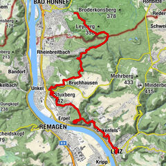
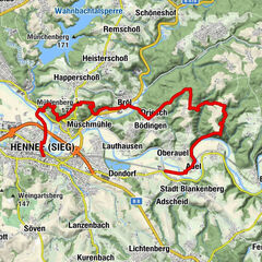
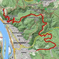
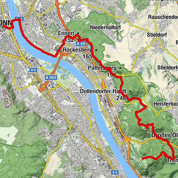
Königswinter (80 m)Milchhäuschen1.1 kmKletterschlucht am Milchhäuschen1.3 kmSchallenberg (310 m)2.1 kmGeisberg (324 m)2.4 kmBiergarten Petersberg6.5 kmKuckstein (190 m)12.7 kmAuf der Herrmes Schleise12.9 kmAuf der Rabenlay13.1 kmAn den Fuchskaulen13.4 kmSt. Gallus-Kirche16.3 kmAlter Zoll22.0 kmBonn22.5 km
- Best season
-
JanFebMarAprMayJunJulAugSepOctNovDec
- Description
-
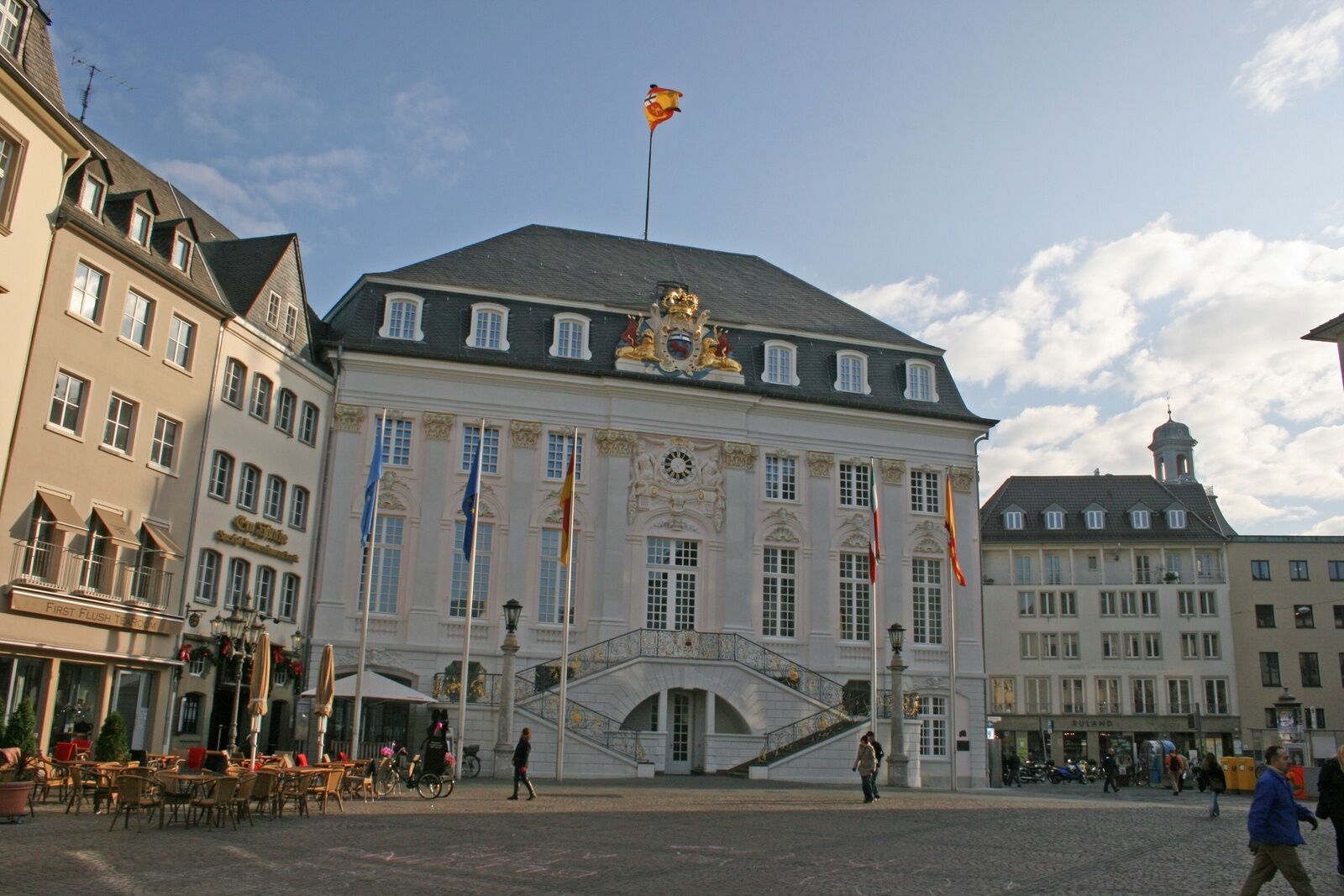
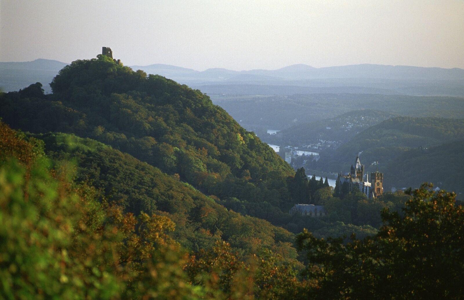
Finally, the RS leads from the nightingale valley on dreamy forest paths to the glamorous Petersberg, where state guests used to come and go. The next highlight is the impressive monastery ruins of Heisterbach. You slowly approach your destination, enjoying the last great distant views before heading straight to Bonn along the Rhine. There, after more than 300 km, the adventurous Rheinsteig hike ends on the Bonn market square.
- Directions
-
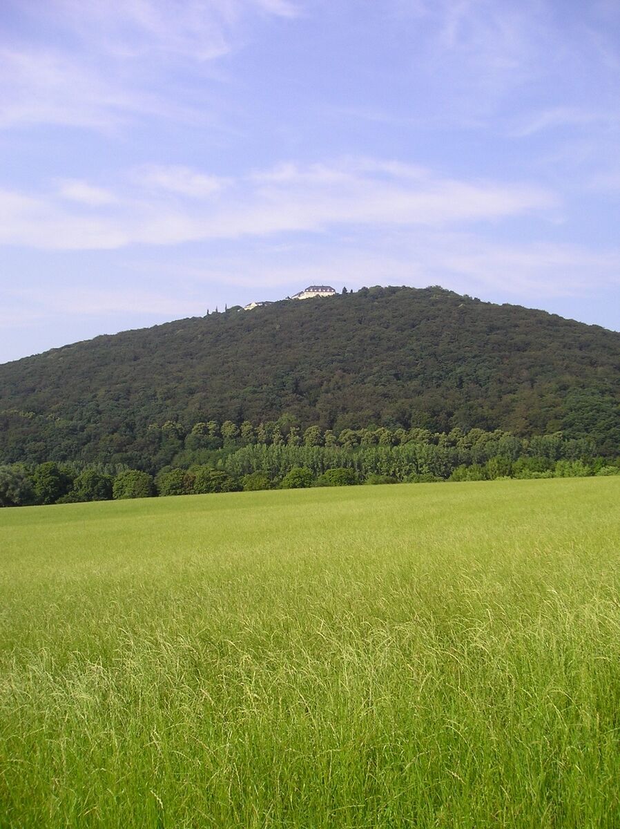
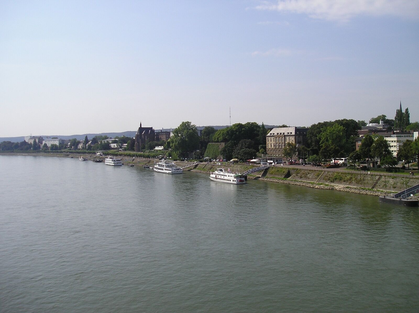
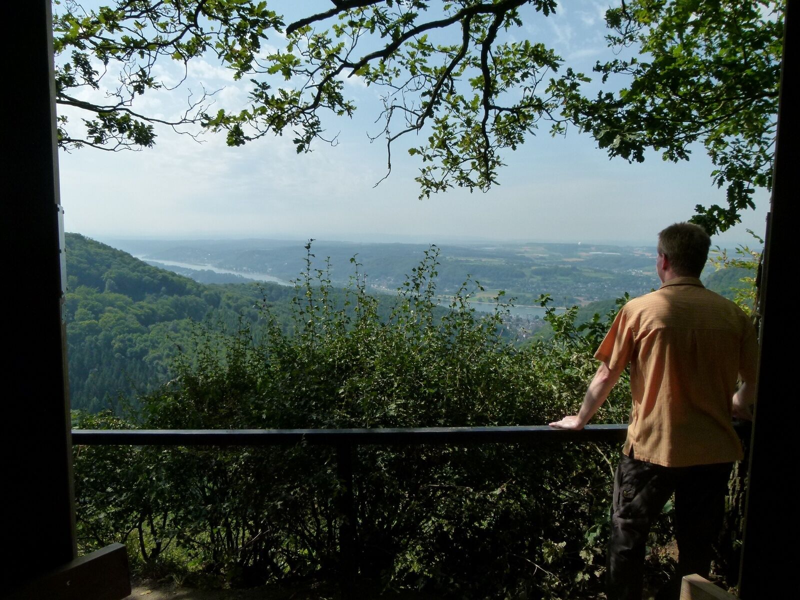
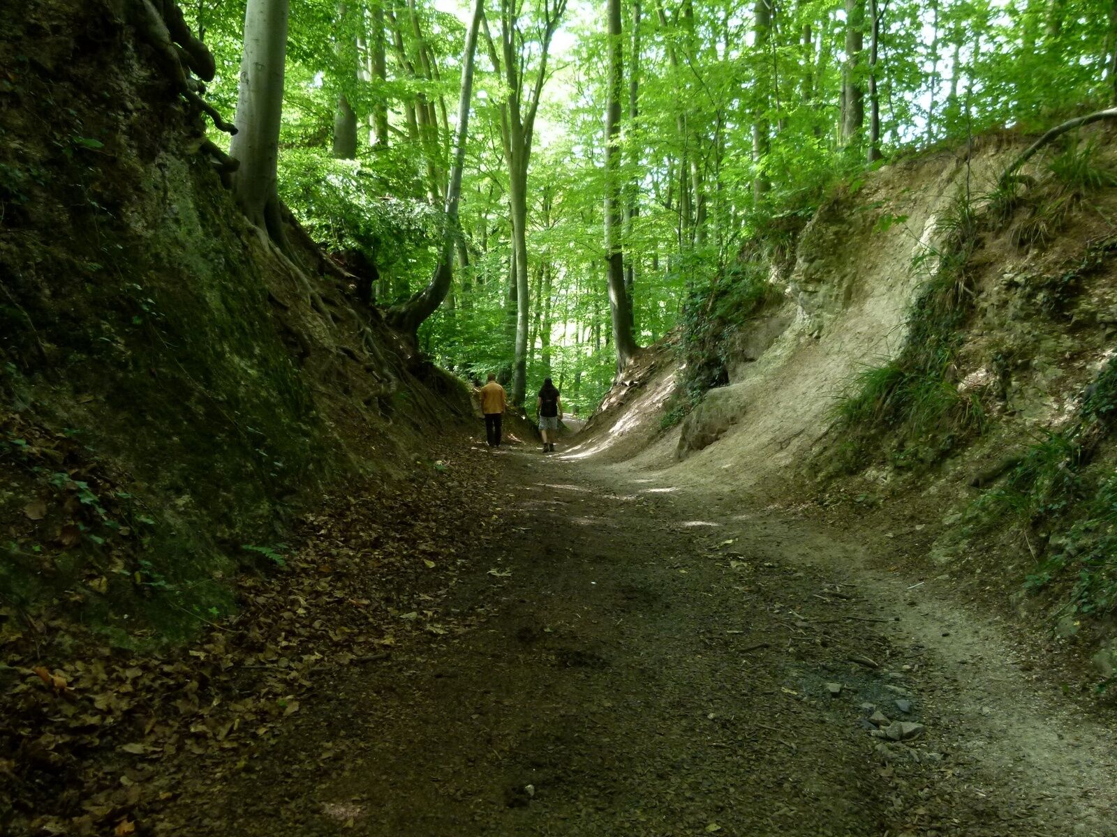
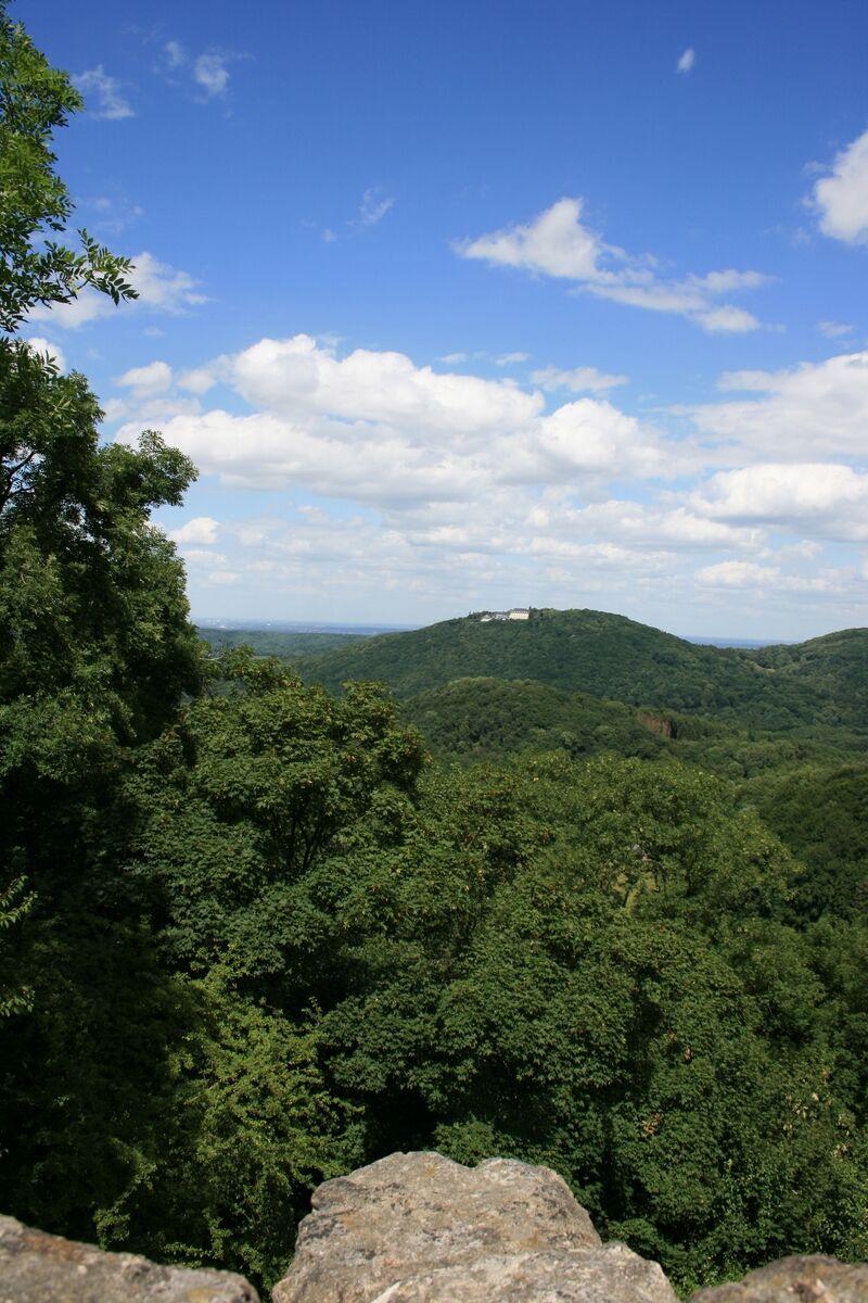
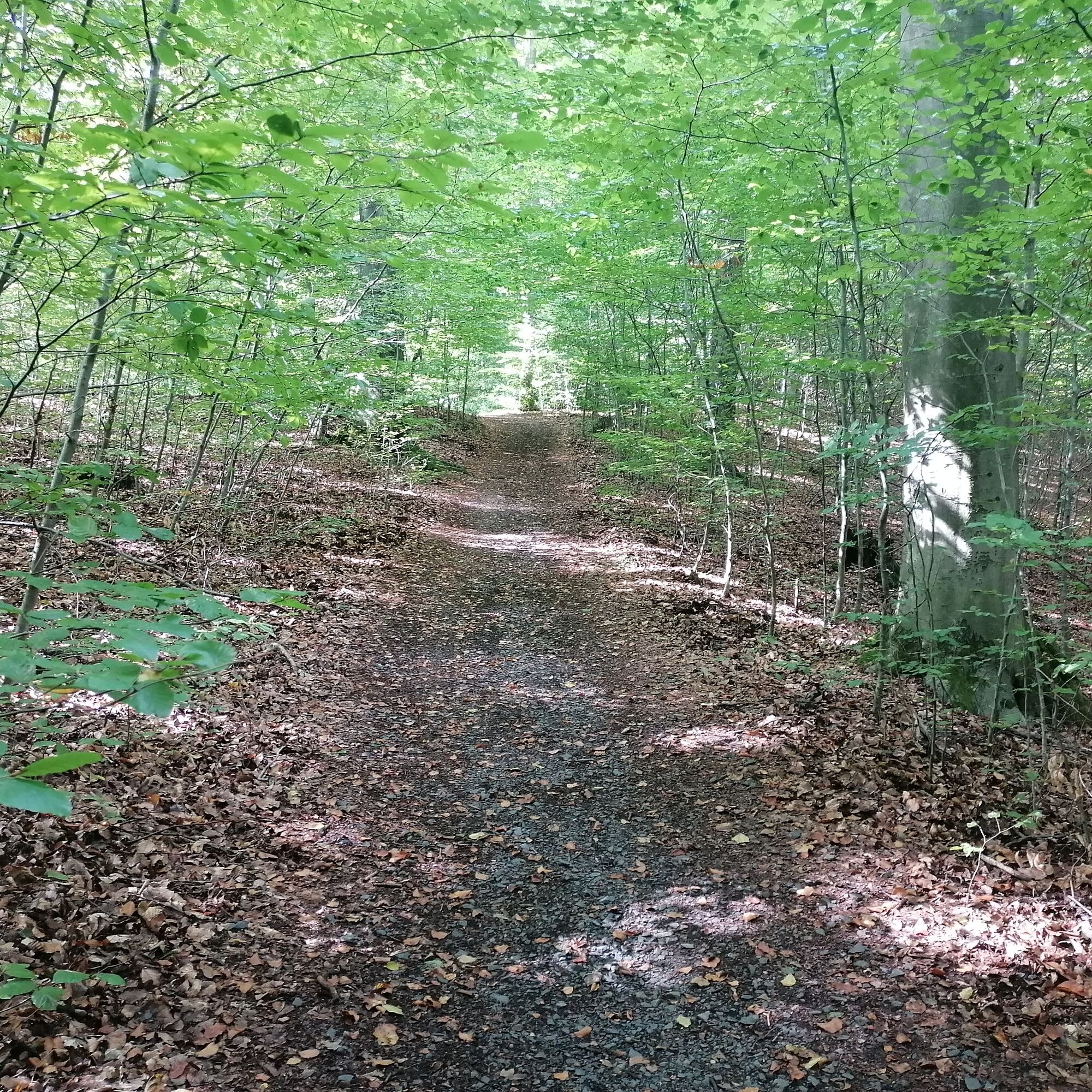
Access: From Königswinter you can reach the Rheinsteig (RS) again after 1.7 km through the Nachtigallental. You hike gently uphill on wide paths to the inviting milk house before you conquer the summit of the Schallenberg on paths. There, a magnificent view opens up over the Siebengebirge. It continues on a winding path to the nearby Geisberg. Here, too, you can rest and have a premium view. After the descent into the Mirbesbachtal it gets loud, because the RS first crosses the L 331 before following a parallel forest path to the left. But after the RS soars up the next climb, the traffic noise quickly fades away. After a significant increase in altitude, a forest meadow opens up, which the RS circles around. At a shelter, it turns left and leads to the Petersberg. On the summit you can first enjoy a great view of the hinterland of the Siebengebirge. Then you walk around the hotel area, which was formerly used as a guest house by the federal government. Before turning your back on the hotel, it is worth taking a detour to the terrace with its great views. Back on the RS, you use a small gate to leave the area. The RS now leads steeply and stony down into the valley, which requires careful attention. Stone wayside crosses show that you are now hiking on the Bittweg. After a noticeable bend to the right, a meadow opens up and then the time has come: Heisterbach Monastery is reached! Here you should definitely plan time for a tour. Then you cross the K 25. The RS now runs above the Mühlental through the forest. You soon change to the edge of the forest and are allowed to walk between the forest and the vines. When the RS bends north at the end of the vineyard, you shouldn't miss the detour to the fabulous view at the nearby "Hülle" hut! Then follow the RS slightly uphill to the edge of Römlinghoven, where you cross Langemarckstrasse. The houses quickly fall back and a challenging ascent begins: via the Kucksteinweg you climb briskly up to the edge of the slope. There the RS follows the Felsenweg, from which there are always magnificent views. Then there is even a viewing platform where, in addition to the panoramic view of the Drachenfels, there is also an informative board on primeval finds relating to the people of Oberkassel. Always close to the edge of the cliff, a dreamlike passage follows through a secluded forest to the view of the Blue Lake. Shortly thereafter, you have a good view of the steep face and get a glimpse of the volcanic subsoil of the Siebengebirge, while down in the valley the water of Dornheckensee glistens. Finally, the RS leaves the edge of the slope and crosses Oberkasseler Straße at the Dornheckensee car park. Back in lush greenery you lose altitude until you are just before the A59. Here the RS turns right and climbs again briefly to the Foveaux cottage, which tempts you to take a last break in the countryside. Then you hike down into the valley, cross the A 59 via footbridge and arrive at the edge of Kündinghoven. Passing the cemetery, it goes through a quiet residential area to Königswinterer Straße. After crossing the railway line, you pass the extensive Telekom area and are finally back on the Rhine. Now you follow the shore path, soon art objects set charming accents. Finally you reach the Kennedy Bridge and change to the left bank of the Rhine (before that there is the possibility to use the ferry). From there you walk upriver to the junction in the Hofgarten. Through the well-kept park you get to Stockenstraße and follow it to the right into the center, where the Rheinsteig adventure ends on Bonn's market square.
- Highest point
- 327 m
- Endpoint
-
Bonn, market square
- Height profile
-
 © outdooractive.com
 - Equipment
-
Hiking boots/shoes
Suitable weatherproof clothing - Safety instructions
-
Wear suitable weatherproof clothing that will protect you from cold, wet, heat and sunshine.
Make sure you take regular breaks and don't overexert yourself.
Take enough fluids with you as there are sections without rest stops.
Wear suitable hiking boots/shoes which give you enough grip on slippery, steep, rocky and uneven surfaces.
Avoid any sections of the route which you feel are too difficult for you. Natural trails can quickly become wet and slippery in adverse weather conditions.
Particularly in autumn, you should be careful of uneven ground, roots, stones or holes that have been covered by leaves.
You need to take these kinds of adverse conditions into account every time you go on a hike.
Particularly steep and dangerous places are made safer with handrails or ropes. Please use these as safety aids. Handrails are not to be climbed on or used to get a better view! - Additional information
- Directions
-
B42 to Königswinter train station
- Public transportation
-
Train to Königswinter station
- Parking
-
At Königswinter train station
- Author
-
The tour Rheinsteig Stage 21: Königswinter - Bonn (South - North) is used by outdooractive.com provided.


General info
-
Bonn & Rhein-Sieg-Kreis
1090
-
Siebengebirge
708
-
Königswinter
196