Rheinsteig Stage 20: Bad Honnef - Königswinter (South - North)


- Brief description
-
From the Drachenfels to the Löwenburg
- Difficulty
-
medium
- Rating
-
- Starting point
-
Bad Honnef, youth hostel
- Route
-
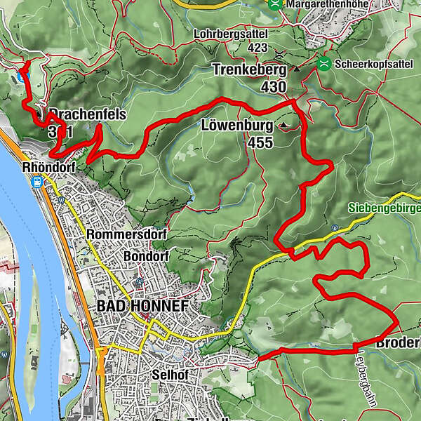
Bad Honnef (75 m)Poßberg (375 m)7.3 kmLöwenburger Hof7.7 kmKleiner Breiberg (288 m)9.2 kmNeue Kapelle11.2 kmRhöndorf11.8 kmDomley11.9 kmDrachenfels13.0 kmSchloß Drachenburg13.6 kmKönigswinter (80 m)13.7 kmAm Bergbonnen13.7 kmAm Kuckstein13.8 km
- Best season
-
JanFebMarAprMayJunJulAugSepOctNovDec
- Description
-
From Bad Honnef you can take the access route to the Rheinsteig and immerse yourself in the forest of the Siebengebirge. The first highlight is the Löwenburg, before you reach Rhöndorf, where you can pay your respects to the first chancellor of the Federal Republic of Germany, Konrad Adenauer. After climbing again, there is the highlight of the stage at the finale: the Drachenfels is calling!
- Directions
-
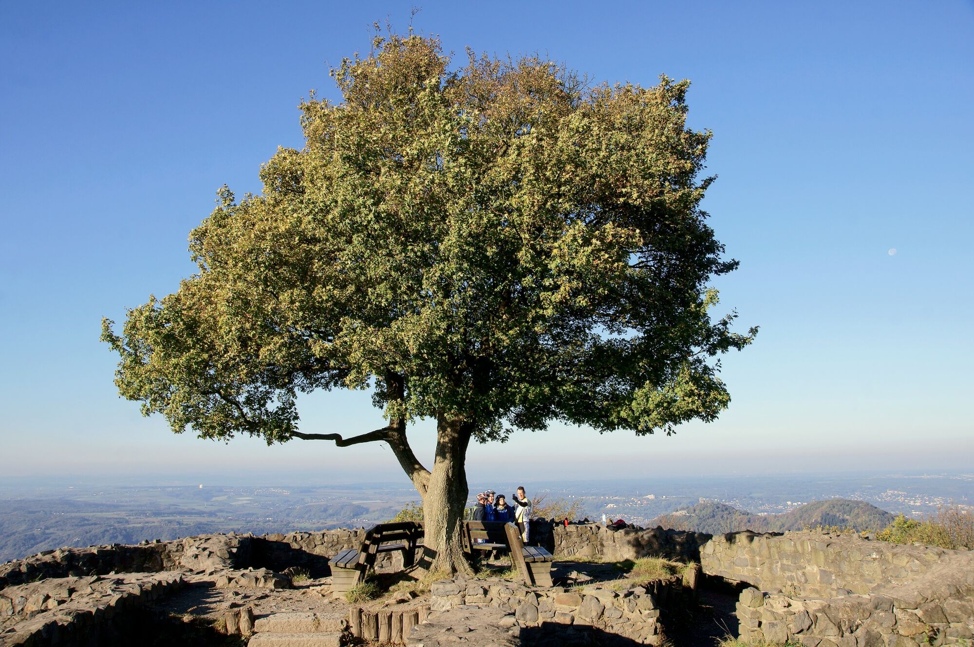
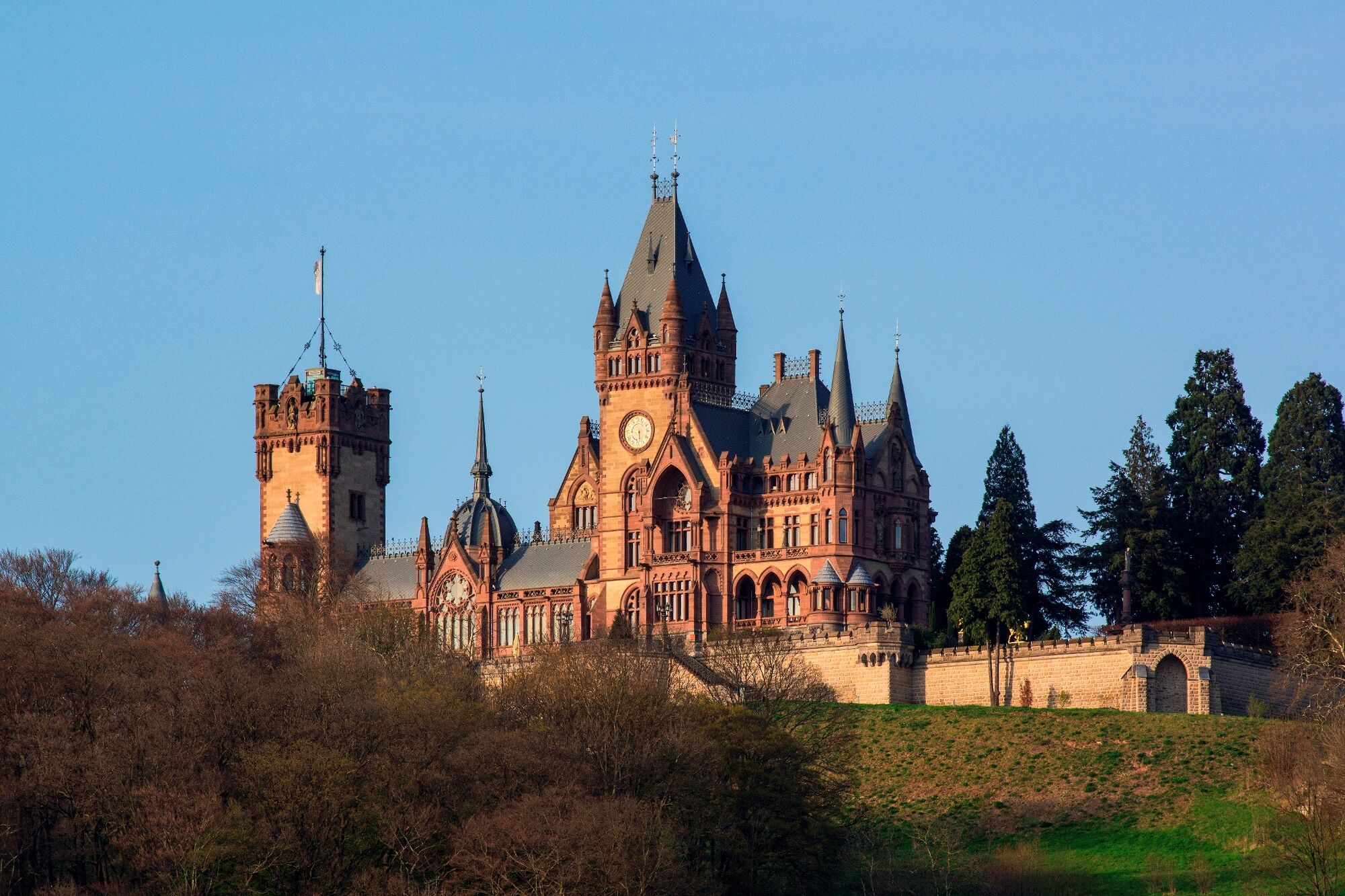
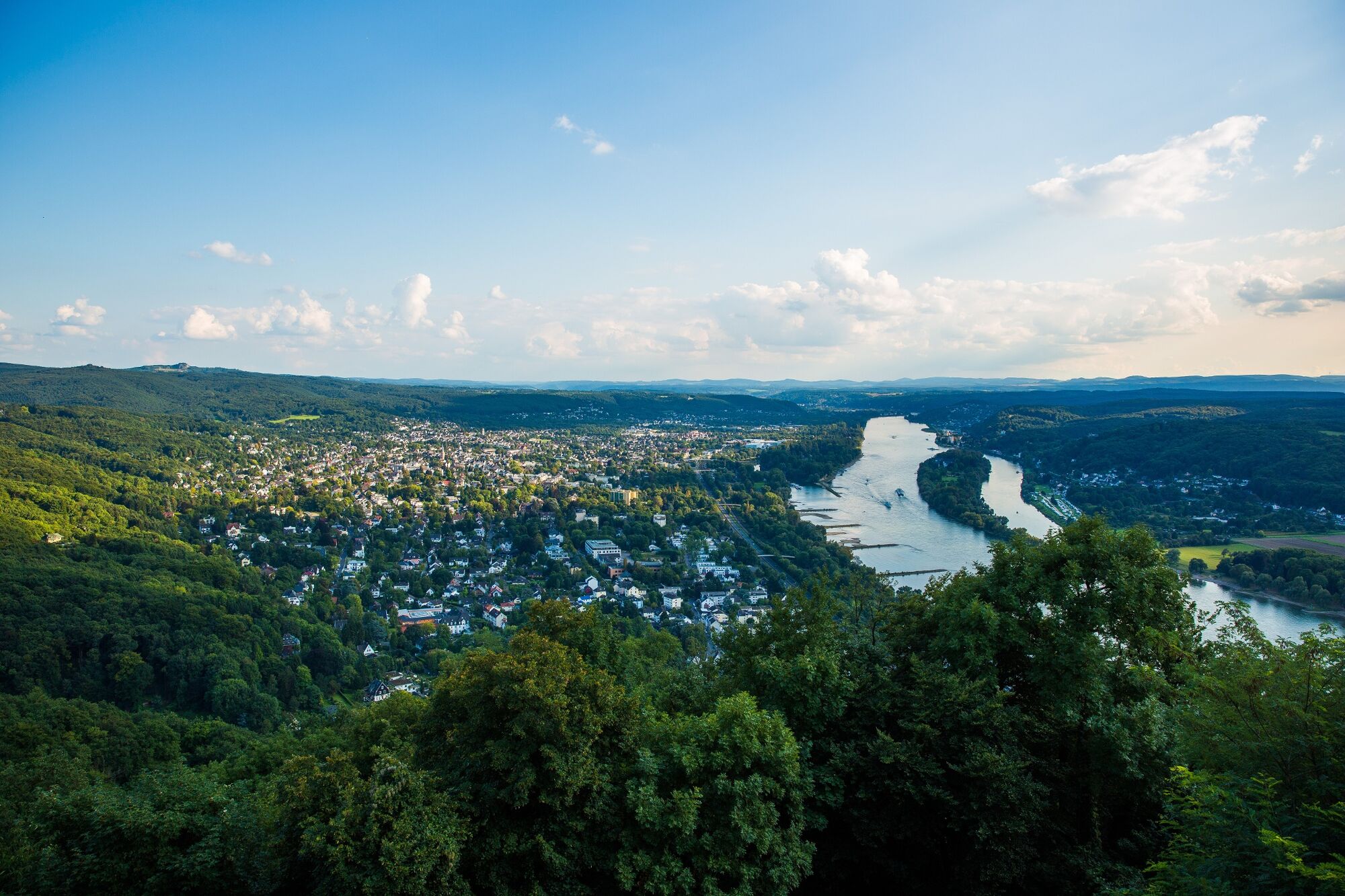
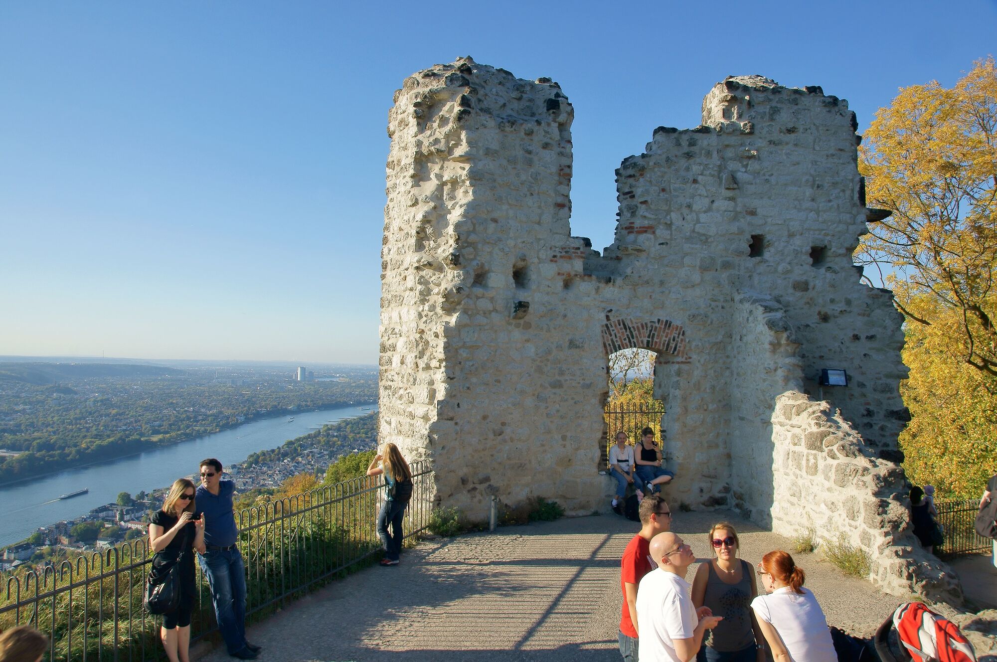
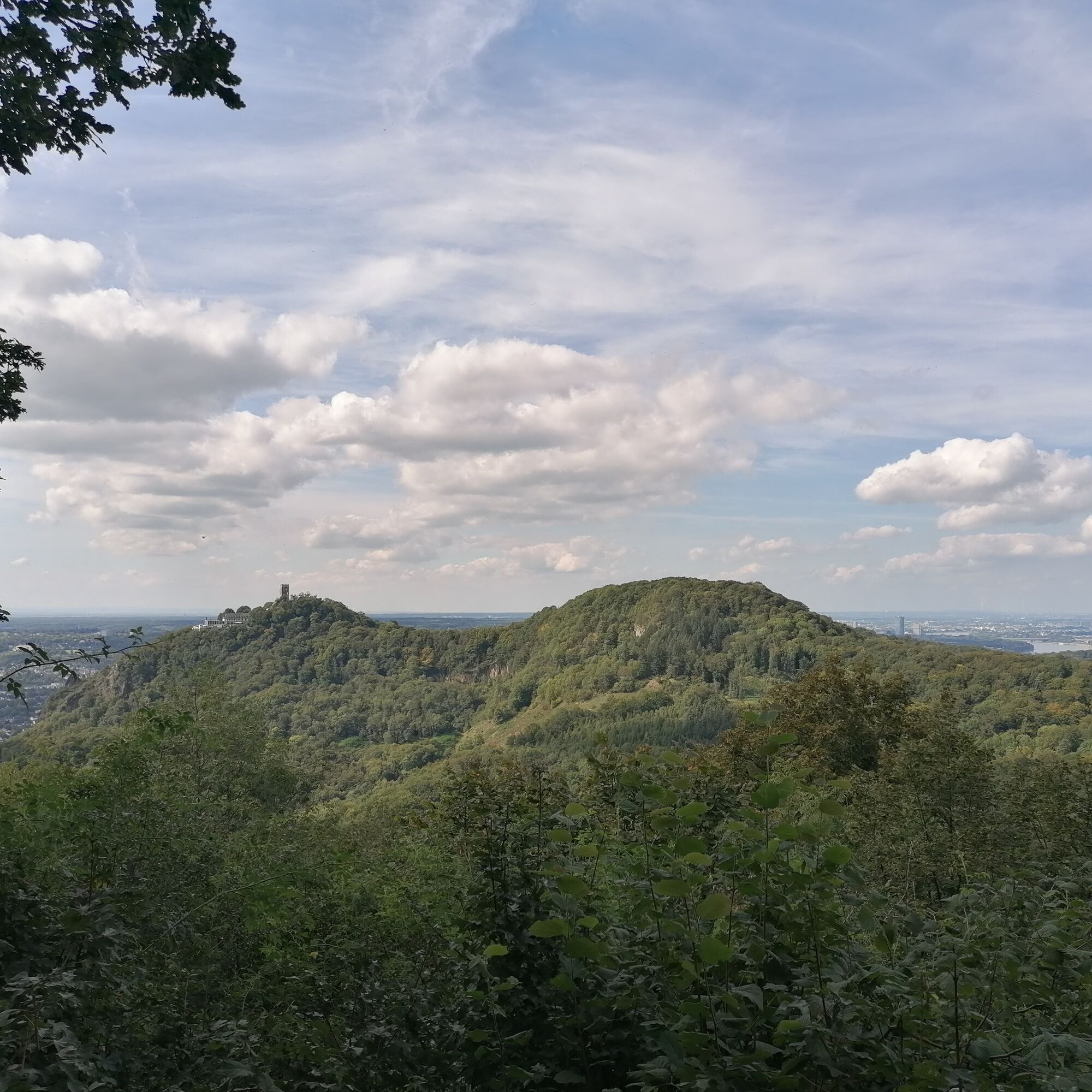
Access: From Bad Honnef train station, take the southern access path up to the youth hostel and on to the edge of the forest. There you come across the Rheinstieg (RS). The RS leads into the Mucherwiesental, which you reach at an information board. Turn right and follow the idyllic valley, with a view of the valley meadow. After crossing the stream, the first challenge awaits: the steep ascent through the flank of the Himmerich. Luckily it doesn't go all the way to the summit, halfway up the slope the RS turns left onto a forest path parallel to the slope. Now you hike relatively relaxed through the shady forest. Only when the RS bends left onto a path does the path become more challenging again: because it goes steeply down into the Schmelztal. There you cross the road and immediately tackle the next climb. This time the Poßberg has to be conquered. Step by step you gain height until the path finally flattens out and you change to the edge of the forest. If you want, you can take a detour to the promising summit and pay a visit to the ruins of the Löwenburg, which is especially worthwhile when the view is clear. The RS passes the Löwenburger Hof, which invites you to stop. The RS then dives back into the forest on a comfortable forest path. The northern access road from Bad Honnef soon joins them and clearings repeatedly interrupt the forest. You can pass the Kleiner Breiberg on a path before a valley view opens up at a shelter. Then you hike relaxed through the flank of the Großer Breiberg. Soon the descent becomes steeper and the path requires attention. Another refuge offers a place to rest before the RS winds further down the valley. Finally, with a sharp left turn, you arrive in the valley. The footpath passes the cemetery and reaches the edge of Rhöndorf. If you want to pay a visit to the Adenauerhaus, walk straight ahead into town, but the RS turns right uphill at the first houses. At first, the ascent to the legendary Drachenfels is still moderate. At the Uhlan Monument, the view sweeps over Rhöndorf to the Rhine and benches invite you to take a break. But when the RS dives back into the forest and passes a shelter there, the incline becomes noticeably steeper. The RS soon blossoms into a demanding path, while at the same time you gain more and more altitude. Finally, it goes uphill in narrow serpentines until you suddenly reach the stairs to the Drachenfels viewing terrace. The terrace offers a fabulously beautiful view that consoles you from the sudden tourist hustle and bustle. If you like, you can now make a detour to the summit of the Drachenfels. Then you follow the RS down the donkey path. Passing rocks you reach the edge of the area around Drachenburg Castle. The RS turns right under the route of the famous Drachenfelsbahn and now leads along the edge of the cogwheel railway to the Drachenburg stop. Ahead you can already see the Petersberg, while you walk to the edge of the area and follow the RS down to the right at the edge of the forest to the turn-off into the Nachtigallental. Access: Via the access path through the Nachtigallental you reach the train station in Königswinter after 1.7 km.
- Highest point
- 360 m
- Endpoint
-
Königswinter, Nachtigallental
- Height profile
-
 © outdooractive.com
 - Safety instructions
-
Health and safety Wear suitable weatherproof clothing that will protect you from cold, wet, heat and sunshine. Make sure you take regular breaks and don't overexert yourself. Take enough fluids with you as there are sections without rest stops. Wear suitable hiking boots/shoes which give you enough grip on slippery, steep, rocky and uneven surfaces. Avoid any sections of the route which you feel are too difficult for you. Natural trails can quickly become wet and slippery in adverse weather conditions. Particularly in autumn, you should be careful of uneven ground, roots, stones or holes that have been covered by leaves. You need to take these kinds of adverse conditions into account every time you go on a hike. Particularly steep and dangerous places are made safer with handrails or ropes. Please use these as safety aids. Handrails are not to be climbed on or used to get a better view!
- Additional information
- Directions
-
B42 to Bad Honnef, follow the signs to the train station. From the station, take the path leading to the Rheinsteig trail through the town until you reach the Mucherwiesen Valley (30 minutes).
- Public transportation
-
Train to Bad Honnef station
- Parking
-
Car park at Bad Honnef train station
- Author
-
The tour Rheinsteig Stage 20: Bad Honnef - Königswinter (South - North) is used by outdooractive.com provided.


General info
-
Bonn & Rhein-Sieg-Kreis
1090
-
Siebengebirge
708
-
Bad Honnef
259