- Brief description
-
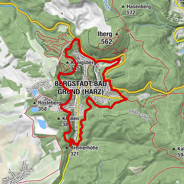
Horizontal path with a few gradients around Bad Grund with views of the Bad Grundner valleys, past the world forest Harz, Hübichenstein, Iberger stalactite cave and the world cultural heritage mine Knesebeck.
- Difficulty
-
easy
- Rating
-
- Starting point
-
7 trailheads - trailhead No. 1 on the Hübichenstein
- Route
-
Laubhütte6.1 kmBergstadt Bad Grund (Harz) (358 m)8.4 km
- Best season
-
JanFebMarAprMayJunJulAugSepOctNovDec
- Description
-
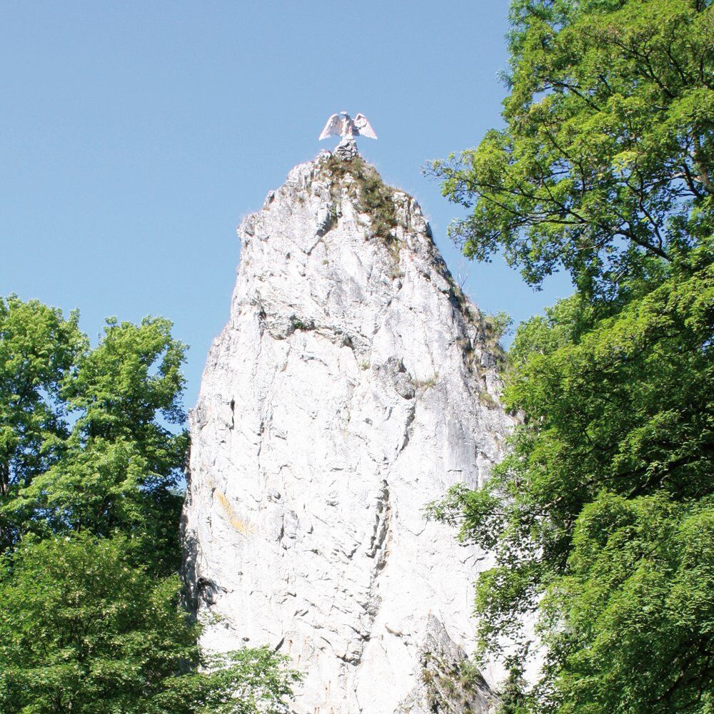
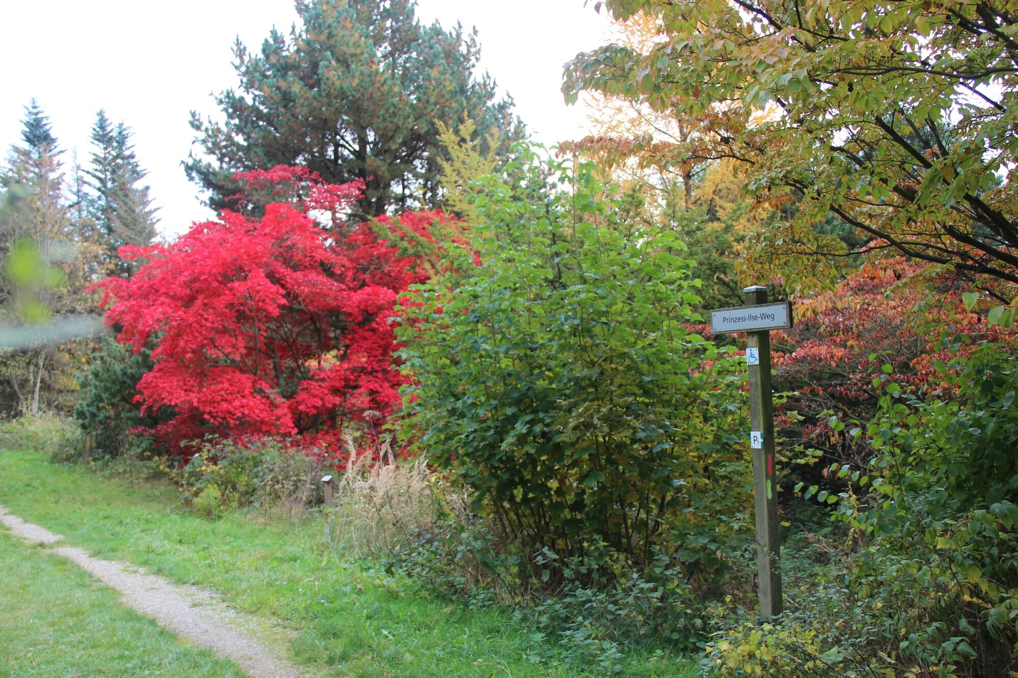
A huge rock pin marks the main entrance to the "König-Hübich-Route": the Hübichenstein. The circular route many views into the five valleys of Bad Grund. It combines many cultural and natural sights such as museums or the water trail to the Knesebeck Mine (World Heritage Site Upper Harz Water Management) with its water gallery and the hydro compressor tower, which is visible from afar. Water treads with clear mountain water ensure cooling and blood circulation. Another highlight is the WeltWald Harz. As an arboretum, it offers a variety of trees from four continents, and it is particularly colorful in spring and autumn.
- Directions
-
The start is at the Hübichenstein towards Teufelstal. Below the federal road is the Iberg settlement on the right. The path continues below the Iberg. It goes past a former small mine, which is now used for respiratory patients. Goes straight to the HöhlenErlebnisZentrum with the Iberger stalactite cave. However, the circular path swings to the right before the Märchental valley and leads to the Rohland via the Paradiesweg. Shortly before the "Waldwinkel" the route meets the water trail (signs explain the underground hydropower). At Eichhörnchenplatz, turn right to the mining museum, the path continues to the left to Laubhütte. Before the ascent to the Gittelder Berg, there is the possibility of treading water above in the Eichelbach valley. Along the Grüne Tanne, it finally turns left towards Kelchtal and back to the starting point.
- Highest point
- 422 m
- Endpoint
-
Round trip
- Height profile
-
 © outdooractive.com
 - Tips
-
There is a stop at the campsite, a large Walpurgis theater area with an open air theater on the Hübichenstein.
- Additional information
- Directions
-
B 242 to the Hübichstein above Bad Grund
- Public transportation
-
Bad Grund can be reached by bus and train via Seesen, Gittelde, Osterode and Clasuthal-Zellerfeld. Information at www.bahn.de
- Parking
-
Free of charge directly at the Hübichenstein
-

-
AuthorThe tour König-Hübich-Route around Bad Grund is used by outdooractive.com provided.


General info
-
Der Harz/ Niedersachsen
1061
-
Oberharz
685
-
Bad Grund
162