Tour data
6.37km
609 - 699m
Distance
103hm
101hm
Ascent
01:43h
 
Duration
Brief description

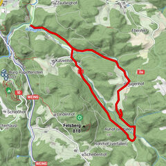
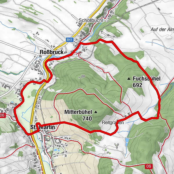
Rundwanderweg Nr.73 in St. Martin

Difficulty
easy
Rating
Technique
Fitness
Landscape
Experience
Route
St. Martin
Zeil
0.1 km
Roßbruck
1.7 km
Reitgraben
4.8 km
St. Martin
6.1 km
Zeil
6.2 km

Highest point
699 m
Endpoint

St. Martin

Height profile

Author
The tour Reitgrabenweg is used by outdooractive.com provided.

Overall rating

5

0

%

4

0

%

3

0

%

2

0

%

1

0

%

Error
An error has occurred. Please try again.
Thank you for your review

Rating has been deleted

GPS Downloads
  • GPX GPS Exchange Format (XML)
  • KML Google Earth, Google Maps
QR Download Codes for Mobile Phones
Other tours in the regions

Popular tours in the area

ZWalk - Rappottenstein - Zur schwebenden Weltkugel

easy Hiking
5.75km | 117hm | 01:30h

Blockheiderunde

easy Hiking
6km | 150hm | 01:30h

Moor and field

medium Hiking
15.24km | 65hm | 03:30h

W1: Waschenberg

medium Hiking
9.83km | 354hm | 03:13h