


- Brief description
-
Regional Route O heads along the spectacular Burgenländischer Mariazellerweg to Preinmühle im Preintal. The Regional Routes are part of the network of paths making up the Viennese Alps (WAB) route. Hikes along these routes lead you to unique views and also insights. The Regional Routes are linked to the network of paths making up the Viennese Alps route. This results in circular hikes in conjunction with the long-distance path.
- Difficulty
-
medium
- Rating
-
- Starting point
-
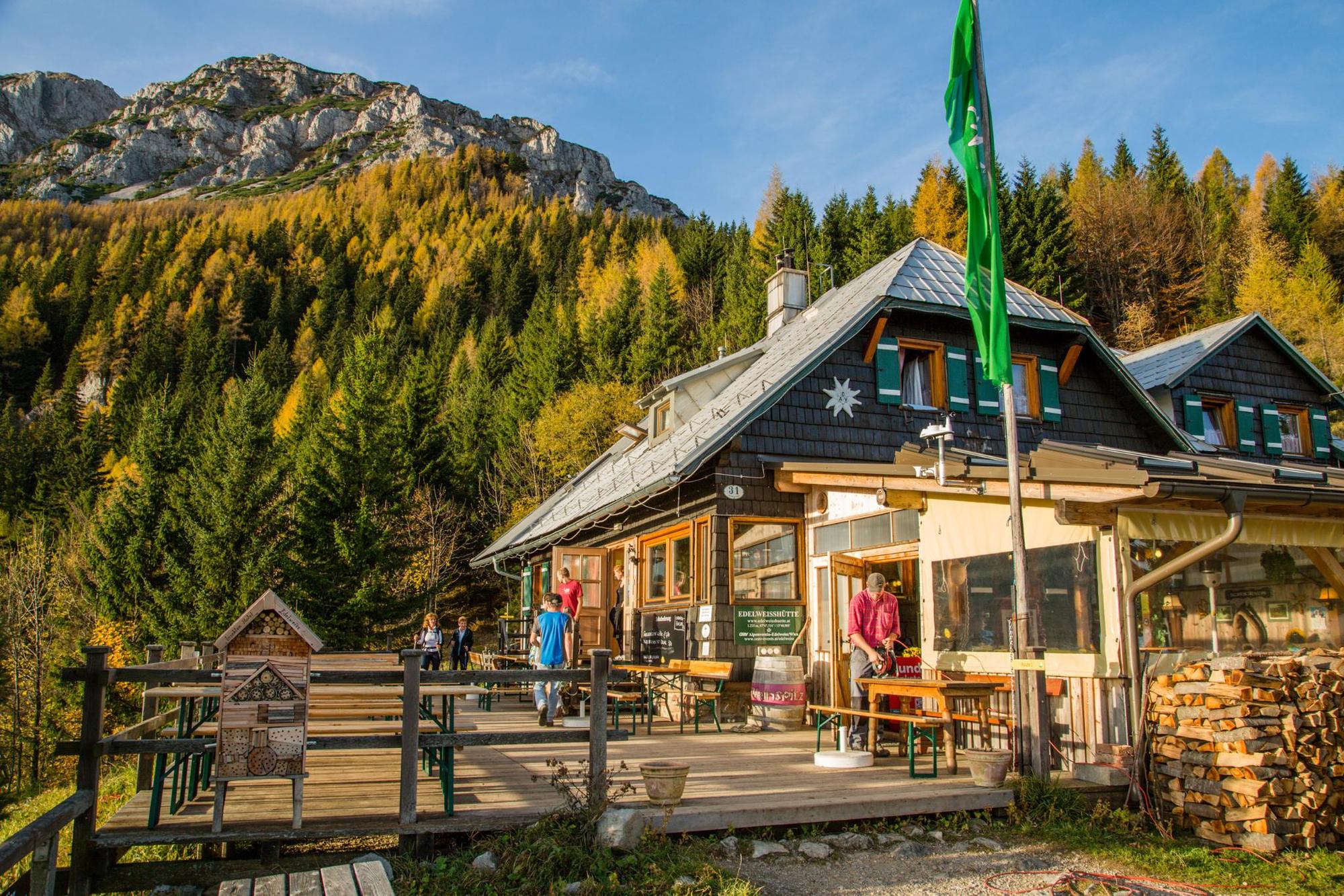
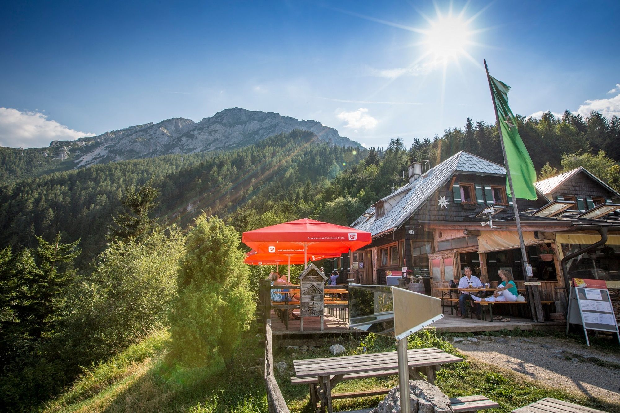
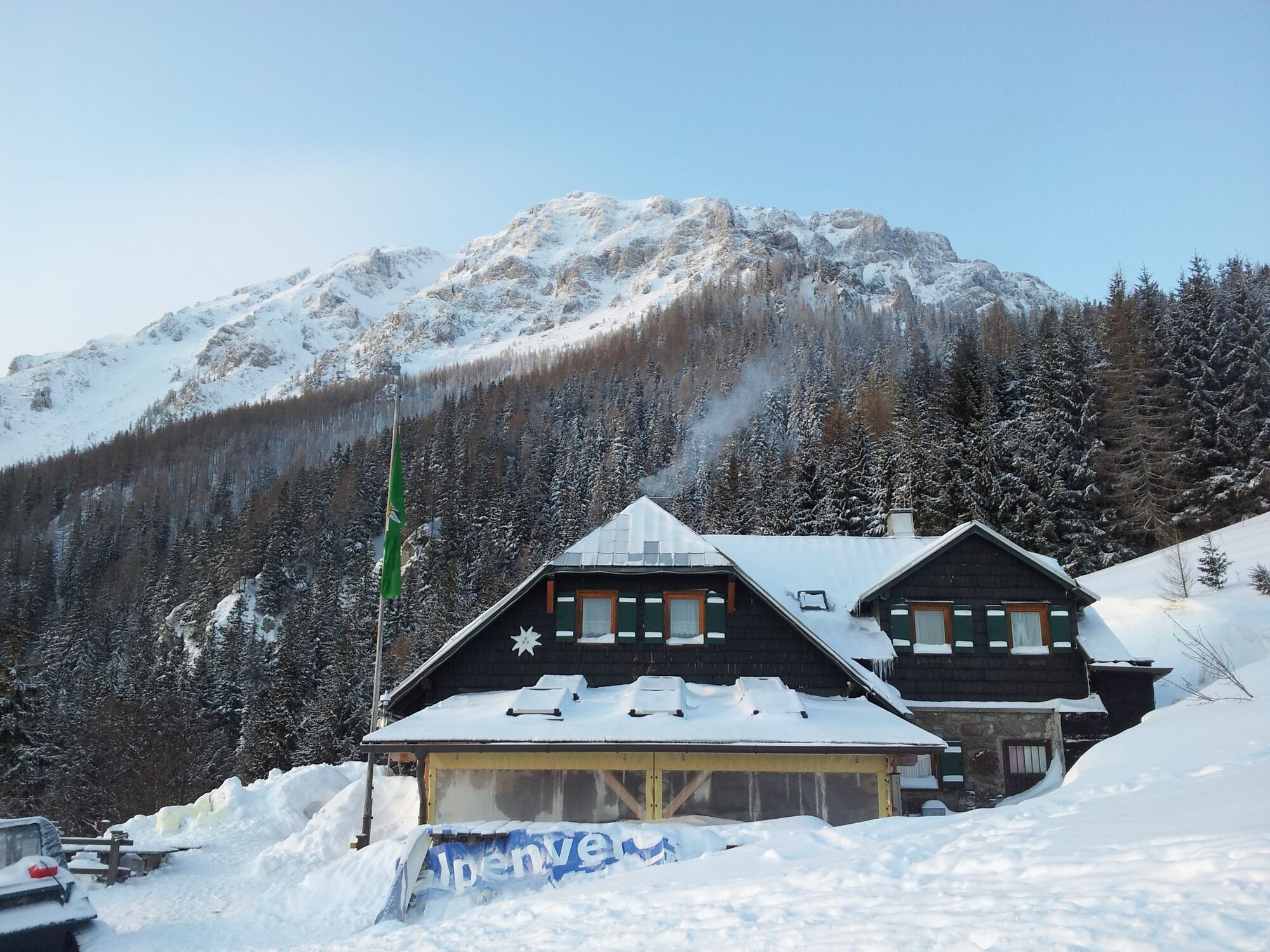
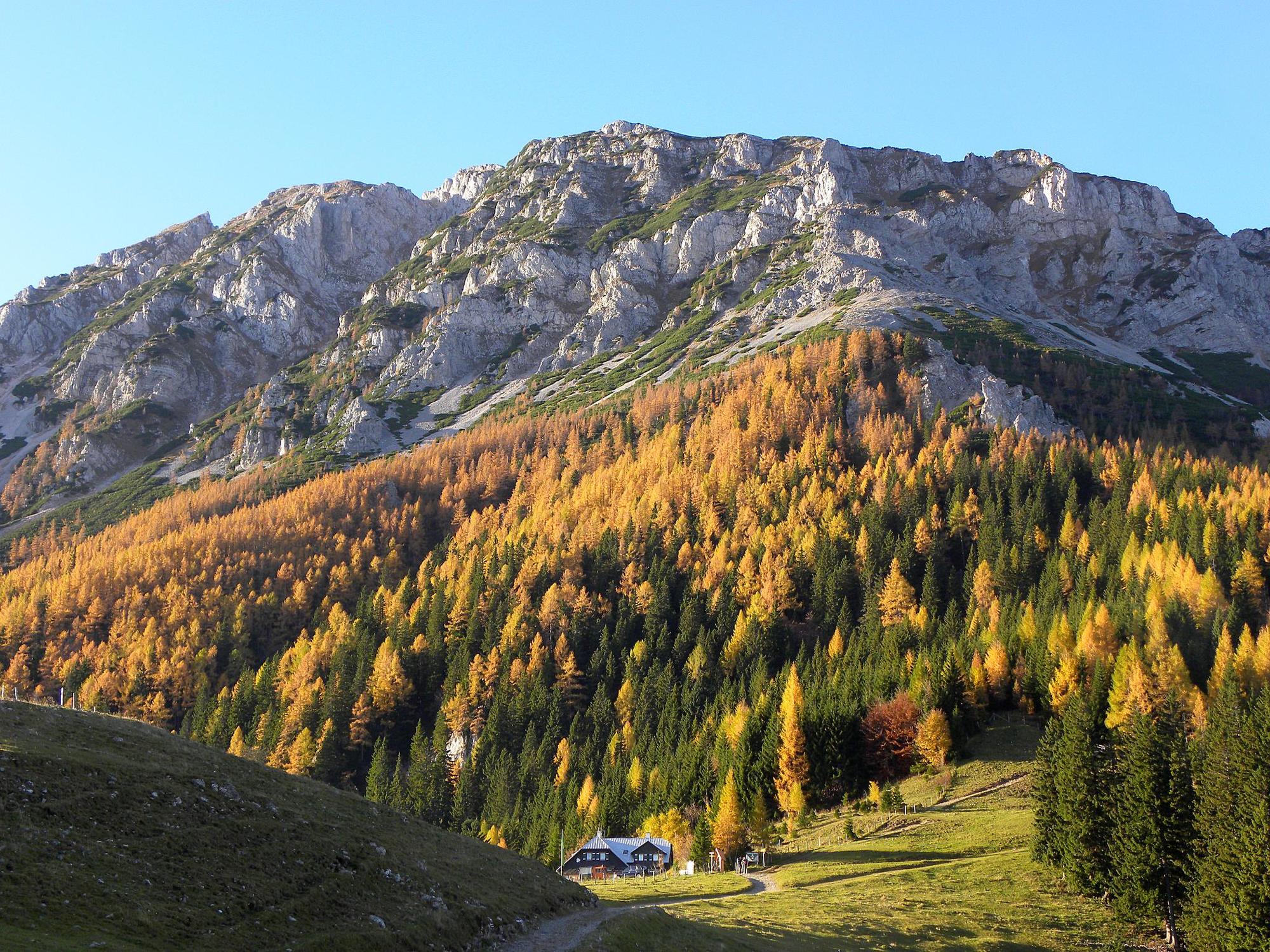
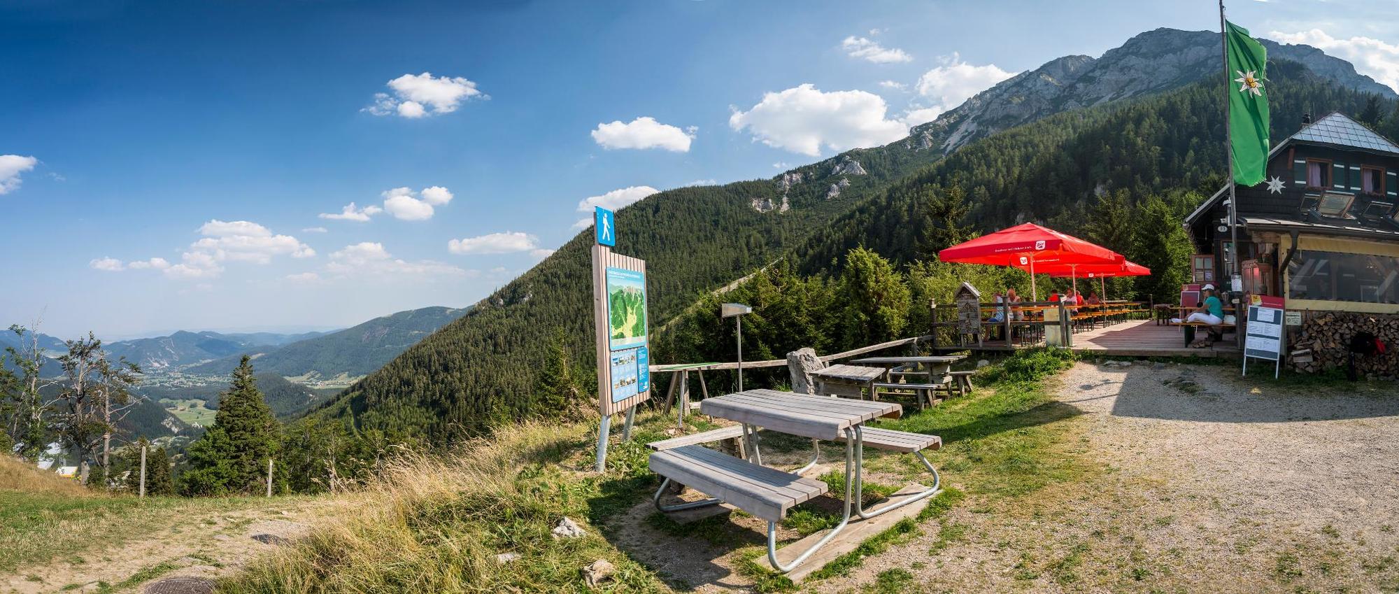
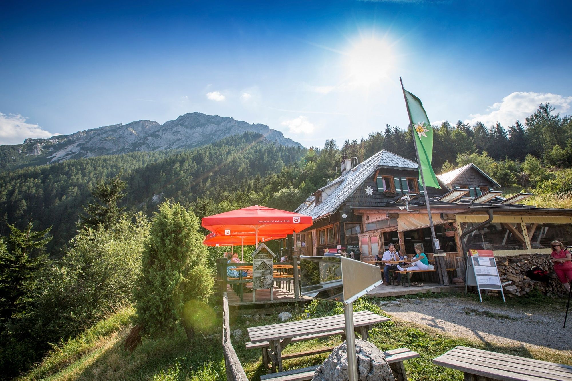
Edelweißhütte am Schneeberg
- Route
-
Putzkapelle2.2 kmWaldkapelle6.8 kmVois7.0 kmGasthof Bacherlwirt11.8 kmPreinmühle14.9 kmObere Preinmühlenhöhle14.9 kmUntere Preinmühlenhöhle14.9 km
- Best season
-
JanFebMarAprMayJunJulAugSepOctNovDec
- Description
-
This stretch could have the motto “out hiking on old paths to see new views.” The first outstanding view of the foot of the Schneeberg is obtained from the Edelweißhütte, which is also the highest part of the hike. After leaving the summit and heading north, we come across the Mariazellerweg trail. This has always been a pilgrimage trail for the devout on the path to Mariazell, as shown by the number of wayside shrines, chapels, and crosses on the side of the trail. Thoughts turn inwardly here and this is a place for reflection. The old school path from Vois to Schwarzau is an opportunity to reflect on a time where education was something to be worked on in the truest sense of the world.
- Directions
-
Either we have had a relaxed night in the Edelweißhütte, or we have already climbed the ascent from Losenheim or Puchberg to Regional Route N. From the Edelweißhütte we look towards Almröserlhaus and turn left from the gravel track onto the steep meadow slope. Red markings (path 231) on the trees guide us down the slope to a wet ditch, which we follow downhill in the direction of Putzenhof. After around 20 minutes of descending through a water ditch and two crossroads of forest paths, we come to another forest road. Path 231, marked in red, continues straight onto a forest path heading towards Putzenhof (50 minutes) - and it is well marked-out with a sign and markings on a tree stump. At this crossroads we turn left and descend slightly whilst heading along the forest path, which is an old Roman road. The markings and signs on Burgenländischer Mariazellerweg 06 will, from now on, guide us into the Voistal valley, then the Preintal valley. After a bend and a short ascent, we turn left at Putzkapelle onto the marked path and head down into the Voistal valley. We descend around 200 metres into the Voistal valley to Wegscheidhof and a lay-by via hiking routes and forest roads. The next few kilometres are paved in the Voistal valley, and we follow this for the next 45 minutes heading towards Vois. After passing the former Gasthaus Nothnagel and a bus stop at a bridge, we turn off the road and ascend veering to the right up a meadow path alongside a house and head uphill towards Schwarzau/Gebirge. This well-trodden path is followed uphill, then we turn left into the forthcoming forest road. The route continues along a right-hand bend then slightly uphill to a large meadow, at the end of which we branch off somewhat to the right onto a forest path once more. A hiking path guides us uphill to Heidelbeerplatz and to the highest point at the edge of an alpine pasture. From this point onwards, we go downhill along a forest path into the Schwarzatal valley before reaching a Bundesstraße. We stay on the right-hand side of the road for around three minutes walking along the road before turning left and crossing the Schwarza over a wooden bridge. On the other side of the river, we follow the cart trail northwards towards Schwarzau. Upon arriving at the road bridge over the Schwarza, we turn left onto the street and follow this on the left past Bacherlwirt and into Preintal. The road keeps ascending to Anhöhe Eckbauer before coming to Hof Mitterhofer (private rooms) heading downhill just before Preinmühle on the fork towards Naßwald. Regional Route O ends here. You may enjoy spending the night at the Mitterhof or hike Regional Route P and continue through the Preinbachtal valley on to Naßwald. Naßwald also features a fine place to spend the night in the Gasthaus zum Raxkönig, and there are also bus links from Naßwald to Schwarzau/Gebirge or to Payerbach-Reichenau railway station.
- Highest point
- 1,225 m
- Endpoint
-
Preinmühle im Preintal near Schwarzau im Gebirge
- Height profile
-

- Equipment
-
Suitable equipment for mountains is absolutely needed!
Please note that this route is in alpine conditions.
Always bring suitable maps. Always wear appropriate, sturdy footwear, bring sun and rain protection and water, as well as a little something to eat. Bring your mobile phone with you and save the mountain rescue emergency number: 140
- Safety instructions
-
Your hiking experience in the Vienna Alps should be a thoroughly enjoyable and safe one. Therefore, please bear the following in mind:
Preparation
When choosing a route, make sure it corresponds to your experience and physical fitness level. Check the weather forecast before you set off. The weather can change surprisingly quickly in the mountains. Always take appropriate equipment with you (e.g. rain protection).
Check whether the cabins and snack stations you intend to visit along the way are open. Inform someone before you set off of your chosen route and when you plan to return.
- Tips
-
Overnight accommodation on this hike can be found at the Edelweißhütte on Schneeberg, as well as in Schwarzau and Preintal.
- Additional information
-
You may like to hike the adjoining routes:
WAB - Regional Route N: Preintal - Habsburghaus
WAB - Regional Route P: Puchberg – Edelweißhütte
Viennese Alps in Lower Austria, www.wieneralpen.at, +43 / 2622 / 78960
Puchberg am Schneeberg tourist office, www.puchberg.at, +43 / 2636 / 2256
Schneeberg chairlift, http://www.wunderwiese.at +43 / 2742 / 36 099 099
- Directions
-
The Edelweißhütte is in alpine surroundings and can only be reached directly from Puchberg, Losenheim, or the Klostertal valley on foot.
If you are coming from Vienna or Graz, take the A2 as far as the exit at Wiener Neustadt West. Take the B26 up to Puchberg am Schneeberg. A road leads from here to the valley station of the chairlift in Losenheim.
- Public transportation
-
Travelling with public transport is difficult. The next bus stop in Schwarzau im Gebirge is an hour’s walk away. Trains regularly depart from Wiener Neustadt station to Payerbach-Reichenau. Continue with the bus to Schwarzau im Gebirge. Nasswald, which is on this route, can also be reached via Payerbach-Reichenau station and then continuing with the 1746 regional bus (in the direction of Rohr im Gebirge or Schwarzau im Gebirge).
- Parking
-
No official car parks are available around the Preinmühle. The next official car park is in the centre of Schwarzau/Gebirge.


- Author
-
The tour WAB - Regional Route O: Edelweißhütte - Preintal is used by outdooractive.com provided.


General info
-
Hochsteiermark
4082
-
Semmering - Rax
2314
-
Schwarzau im Gebirge
540


