Winter
Summer
Weather
Webcams
Accommodations
Tours
Search history
Search suggestions
No results found
Search
Tours
Home
Summer Österreich
Lower Austria
Tours
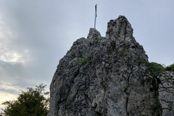
Hahnkreuzrunde
Regions
Weather
Webcams
Tours
Highlights
Bathing lakes
Accommodations
Offers
Sports provider
Events
Ski resorts
Cross-country skiing
Snow parks
Hahnkreuzrunde
Hiking
Bookmark
Map
show
hide
Print
Tour data
5.68
km
296 - 338
m
Distance
69
hm
70
hm
Ascent
01:25
h
Duration
Stefan Offenthaler
created am 28.03.2020
898
Views
Rating
Technique
Fitness
Landscape
Experience
Route
Wolfpassing
village
0.6 km
Knolling
hamlet
4.2 km
Highest point
338 m
1,7
Write a review
Overall rating
5
0
%
4
0
%
3
33
%
2
0
%
1
67
%
Reviews
1,7
(3)
0 Comments
Write a review
Error
An error has occurred. Please try again.
Thank you for your review
Rating has been deleted
Report tour
GPS Downloads
GPX
GPS Exchange Format (XML)
KML
Google Earth, Google Maps
QR Download Codes for Mobile Phones
Hahnkreuzrunde
QR Codes - tour download for cell phones
GPX
KML
Other tours in the regions
Mostviertel
2454
Eisenstraße Niederösterreich
918
Steinakirchen am Forst
108
Popular tours in the area
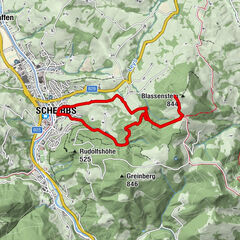
Auf den Blassenstein
easy
Hiking
8.3
km |
462
hm |
02:30
h
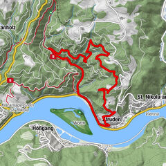
St. Nikola: Burg Werfenstein Hiking Trail
medium
Hiking
5.7
km |
172
hm |
02:30
h
Trefflingfall über Hochbärneckhütte
easy
Hiking
12.09
km |
317
hm |
04:00
h
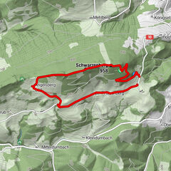
Schwarzenberg
easy
Hiking
4.54
km |
261
hm |
01:09
h
No entries found.
The search is currently not available.
Please refine your search.
Local search results
(<= 25km)
More results
(> 25km)
%count% Search results
%name%
%type%
%elevation%
%population%
%lpButton%