Tour data
8.69km
423
- 900m
478hm
495hm
03:00h
- Brief description
-
Nette familienfreundliche Wanderung.
- Difficulty
-
easy
- Rating
-
- Route
-
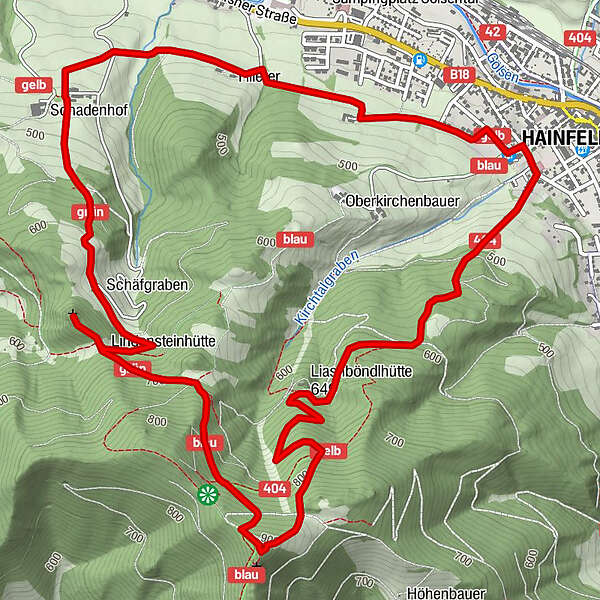
Hainfeld0.0 kmKirche Hainfeld0.1 kmGölsen1.6 kmLindensteinhütte3.9 kmLindenstein (699 m)4.1 kmHainfelder Hütte5.6 kmLiasnböndl Naturfreundehütte7.0 kmHainfeld8.7 km
- Best season
-
JanFebMarAprMayJunJulAugSepOctNovDec
- Highest point
- 900 m

GPS Downloads


Other tours in the regions
-
Wienerwald
4219
-
Elsbeere-Wienerwald
1218
-
Hainfeld
411