
- Brief description
-
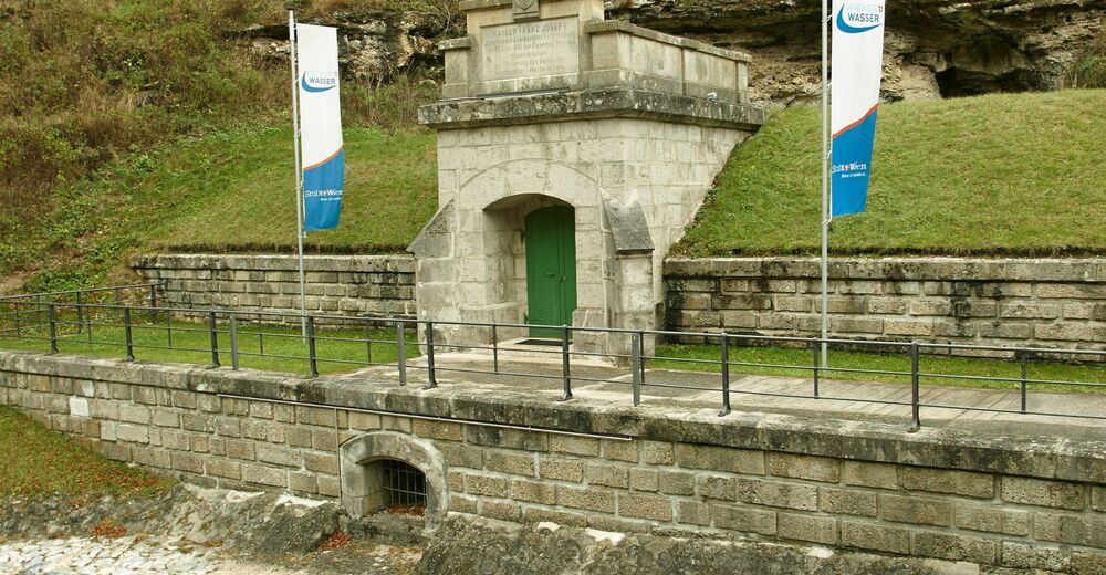
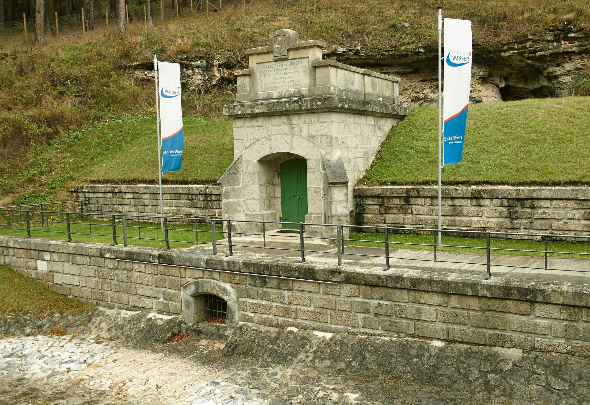
The source of life for the inhabitants of Vienna lies in Reichenau. The Kaiserbrunn spring is the source of the first Vienna water pipeline, built between 1869 and 1873 . The water flows from Kaiserbrunn to Vienna every day.
- Difficulty
-
medium
- Rating
-
- Route
-
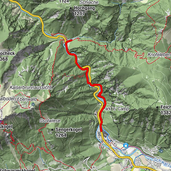
Stollen0.3 kmStollen0.5 kmMittagsteinhöhle0.6 kmStollen zur Wasserleitung2.6 kmAbbrennbrückenkluft2.7 kmSpritzbetonhöhle2.9 kmStollenloch3.0 kmStollenlochhöhle3.0 kmSpannbrücken-Halbhöhle3.4 kmSchnepfkapelle3.6 kmam Wasserwerk3.7 kmKaiserbrunn3.7 kmKaiserbrunnen3.8 km
- Best season
-
JanFebMarAprMayJunJulAugSepOctNovDec
- Description
-
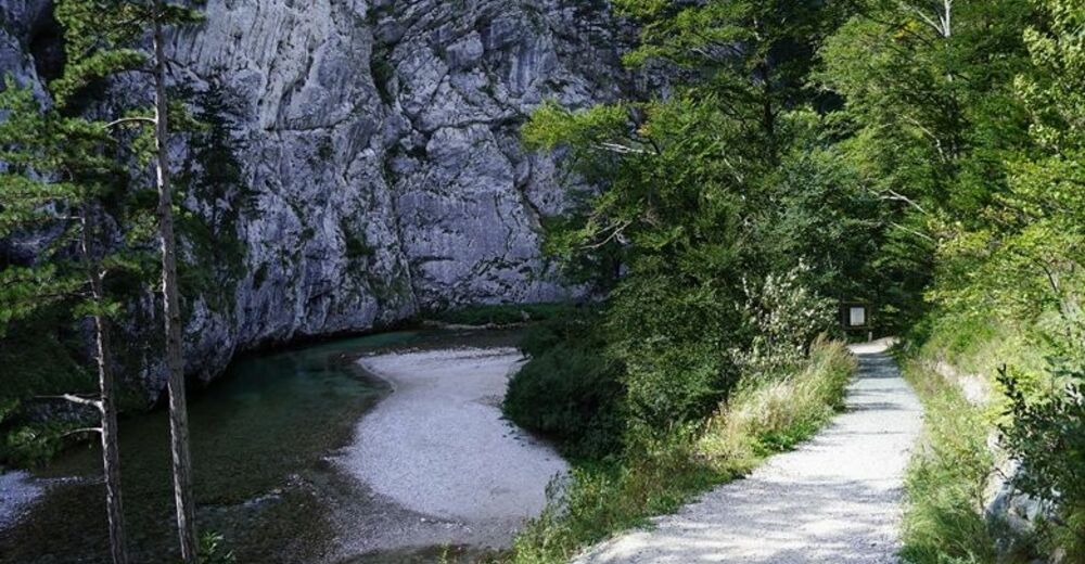
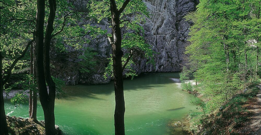
The Vienna Water Pipeline Trail was established along the most beautiful sections of the water pipeline in 1998. The section with the most striking landscape is surely that leading through the wild and romantic Höllental. The hike can also be combined with a visit to the water pipeline museum in Kaiserbrunn.
- Directions
-
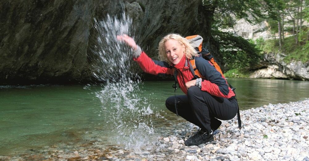
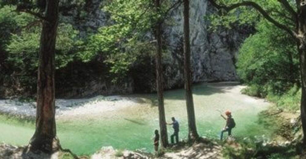
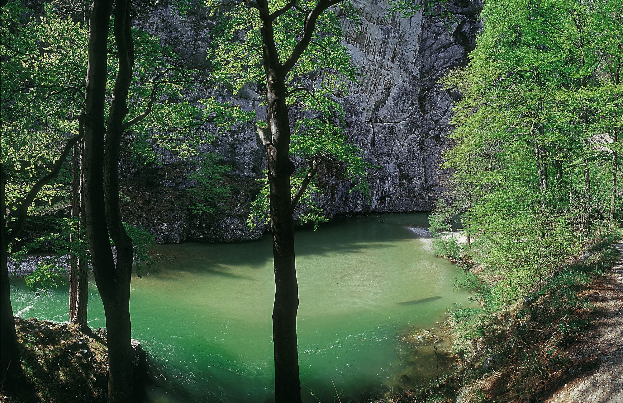
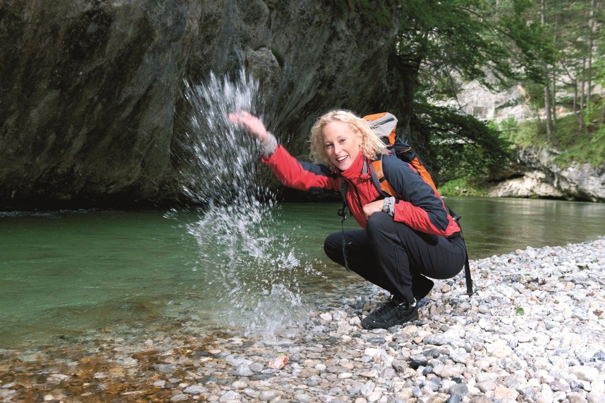
The starting point for the hike is the car park at the end of the village of Hirschwang. From here, we walk to Kaiserbrunn through the stunning Höllental between Rax and Schneeberg. Crossing a climb with ladders and stairways makes this hike a special experience. This is only surpassed by the view of the crystal clear view of the Schwarza river, which takes a picturesque course through the forest, past gravel banks and steep rocks. From Kaiserbrunn we either take the same route back to the start, or take a bus, taxi or car back to Hirschwang.
- Highest point
- 567 m
- Endpoint
-
Kaiserbrunn
- Height profile
-

- Equipment
-
Always bring suitable maps. Always wear appropriate, sturdy footwear, bring sun and rain protection and water, as well as a little something to eat. Bring your mobile phone with you and save the mountain rescue emergency number: 140
- Safety instructions
-
The route is not passable at high water!
Mountain rescue emergency number: 140
EU emergency number: 112
Your hiking experience in the Vienna Alps should be a thoroughly enjoyable and safe one. Therefore, please bear the following in mind:
Preparation
When choosing a route, make sure it corresponds to your experience and physical fitness level. Check the weather forecast before you set off. The weather can change surprisingly quickly in the mountains. Always take appropriate equipment with you (e.g. rain protection).
Check whether the cabins and snack stations you intend to visit along the way are open. Inform someone before you set off of your chosen route and when you plan to return.
- Tips
-
Combine your hike with an overnight stay in the Rax region! The Hotel Seminar Park Hirschwang, the Wellness Seminar Hotel Raxalpenhog, Flackl-Wirt or the Marienhof in Reichenau and Payerbacherhof can be booked online now.
- Directions
-
Take the A2 to Knoten Seebenstein - S6 to Gloggnitz - B27 to Hirschwang an der Rax
- Public transportation
-
Take the Südbahn (southern train) to Payerbach-Reichenau. There are regular buses between Payerbach-Reichenau station and the starting point of the First Vienna Water Pipeline Trail.
- Parking
-
There are parking spaces at the end of the village of Hirschwang.


- Author
-
The tour First Vienna Water Pipeline Trail is used by outdooractive.com provided.


General info
-
Hochsteiermark
4082
-
Semmering - Rax
2314
-
Reichenau / Rax - Raxalpe
937


