- Brief description
-
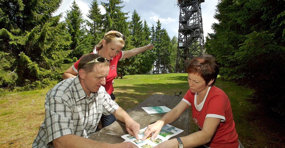
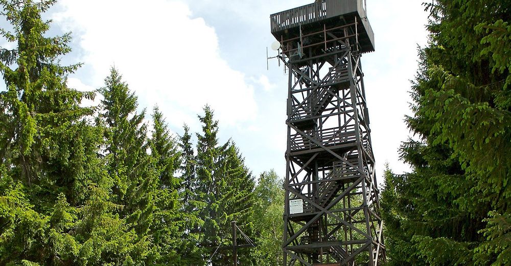
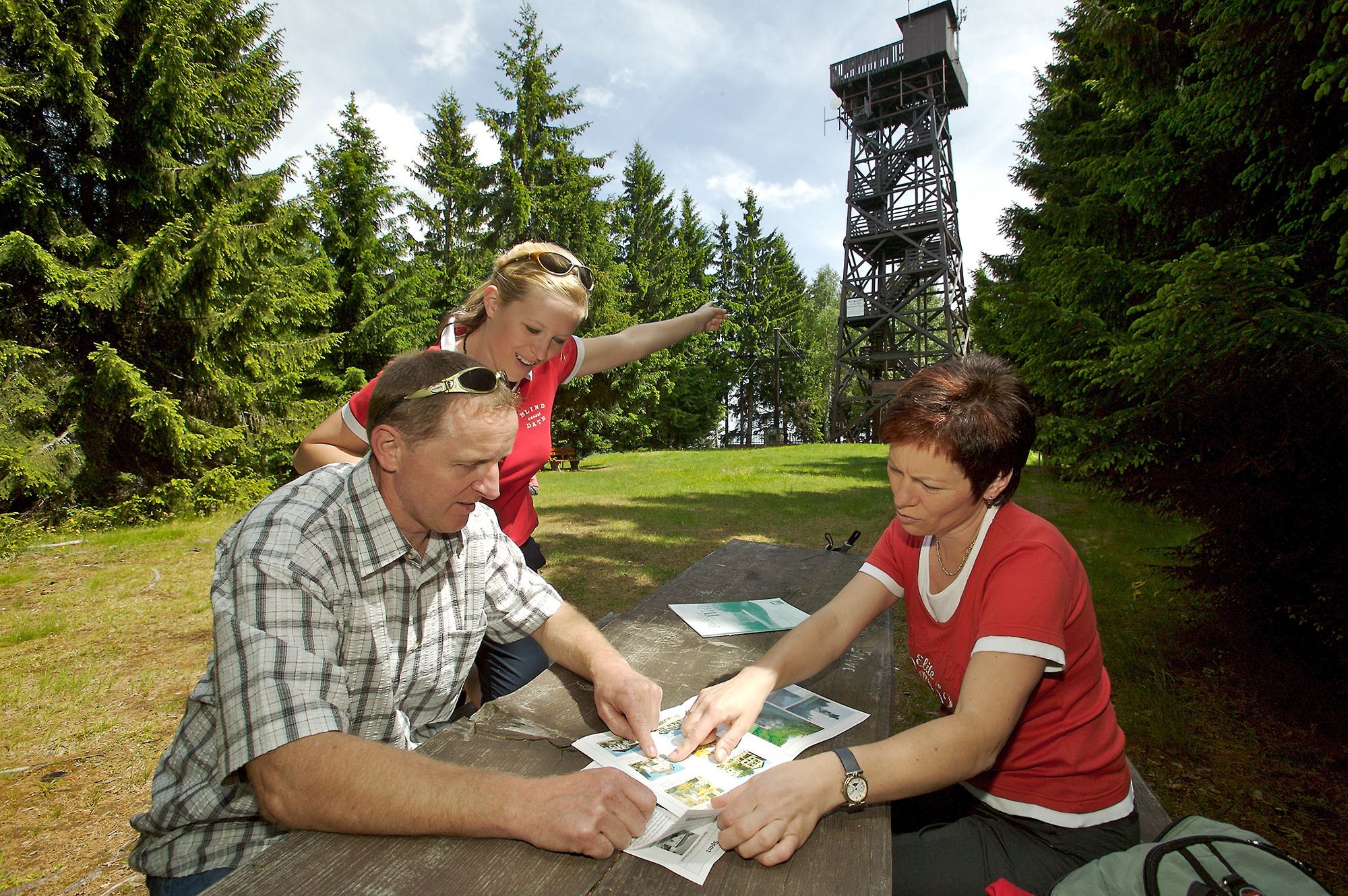
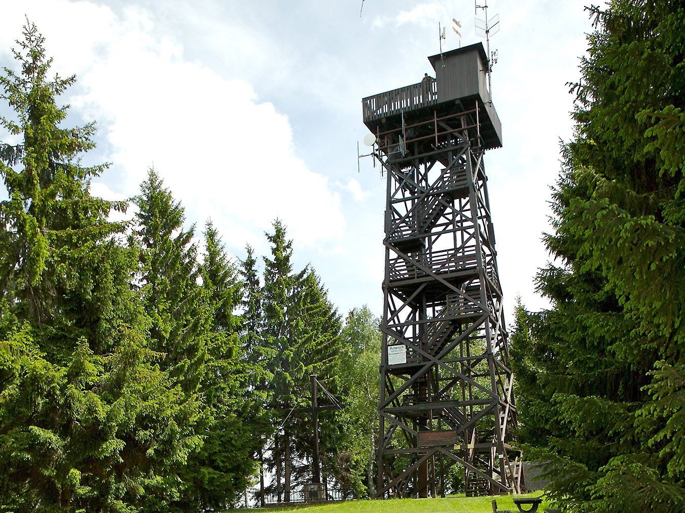
Hike to the Hutwisch lookout tower, via the Gasthof Höhwirt. At 896m in height, and with 104 steps, the lookout tower offers breathtaking views.
- Difficulty
-
easy
- Rating
-
- Starting point
-
Gasthof Grandits in Kirchschlag
- Route
-
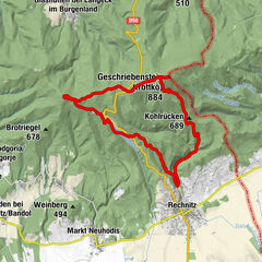
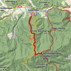
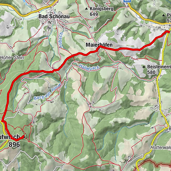
Grandits0.1 kmMaierhöfen2.4 kmKapelle2.4 kmHutwisch (896 m)7.7 km
- Best season
-
JanFebMarAprMayJunJulAugSepOctNovDec
- Description
-
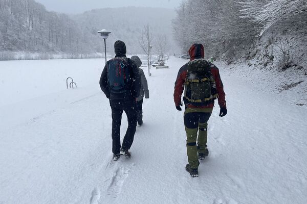
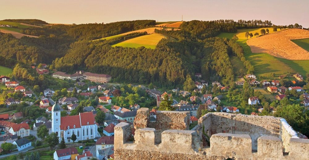
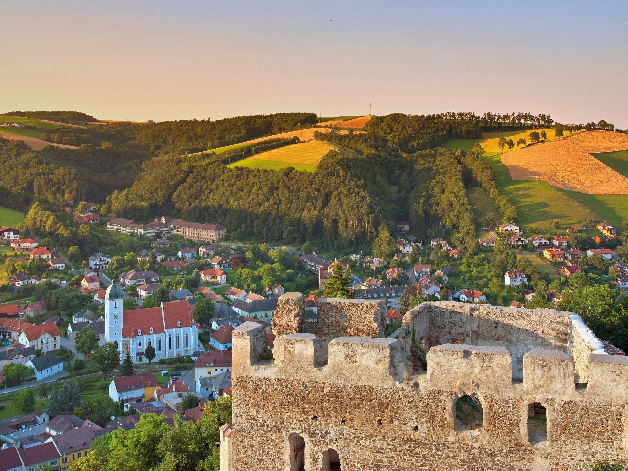
Departing from the Gasthof Hotel Grandits just outside the centre of Kirchschlag in Bucklige Welt, you will arrive at the Hutwisch lookout post in just over two hours. The route leads down paved roads and through forests, through Maierhöfen and Ortbauer, to Hochneukirchen. The Gasthof Höhwirt is situated just 70m below the lookout tower, in densely-wooded surroundings. If you stop here, you will be welcomed into a pleasant atmosphere with good traditional food and international dishes. You will reach the Höhwirt by turning right onto Landstrasse (B road) 146 about one kilometre from the destination. Then it’s on to the highest peak of the Bucklige Welt – the Hutwisch. Climbing the 104 steps to the Hutwisch lookout post is worthwhile. Here you have a view of Lake Neusiedl and the Schneeberg!
- Directions
-
We will start at Gasthof Grandits in Kirchschlag and follow the E2 route markings, on a moderate incline up the Rotte Maierhöfen. We will pass through Maierhöfen, heading from the farm to the chapel, before taking a short left and immediately turning right and heading onto the ridgeway. We will go straight on to Ortbauer. On the tarmac road, we will bear left for about 150m, before turning right onto the trail. We will follow the E2 trail, marked by yellow signs, through the Wolfsbühlewald on a moderate ascent, before crossing a road. We will continue along the yellow route. We will turn left towards Harmannsdorf, and left onto the path which will lead us to the Hutwisch lookout tower.
- Highest point
- 894 m
- Endpoint
-
Hutwisch outlook tower or Gasthof Höhwirt
- Height profile
-

- Equipment
-
Bring a suitable map . Wear suitable, sturdy shoes , and bring sun and rain protection, as well as water and a bite to eat. Bring your mobile phone, and save the emergency number of the mountain rescue team: 140
- Safety instructions
-
Walking in the Viennese Alps should be a completely safe and beautiful experience. Therefore, please note the following:
Preparation
Make sure that your choice of route matches your hiking experience and your physical condition. Check the weather forecast. In the mountains, the weather can change surprisingly quickly. For this reason, make sure you are well-equipped (e.g. bring rain protection).
Check that the huts and refreshment stations that you want to visit along the way will be open. Tell someone which route you have chosen, and when you hope to return, before you set off.
- Tips
-
Combine your walk with an overnight stay in Kirchschlag. Rooms at the Hotel zur Post Hönigwirt can be booked online.
- Additional information
-
Wiener Alpen in Niederösterreich, www.wieneralpen.at
- Directions
-
From the A2 southern motorway: If you are coming from Vienna, take the Krumbach exit. If you are coming from Graz, take the Aspang-Zöbern exit. Take the B54 to Bad Schönau. After about 7.5km, you will reach Kirchschlag in Bucklige Welt. Turn right after entering the village. Continue 200m to Hotel Gasthof Grandits.
- Public transportation
-
Daily bus connections operated by BLAGUSS NÖ take you from Südtiroler Platz in Vienna, to Bad Schönau or Kirchschlag.
If you are travelling by train, take the southern train (Südbahn) to Wiener Neustadt, and then the regional train (Regionalzug, towards Aspang) to Edlitz-Grimmenstein. From there, take the bus to Kirchschlag.
See www.oebb.at or www.vor.at for more information.
- Parking
-
Parking facilities are available at Hotel Gasthof Grandits.
- Author
-
The tour Kirchschlag – Hutwisch or Höhwirt route is used by outdooractive.com provided.


General info
-
Wiener Alpen
3045
-
Bucklige Welt - Wiener Alpen
792
-
Bad Schönau
188