Hut hopping in the Raxalpe area (Number 4: mountain station - Ottohaus - Seehuette)


- Brief description
-
Hiking from hut to hut – “hut hopping” – in the Rax is one of the most popular trails in the region. It means being able to hike in subalpine heights, through meadows and the mountain pine zone, without having to tackle difficult gradients.
- Difficulty
-
medium
- Rating
-
- Starting point
-
Note about Hirschwang an der Rax, valley station of the Rax aerial cableway
- Route
-
BerggasthofPraterstern (1,623 m)1.5 kmKönigsschusssattel (1,654 m)5.3 kmNeue Seehütte5.3 kmBrach5.4 kmPreiner Wand (1,783 m)6.3 kmQuartetthöhle6.3 kmPreinerwandsteighöhle6.4 kmDuohöhle6.4 kmHohe Kanzel (1,699 m)7.7 kmHohe-Kanzel-Höhle7.8 kmJakobskogel (1,737 m)8.4 kmJakobshöhle I8.5 kmHöhlenruine8.5 kmJakobskogelschacht8.8 kmVilma-Haid-Aussicht8.8 kmOttohaus8.9 kmPraterstern (1,623 m)9.1 kmBerggasthof10.7 km
- Best season
-
JanFebMarAprMayJunJulAugSepOctNovDec
- Description
-
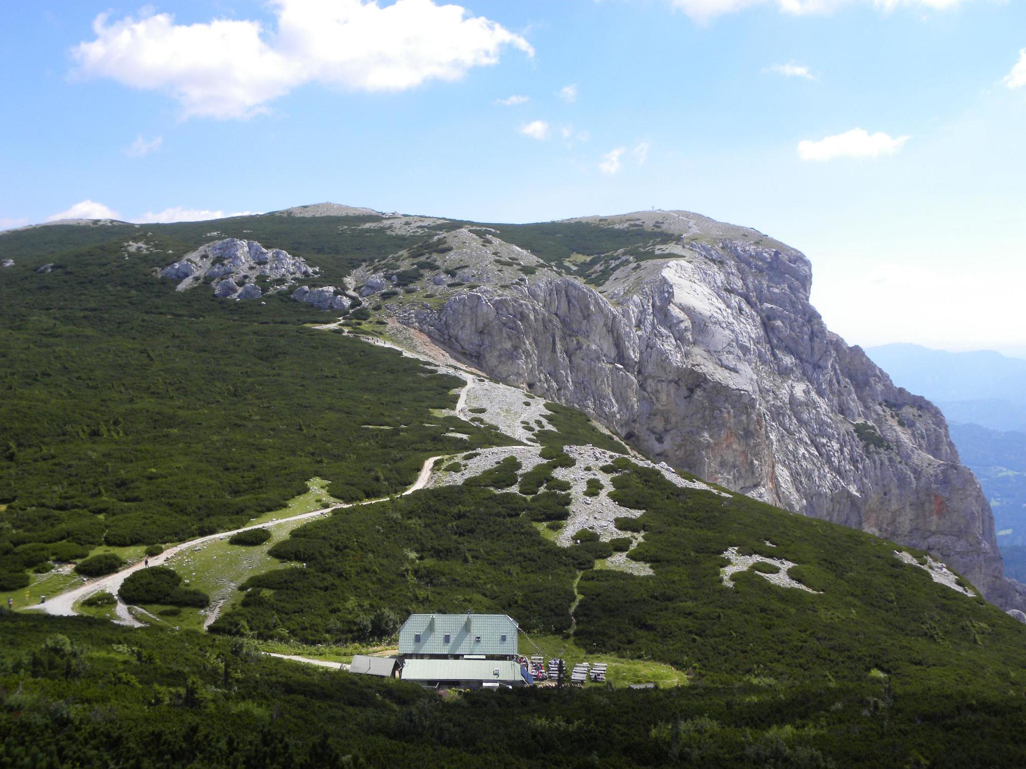
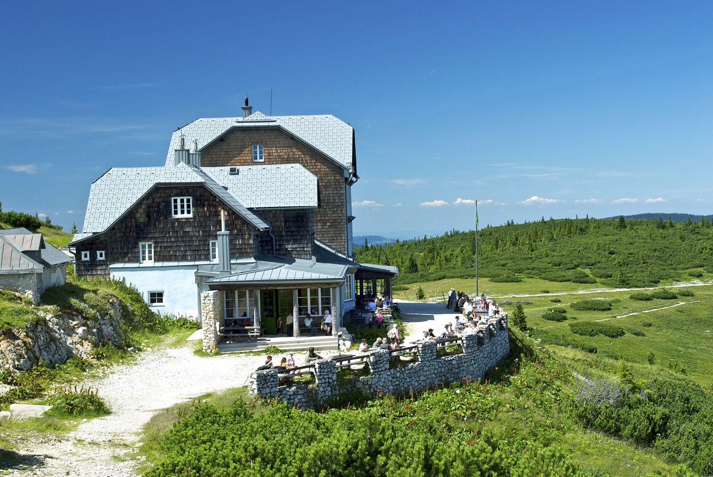
Travel up on the Rax aerial cableway, which opened in 1926, and is the oldest cable car system in Austria. A special feature of the Ottohaus, which is the hut nearest to the summit station, is a large Alpine garden which covers 4000m2, and boasts around 200 region-specific Alpine plant species. The name of the next station, the Seehütte, is derived from the name of a small lake, which was drained shortly after the 1st World War. Without having to overcome any great difficulties, you can “hop” from hut to hut in the Rax. Due to its short length, this variation of the popular Rax hiking route is suitable for families. However, the conditions must be suitable!
- Directions
-
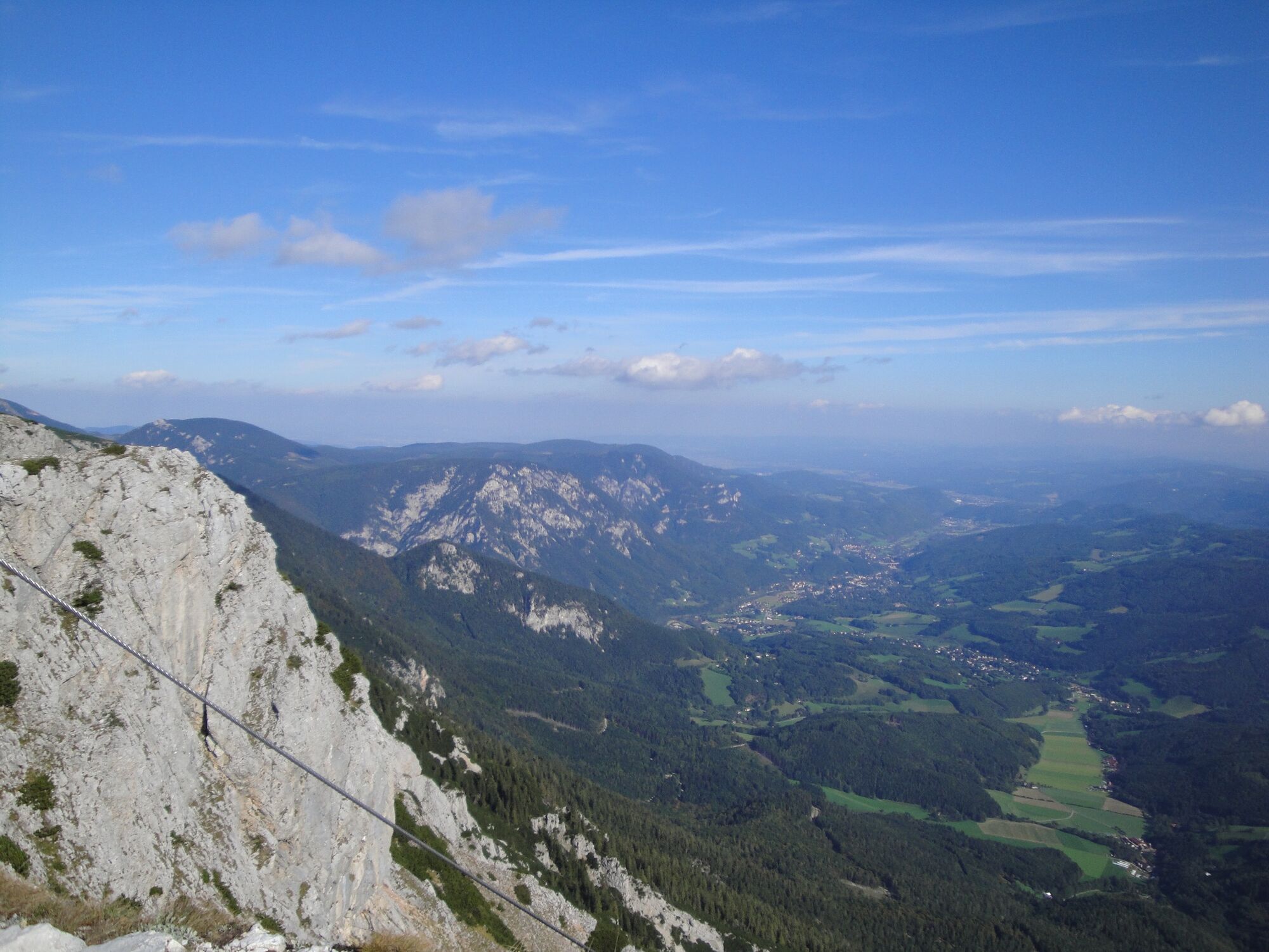
We will start by taking the Rax aerial cableway. Just a few minutes later, we will arrive at the summit station at 1547m above sea level. From the summit station, we will follow the red signs to the Gatterlkreuz (Gatterl cross), and then back to the Ottohaus. The journey to the first hut of the tour takes 45 minutes, and involves an ascent of 100m. The lakeside route then gently descends, leading to the Neu Seehütte, which is situated in a valley. The route leads back past the Preiner Wand Kreuz (Preinerwand cross) and over the well-known Preiner Wand climbing paradise, before the ridgeway leads through the mountain pine route and back to the Ottohaus. Anyone who wants to reach another summit can climb the Jakobskogel (1737m), which is located near to the Ottohaus. Finally, we will return to the Ottohaus, and head back to the summit station.
- Highest point
- 1,788 m
- Endpoint
-
Raxalpen Berggasthof, summit station of the Rax aerial cableway
- Height profile
-

- Equipment
-
Bring a suitable map. Wear suitable, sturdy shoes, and bring sun and rain protection, as well as water and a bite to eat. Bring your mobile phone, and save the emergency number of the mountain rescue team: 140
- Safety instructions
-
Walking in the Viennese Alps should be a completely safe and beautiful experience. Therefore, please note the following:
Preparation
Make sure that your choice of route matches your hiking experience and your physical condition. Check the weather forecast. In the mountains, the weather can change surprisingly quickly. For this reason, make sure you are well-equipped (e.g. bring rain protection).
Check that the huts and refreshment stations that you want to visit along the way will be open. Tell someone which route you have chosen, and when you hope to return, before you set off.
Tours of the plateau are not recommended in fog and strong winds!
- Tips
-
Combine your walk with an overnight stay in the Raxalpen Berggasthof, in the direct vicinity of the summit station!
- Additional information
-
Stützpunkte:
Raxseilbahn Berggasthof, +43/2666/52450
Ottohaus, +43/2666/52402
Neue Seehütte, +43/676/7488719
Weitere Infos:
Wiener Alpen in Niederösterreich, www.wieneralpen.at, +43 / 2622 / 78960
Tourismusbüro Reichenau, www.reichenau.at, +43 / 2666 / 52865
Raxalpe, www.raxalpe.com, +43 / 2666 / 52497
- Directions
-
A2 to Knoten Seebenstein – S6 to Gloggnitz – B27 to Hirschwang an der Rax, the valley station of the Rax aerial cableway (just outside Hirschwang)
- Public transportation
- Parking
-
Parking spaces are available at the valley station of the Rax aerial cableway.

- Author
-
The tour Hut hopping in the Raxalpe area (Number 4: mountain station - Ottohaus - Seehuette) is used by outdooractive.com provided.


General info
-
Hochsteiermark
4082
-
Waldheimat
2196
-
Reichenau / Rax - Raxalpe
937


