Tour data
18.46km
1,000
- 1,738m
738hm
06:00h
- Rating
-
- Starting point
-
Bergstation Sesselbahn
- Route
-
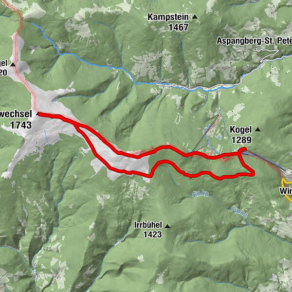
Berggasthof Mönichkirchner Schwaig0.2 kmHallerhaus1.3 kmStoa Alm1.8 kmSteinerne Stiege (1,505 m)2.3 kmNiederwechsel (1,669 m)4.8 kmWetterkoglerhaus8.0 kmHochwechsel (1,743 m)8.0 kmVorauer Schwaig12.1 kmBerggasthof Mönichkirchner Schwaig18.2 km
- Highest point
- 1,738 m
- Rest/Retreat
-
Gasthaus Stern, Gasthaus Enzian, Hallerhaus, Wetterkoglerhaus, Vorauer Schwaig,
- Ticket material
-
Berg- oder Talstation Sessellift, Gemeindeamt.
GPS Downloads


Trail conditions
Asphalt
Gravel
Meadow
Forest
Rock
Exposed
Other tours in the regions
-
Wiener Alpen
3048
-
Wechselland - Wiener Alpen
1704
-
Aspangberg - St. Peter
435