- Brief description
-
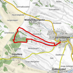
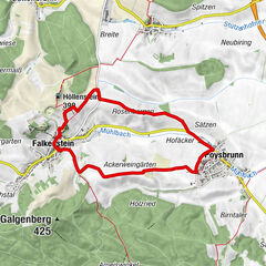
Start / Finish: Staatz
- Difficulty
-
easy
- Rating
-
- Starting point
-
Staatz-Kautendorf, Schlossplatz 5
- Route
-
StaatzKautendorfSt. Martin0.3 kmEnzersdorf bei Staatz0.9 kmSt. Nikolaus4.9 kmAmeis5.2 kmWaltersdorf bei Staatz10.8 kmSt. Kilian10.9 kmGasthaus Wiesmann10.9 kmEnzersdorf bei Staatz13.8 kmPizzeria Mali13.8 kmKalvarienberg14.9 kmKautendorf16.7 kmStaatz16.8 kmSchlosskeller Staatz17.1 kmStaatzer Berg (332 m)17.2 km
- Description
-
Visit the villages without chimneys in Staatz and the surrounding area! Along the way you can fortify yourself at self-service stalls.
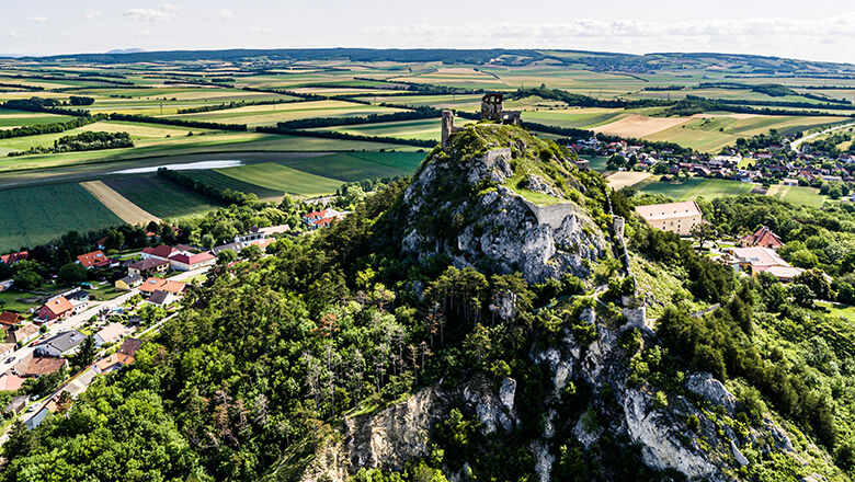
Along the hiking trail you walk through four cellar lanes - "Schlichtenberg" in Kautendorf, "Auberg" in Enzersdorf, "Trift" in Waltersdorf and the "Loamgstettn" in Ameis. This round of cellar lanes offers a wonderful view of the surrounding area and the striking "Staatzer Berg" is a constant companion.
- Directions
-
Start at the VAZ Staatz, pass the castle cellar and the "Staatzer Speis", through the castle park to the B46. Along Lindenstraße you reach the "Schlichtenberg", the cellar alley in Kautendorf. After going around the cellar alley, continue towards the "Kalvarienberg", with baroque stations of the cross. Arrived in the upper town of Enzersdorf, you walk along the village. A sunken path leads to the "Auberg", the Enzersdorfer Kellergasse. After this cellar alley, you arrive in Waltersdorf. Walk along the village, past the chapel to the Bründlquelle spring, then to the Waltersdorfer Kellergasse "Trift". At the end of the cellar alley you continue to Ameis, where you can explore one of the most beautiful cellar alleys in the country, the "Loamgstettn". Then you walk towards Ameis, past the church, through the gentle landscape, with a view of the Staatzer Berg. Arrived in Enzersdorf, you pass the sports field and cemetery and reach the starting point again after the Staatz church.
- Highest point
- 315 m
- Endpoint
-
Staatz-Kautendorf, Schlossplatz 5
- Height profile
-

- Directions
-
Staatz can be reached from Vienna via the A5 motorway, exit Schrick to Mistelbach. Follow the B46 in the direction of Laa/Thaya. In Staatz-Kautendorf follow the signs to Schlossplatz 5.
- Parking
-
Parking spaces are available at the starting point VAZ Staatz/ Prof. Anton Kornherr-Musikerheim.
- Author
-
The tour Staatzer Kellergassenrunde is used by outdooractive.com provided.


General info
-
Weinviertel
943
-
Leiser Berge
377
-
Staatz
74