


- Brief description
-
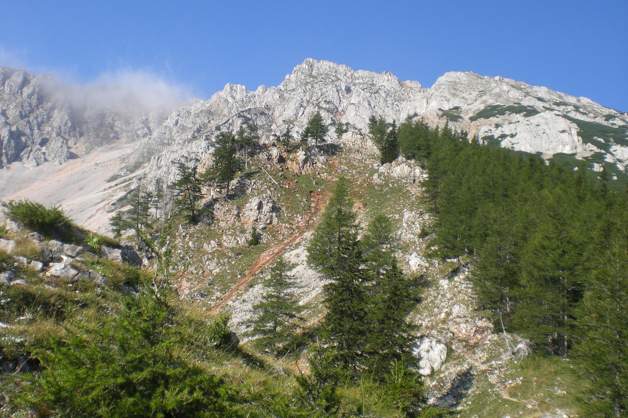
Demanding mountain tour with exposed spots and rock faces.
- Starting point
-
Lower station of the Schneeberg chairlift
- Route
-
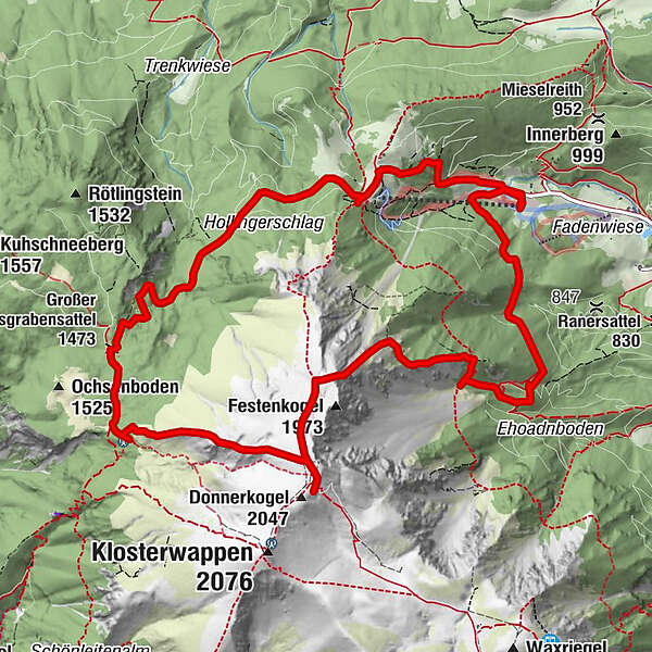
Lahning-Inn0.0 kmPuchis Welt0.1 kmKaiserstein (2,061 m)5.8 kmFischerhütte5.8 kmDonnerkogel (2,047 m)6.0 kmDurchgangshöhle6.0 kmSchauerstein (1,866 m)7.0 kmHeinrich-Krempel-Hütte8.0 kmWindloch III9.0 kmWindloch IV9.3 kmWindloch I9.3 kmAlmgatterl9.6 kmFadensattel12.5 kmLahning-Inn13.9 kmPuchis Welt14.0 km
- Description
-
The route begins at the lower station of the Schneeberg chairlift. Follow the red signs below the chairlift, to easily reach the Bürklehütte inn. The Weninger Steig path is the quicker, more direct ascent to the Bürklehütte. Food and drink are not served in this inn.
Right at the highest point as you head towards the Edelweisshütte inn, the path turns right towards the Rieshütte inn and on to the Nandlgrat trail. Continue to follow the blue signs between Breiter Ries and Lahningries along the high rock formations and rock faces, until the Nandlgrat trail ends.
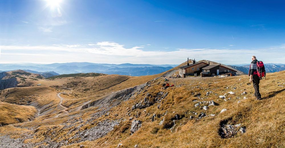
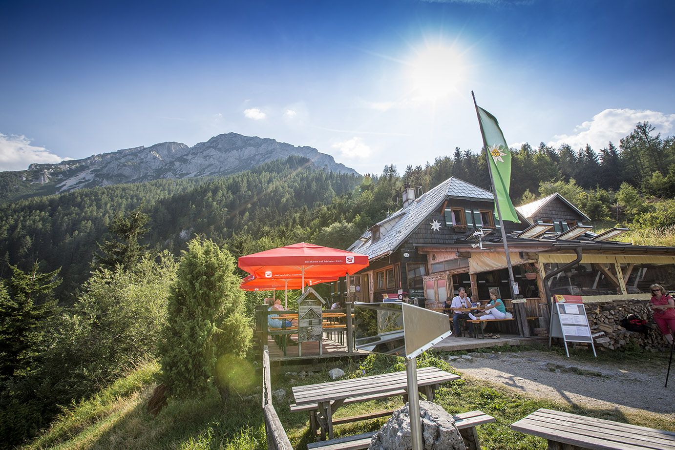
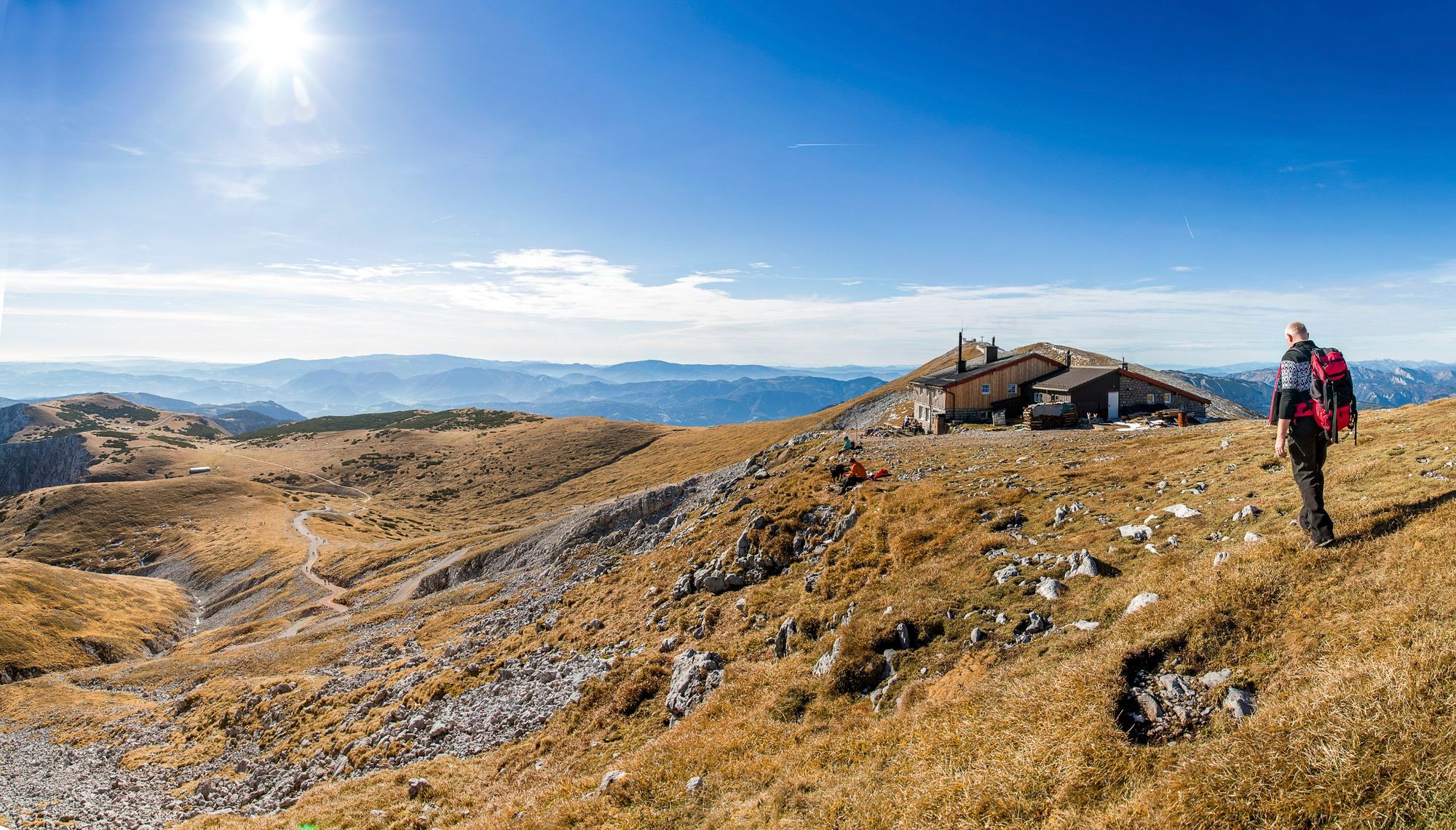
Head across the alpine meadow to the Fadensteig path, and turn left towards the Fischerhütte inn.
After a rest in the Fischerhütte, the descent begins along the so-called Schauerstein. Follow the green signs, and then the yellow ones, to the Edelweisshütte. From there, you can take the Schneeberg chairlift down to the valley, or follow the yellow signs to the lower station.
- Directions
-
The route begins at the lower station of the Schneeberg chairlift. Follow the red signs below the chairlift, to easily reach the Bürklehütte inn. The Weninger Steig path is the quicker, more direct ascent to the Bürklehütte. Food and drink are not served in this inn.
Right at the highest point as you head towards the Edelweisshütte inn, the path turns right towards the Rieshütte inn and on to the Nandlgrat trail.
Continue to follow the blue signs between Breiter Ries and Lahningries along the high rock formations and rock faces, until the Nandlgrat trail ends.
Head across the alpine meadow to the Fadensteig path, and turn left towards the Fischerhütte inn.
After a rest in the Fischerhütte, the descent begins along the so-called Schauerstein. Follow the green signs, and then the yellow ones, to the Edelweisshütte. From there, you can take the Schneeberg chairlift down to the valley, or follow the yellow signs to the lower station.
- Highest point
- 2,042 m
- Endpoint
-
Lower station of the Schneeberg chairlift
- Height profile
-

- Equipment
-
Sturdy mountain boots, rain protection and drinking water
- Tips
-
A wonderful, demanding ascent for mountaineers with a very good level of physical fitness and coordination.
- Additional information
-
www.schneebergsesselbahn.at
http://www.iocus.at/Fischerhuette/
www.schneebergbahn.at
-

-
AuthorThe tour Schneeberg - Nandlgrat is used by outdooractive.com provided.


-
Hochsteiermark
4075
-
Semmering - Rax
2307
-
Reichenau / Rax - Raxalpe
931


