Apricot blossom in Hartl on the Luftberg in Aggsbach-Dorf in the Wachau


- Brief description
-
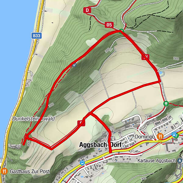
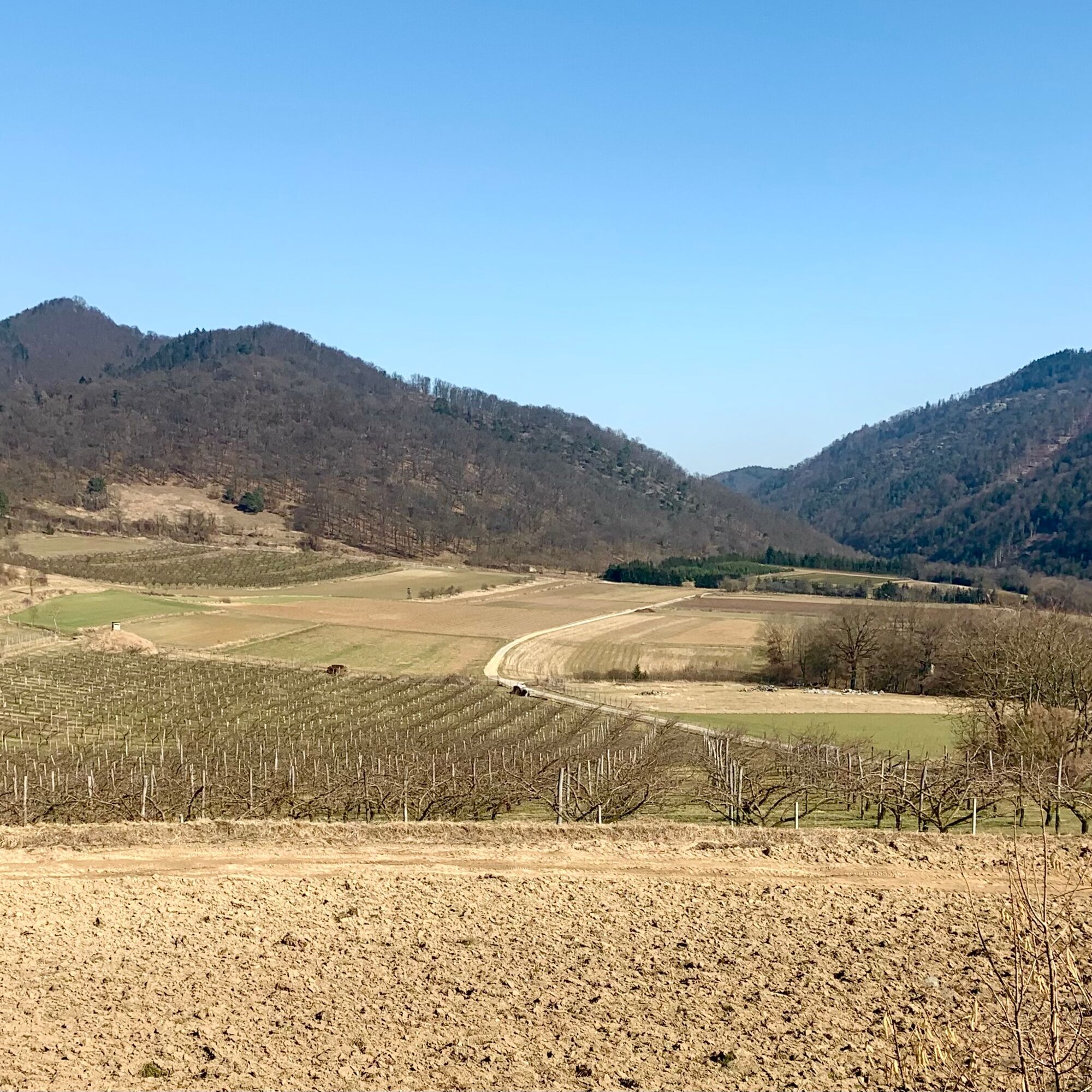
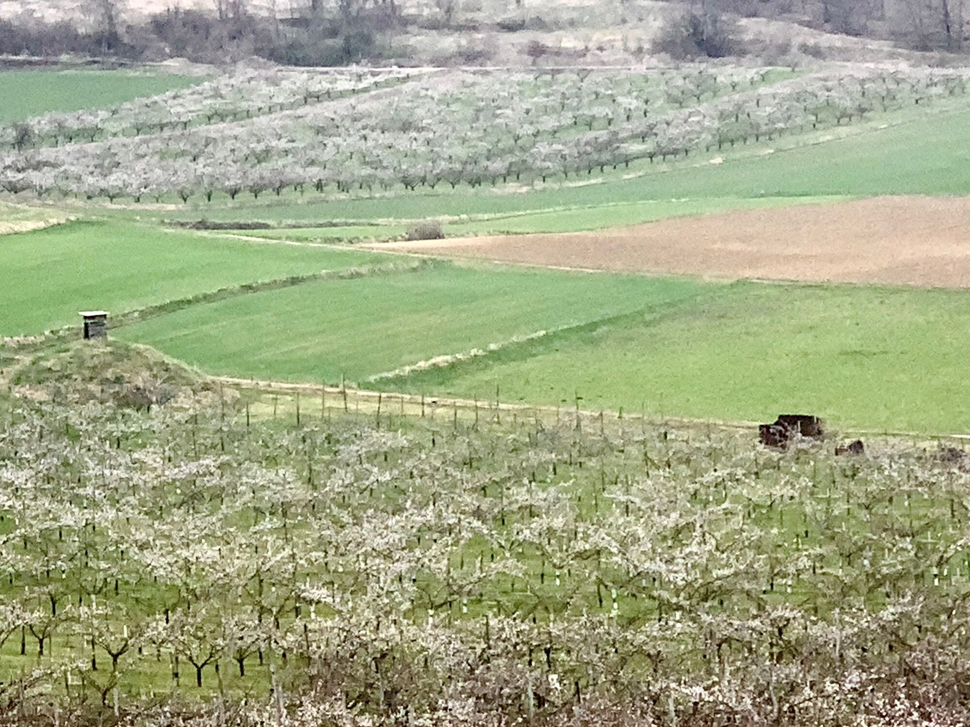
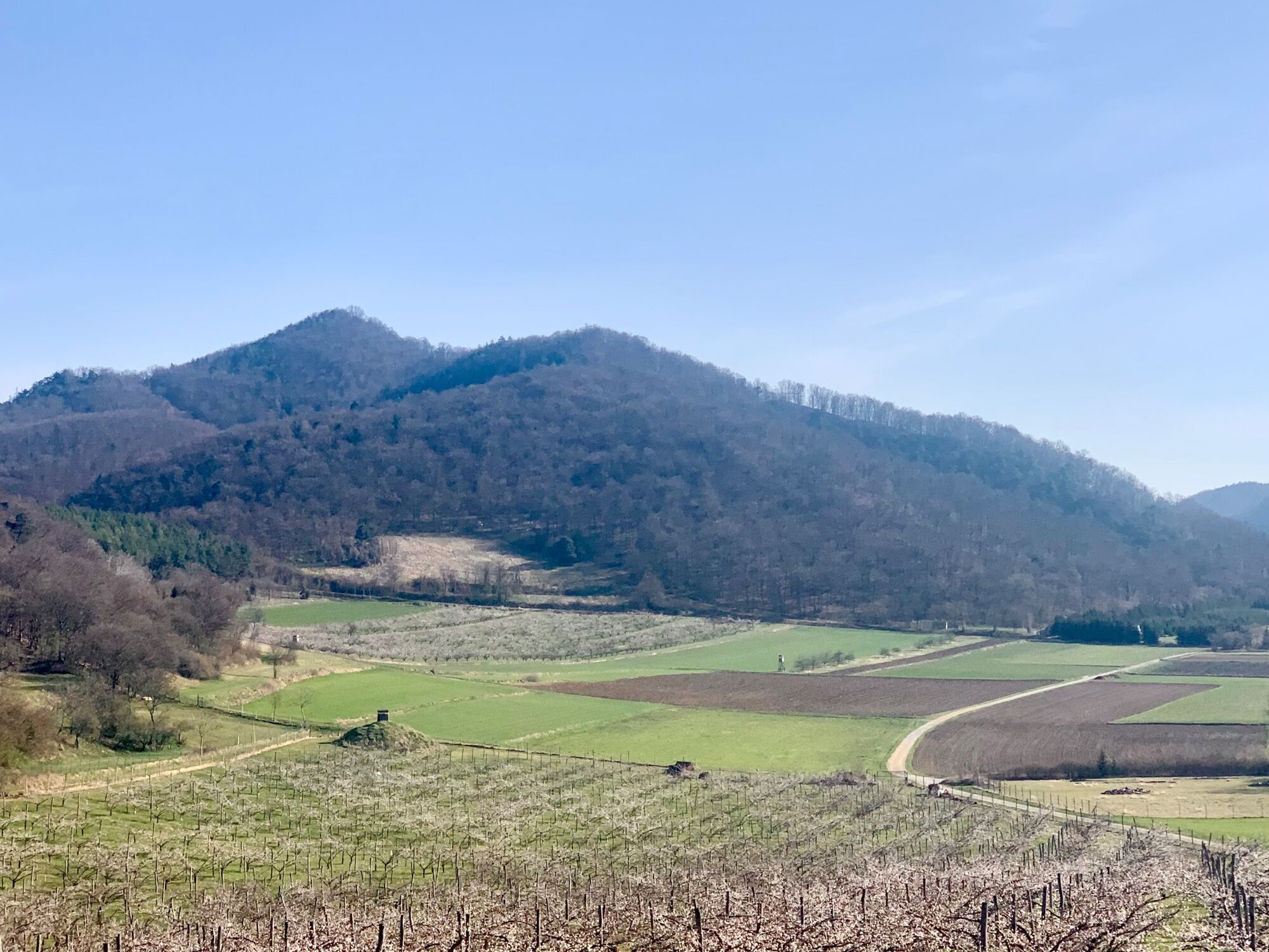
The Hartl is an area facing southeast, about 50 to 60 m above the village along the Aggsbach, at the foot of the Luftberg, on which there are 2 large apricot gardens.
- Difficulty
-
easy
- Rating
-
- Starting point
-
In Aggsbach-Dorf at the exit of Hartl Weg from the L162 state road.
- Route
-
Aggsbach-Dorf3.3 km
- Best season
-
JanFebMarAprMayJunJulAugSepOctNovDec
- Description
-
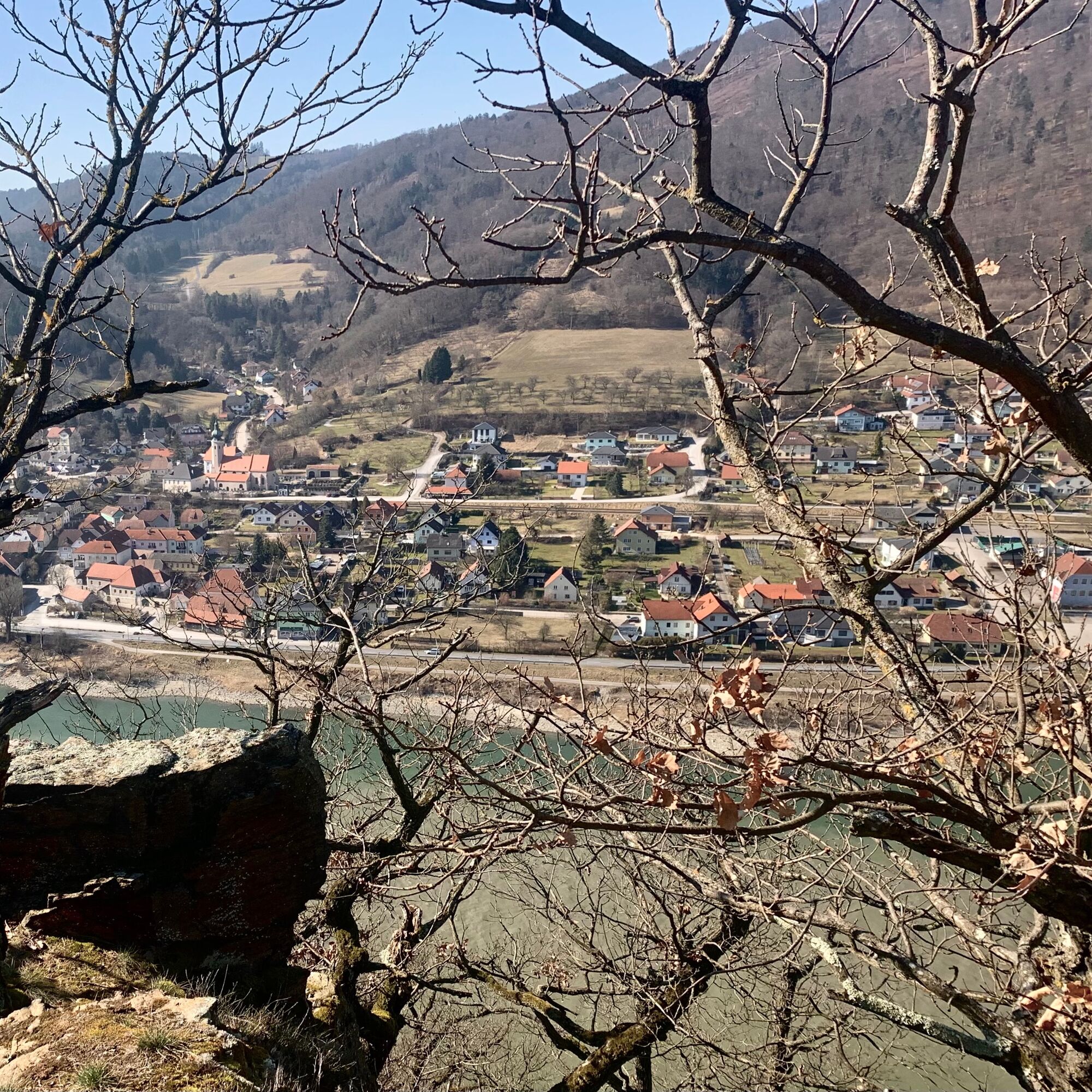
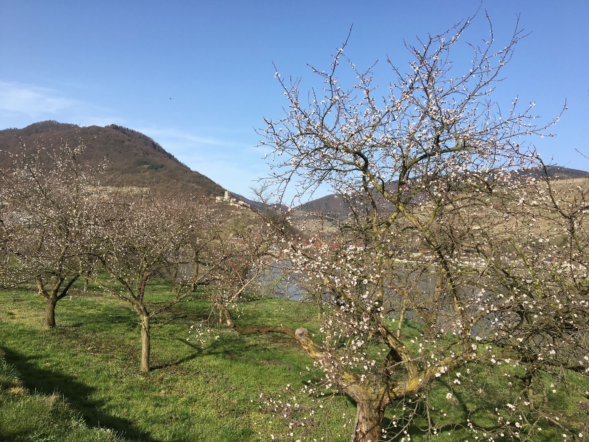
The first opportunity to see the apricot blossom in the Wachau Valley, if you drive on the right bank of the Danube from Melk in the direction of Krems, is in Aggsbach-Dorf. Aggsbach is a street village that stretches along the Aggsbach, which flows in a south-westerly direction, approximately from the area of the tributary of the Mitterbach to the confluence with the Danube.
Halfway into Aggsbach village, approximately at House number 34, the is a steep ascent, about 50 to 60 m from the valley floor up into the Hartl. When you arrive on the higher plateau, you can immediately see the large apricot gardens to the northwest and northeast.
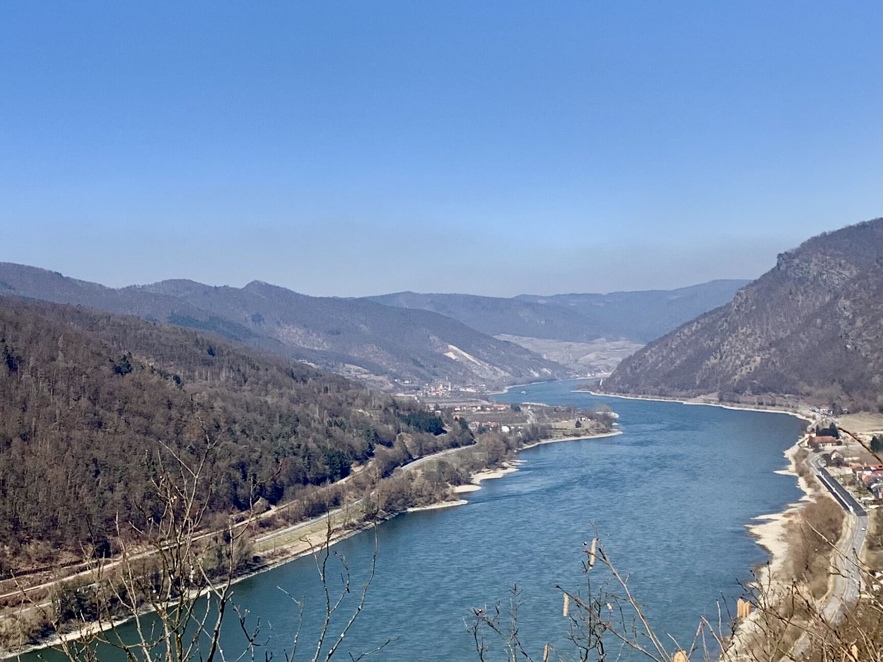
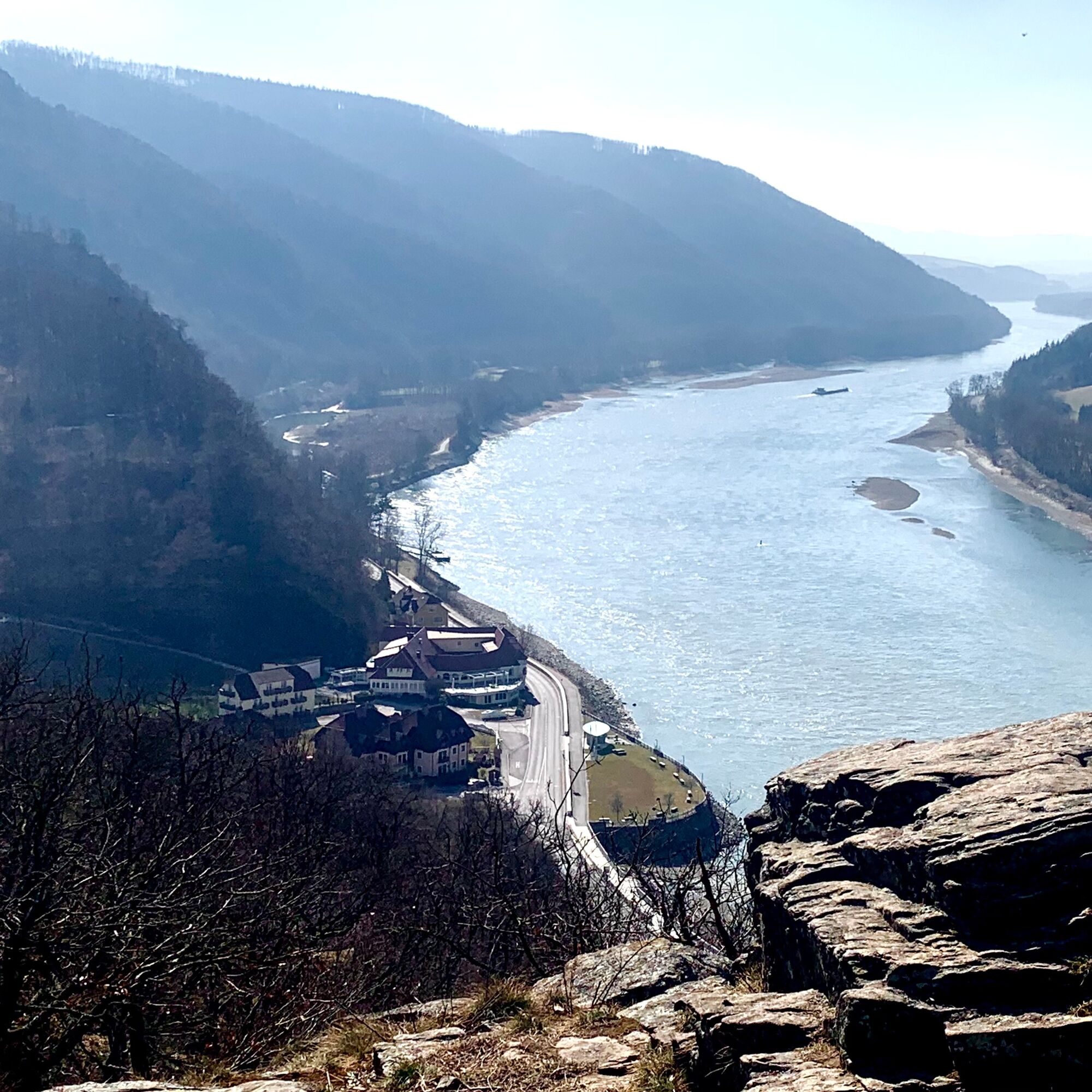
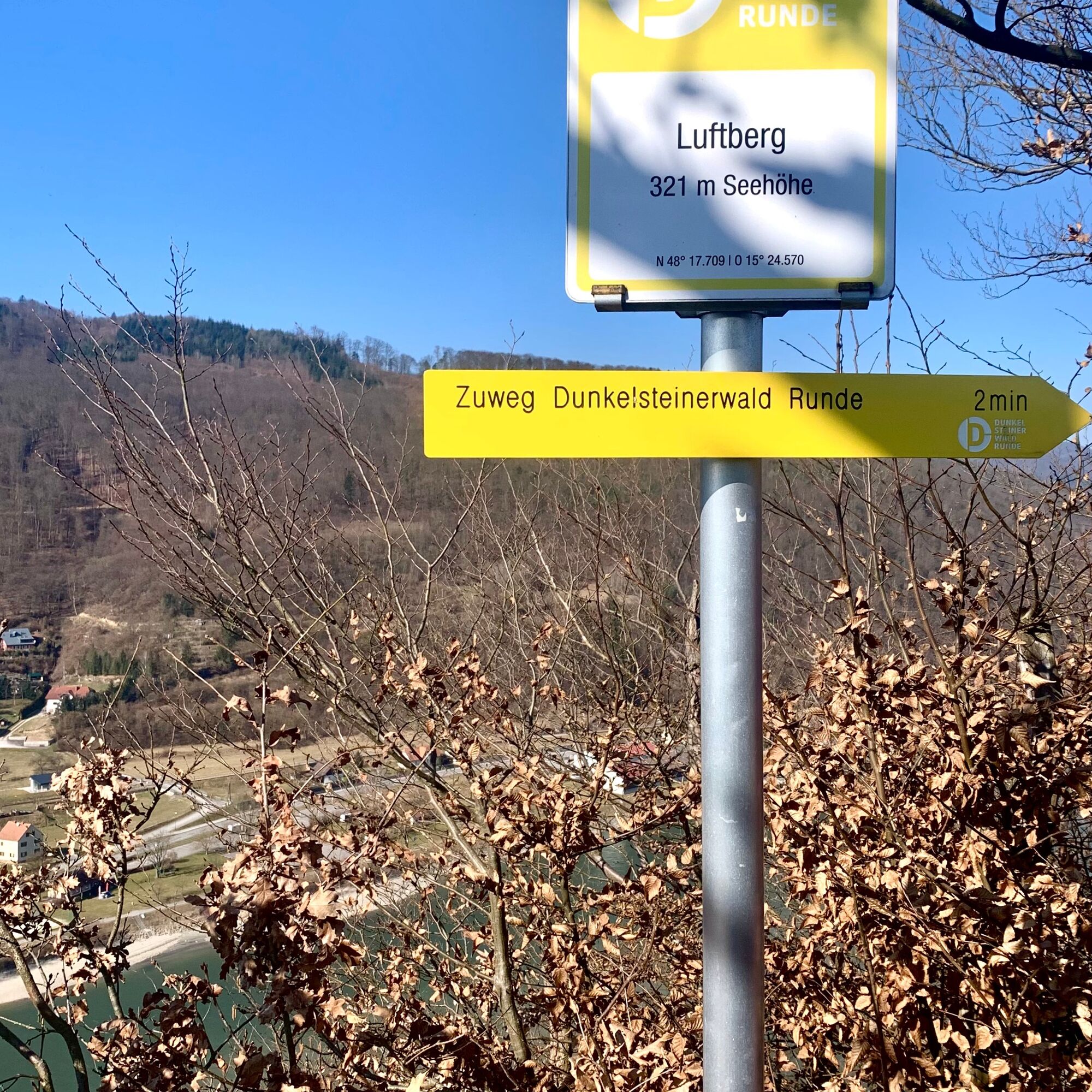
The hike goes around the apricot gardens by first going west to the Luftberg and from there in a north-easterly direction until you descend again in a south-easterly direction to the bottom of the Hartl.
The hike is about 3.5 km long. You should allow around 2 hours for this so that you can enjoy the beautiful view of the Danube with a snack on the summit of the Luftberg.
- Directions
-
From the starting point at the end of the Hartlweg from the state road, which runs through Aggsbach-Dorf, it goes steeply to the north for about 50 to 60 m.
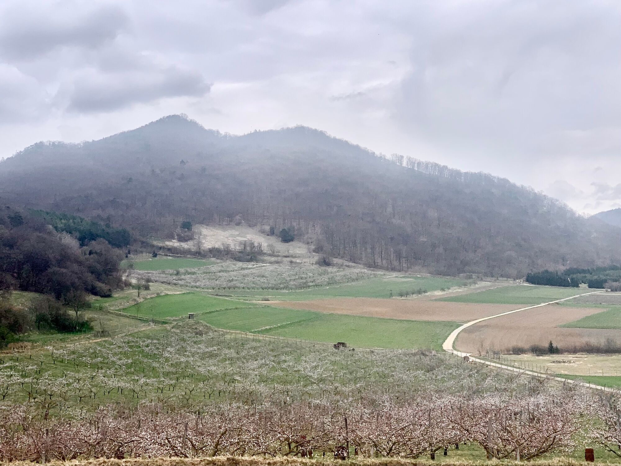
Once at the higher level, a plain spreads out, at the beginning of which we follow the path that runs to the west, which also bears the logo of the Dunkelsteinerunde. At the end the path makes a 90 degree right turn and goes north to the summit of the Luftberg, from which there is a wonderful view of the Danube and the Wachau.
You can see to the west as far as Melk Abbey and to the east you can see the Aggstein Castle ruins on the right bank of the Danube and Schwallenbach, where there are also apricot blossoms, on the left.
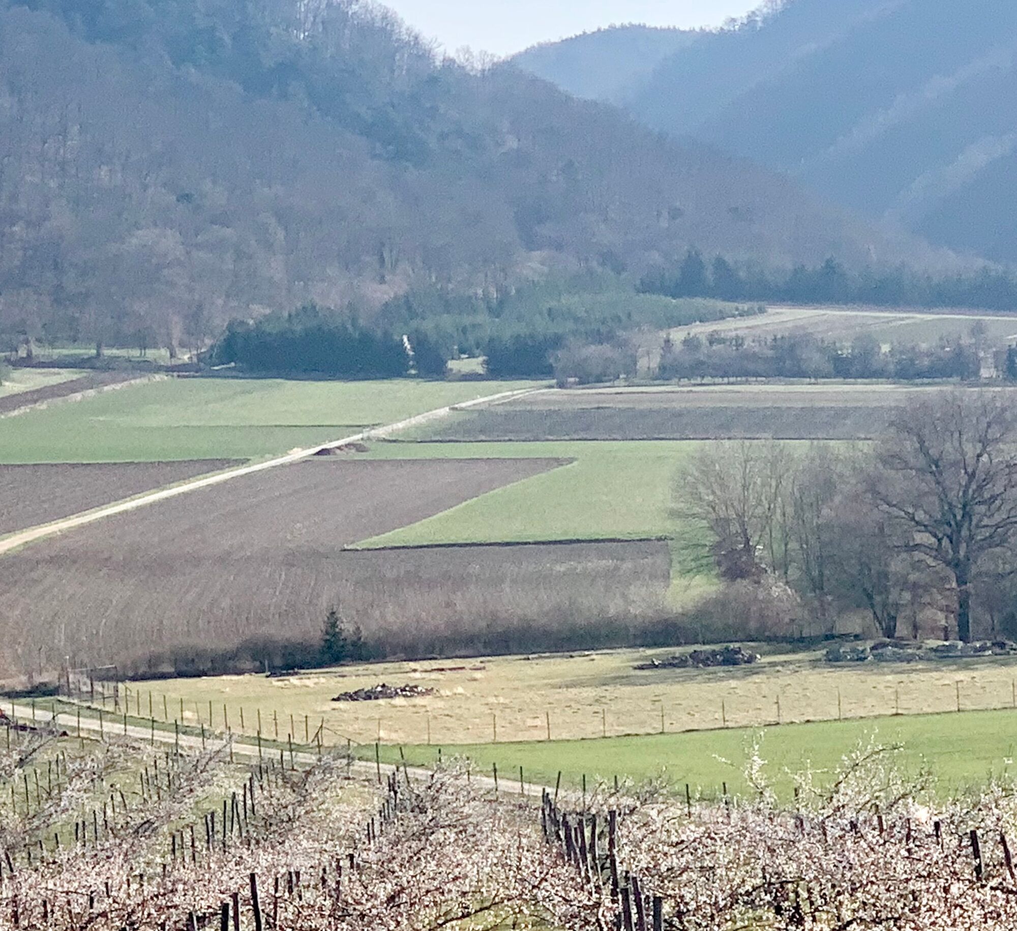
From the Luftberg summit we walk along the ridge in a north-easterly direction until we reach the World Heritage Trail, which is also the Way of St. James in this section, and continue downhill to the right in a south-westerly direction. Here we come to the 2nd large apricot garden of the Hartl, this is the name of this raised ground from the Aggsbach valley, on the right hand side.
When we have reached the level of the plain, we continue in a westerly direction until we turn left onto the approaching Hartlweg and on the same path that we came up on, we descend again to the state road.
- Highest point
- 341 m
- Endpoint
-
At the starting point at the end of the Hartl Weg from the L162 state road.
- Height profile
-

- Equipment
-
Hiking shoes and something to drink as well as provisions for a snack on the Luftberg.
- Safety instructions
-
Hiking shoes are necessary to climb the Luftberg.
To protect the knee joints, some may use hiking sticks, which can also be helpful on a short, steep descent in a northeasterly direction.
- Tips
-
A visit to the Carthusian monastery of Aggsbach, a former Carthusian monastery that was founded in 1380.
As a fief of the dukes of Bavaria, Aggsbach was owned by the Kuenringer, later the Maissauer. In 1380 Heidenreich von Maissau and his wife Anna von Kuenring founded the “Marienpforte” Charterhouse for a prior and twelve monks in a side valley of the Aggsbach. The former cell wing of the Carthusian monastery was demolished in 1782 after the monastery was closed under Joseph II.
A meditation garden was created in its place in 2016, based on the results of the excavation projects of the Federal Monuments Office.
- Additional information
-
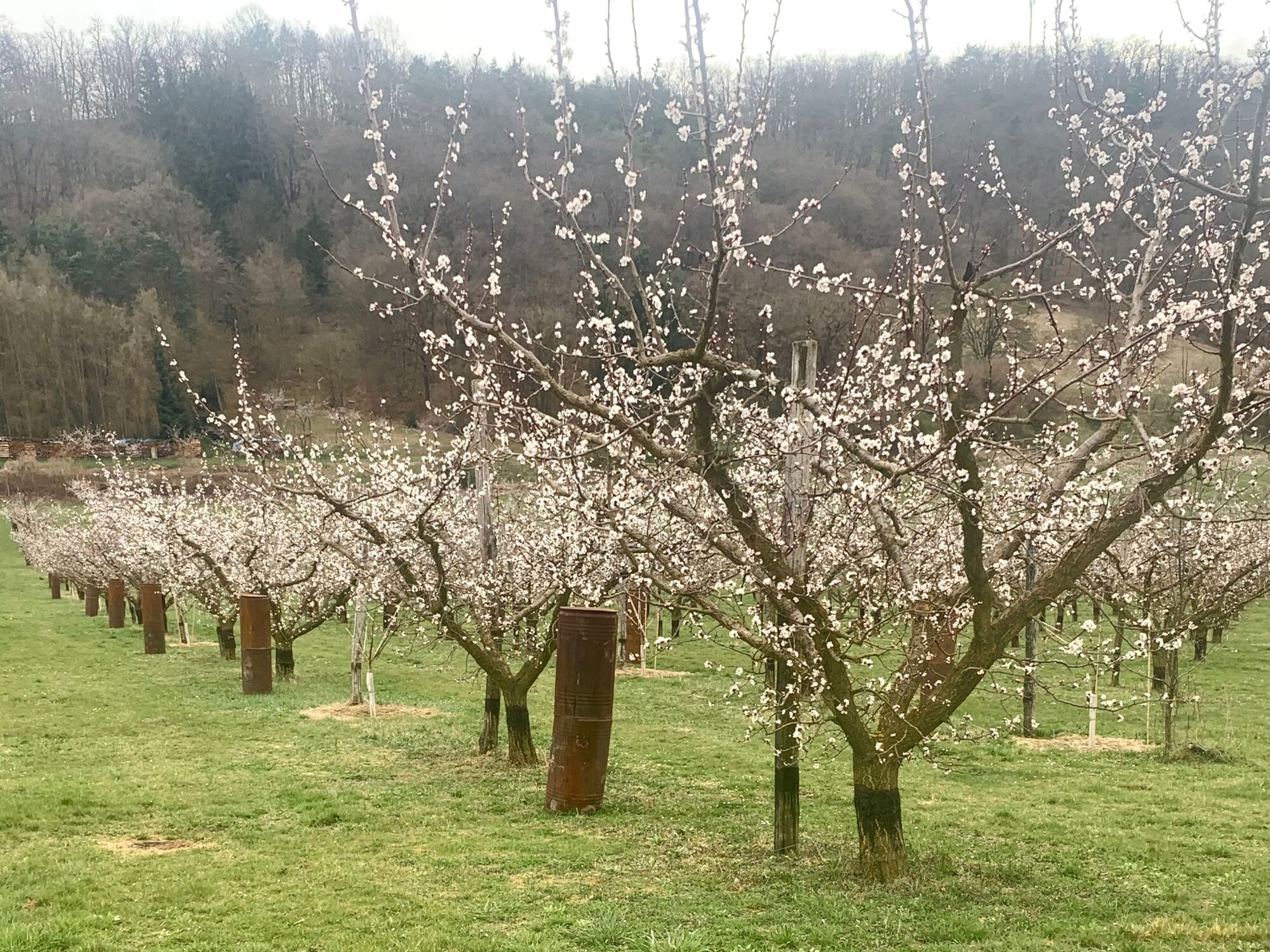
The apricot trees on the Hartl are short-stemmed trees with round crowns. This makes harvesting easier, as it can be done standing without ladders.
According to EU regulation, Wachau Valley apricots are exclusively apricots that grow in the localities of the Wachau.
The "Original Wachau Apricot Association" takes care of the marketing of the Wachau apricot.
- Directions
-
Take the car on the B33 from Mautern or Melk to Aggsbach-Dorf. When driving through Aggsbach-Dorf on the main road in the area of the bridge over the Aggsbach which flows into the Danube, take the junction in the direction of Gansbach, St. Pölten and drive through Aggsbach-Dorf to the municipal office.
- Public transportation
- Parking
-

-
AuthorThe tour Apricot blossom in Hartl on the Luftberg in Aggsbach-Dorf in the Wachau is used by outdooractive.com provided.


General info
-
Donau Niederösterreich
2289
-
Dunkelsteinerwald
1373
-
Schönbühel-Aggsbach
533


