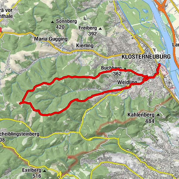
Tour data
20.68km
165
- 490m
350hm
390hm
02:10h
- Brief description
-
Klosterneuburg windischhütte
- Difficulty
-
easy
- Rating
-
- Starting point
-
Essl Museum
- Route
-
KlosterneuburgWeidling2.7 kmKammersberg (392 m)6.2 kmEschenplatzl8.0 kmKropfeiche (495 m)8.9 kmWindischhütte9.9 kmHaschberg (400 m)15.2 kmGöbling17.9 kmSchwarzes Kreuz18.7 kmKlosterneuburg20.6 km
- Best season
-
JanFebMarAprMayJunJulAugSepOctNovDec
- Highest point
- windischhütte (490 m)
- Endpoint
-
Windischhütte
- Rest/Retreat
-
Winischhütte
- Source
- christian seethaler
GPS Downloads


Other tours in the regions
-
Wienerwald
58
-
Wien und Umgebung
40
-
Klosterneuburg
13