HWW-Hiking route: Mönichkirchen - Hochwechsel (circular trail)


- Brief description
-
This HWW hiking route is part of the Wechselland Historical Long-Distance Hiking Trail (HWW), which tells the story of Wechselland along more than 100 HWW stations. More information can be found at www.wechsel-wandern.at.
- Difficulty
-
difficult
- Rating
-
- Starting point
-
Mönichkirchen
- Route
-
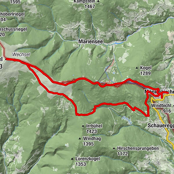
Pfarrkirche Mönichkirchen0.4 kmMönichkirchen0.4 kmSchauquellfassung1.9 kmBerggasthof Mönichkirchner Schwaig3.1 kmAlpengasthof Enzian3.2 kmHallerhaus4.2 kmStoa Alm5.0 kmSteinerne Stiege (1,505 m)5.4 kmNiederwechsel (1,669 m)7.9 kmHochwechsel (1,743 m)11.1 kmWetterkoglerhaus11.1 kmVorauer Schwaig15.3 kmTränktörl21.3 kmMönichkirchen25.1 kmPfarrkirche Mönichkirchen25.4 km
- Best season
-
JanFebMarAprMayJunJulAugSepOctNovDec
- Description
-
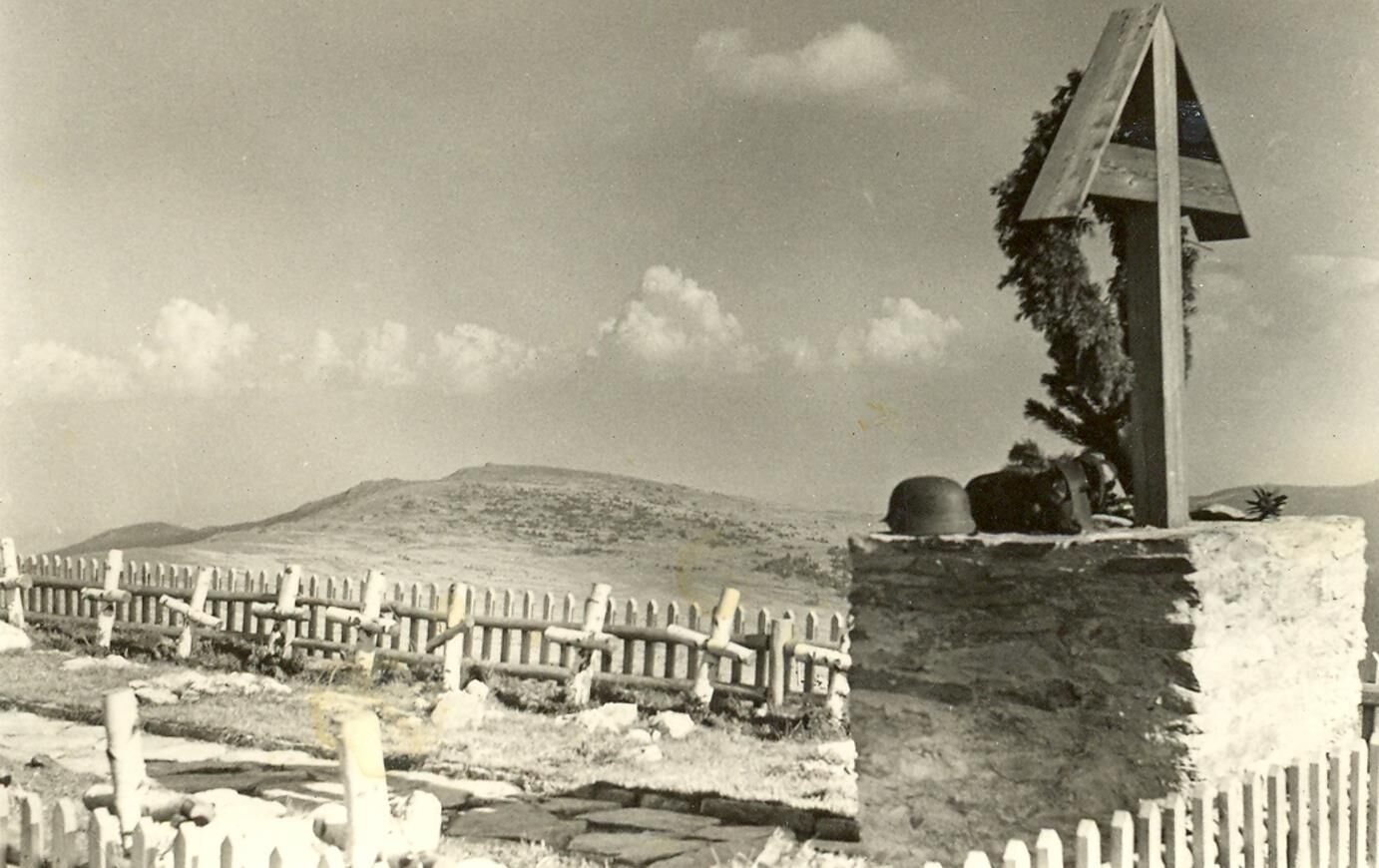
This extensive HWW hiking route leads from Mönichkirchen via the Niederwechsel to the Hochwechsel/Wetterkoglerhaus and from there via the Vorauer Schwaig and Alte Glashütte back to Mönichkirchen. Due to the fierce fighting in April and May 1945, many soldiers fell in Wechselland and the surrounding area. At the HWW station Niederwechsel you can find out which military cemeteries there are in Wechselland.
- Directions
-
The tour is not signposted throughout. Route guidance with app recommended.
- Highest point
- 1,741 m
- Endpoint
-
Mönchkirchen
- Height profile
-

- Equipment
-
Small backpack with water bottle (+ provisions)
Sturdy shoes
Appropriate clothing - preferably several layers - "onion principle
Rain and sun protection
Hiking sticks as needed
Cell phone
Small first aid kit
Route description
Before the start of the hike, check the possibilities for refreshments, including opening times, or pack appropriate food and drink - Safety instructions
-
Important telephone numbers: Euro emergency call: 112 Emergency call mountain rescue: 140 (if possible please give GPS data) Rescue: 144 Fire department: 122 Police 133
The trail can be walked without any major difficulties and is therefore suitable for the whole family.
Tips for even more hiking pleasure: Rules of conduct while hiking.
A few tips on how to behave properly and fairly in the forest:
(Source: www.bundesforste.at )
Hikers should avoid visits to the forest about 1.5 hours before sunrise and after sunset, as wild animals are particularly active during this time. Plastic bottles, handkerchiefs, cigarette butts & Co have no place in the forest! Please make sure that you do not leave any trash in the forest. Camping and making fire - is strictly forbidden in the forest! In principle, each person is allowed to collect 2 kg of mushrooms and berries per day for personal use in the forest. It is only forbidden if the forest owner expressly prohibits it. - Additional information
-
Historical long-distance hiking trail Wechselland
www.wechsel-wandern.at
Historical Association Wechselland
Chairman Dr. Andreas Salmhofer
Tel: +43 664/400 27 17
info@geschichte-wechselland.at
www.geschichte-wechselland.at
Information about the region, places to stop and stay, excursion destinations, etc., can be found here:
Eastern Styria Tourist Board
Herbal Region Wechselland office
Main square 20, 8240 Friedberg
T: +43 3339/25110-19
wechselland@oststeiermark.com
www.oststeiermark.com
- Public transportation
-
Timetables and travel information can be found at:
Bus: www.richard.at
Train: www.oebb.at
For local transportation we recommend the SAM- Sammeltaxi Oststeiermark: www.oststeiermark.at/sam
-

-
AuthorThe tour HWW-Hiking route: Mönichkirchen - Hochwechsel (circular trail) is used by outdooractive.com provided.


General info
-
Wiener Alpen
3040
-
Wechselland - Wiener Alpen
1701
-
Mönichkirchen
358