
- Brief description
-
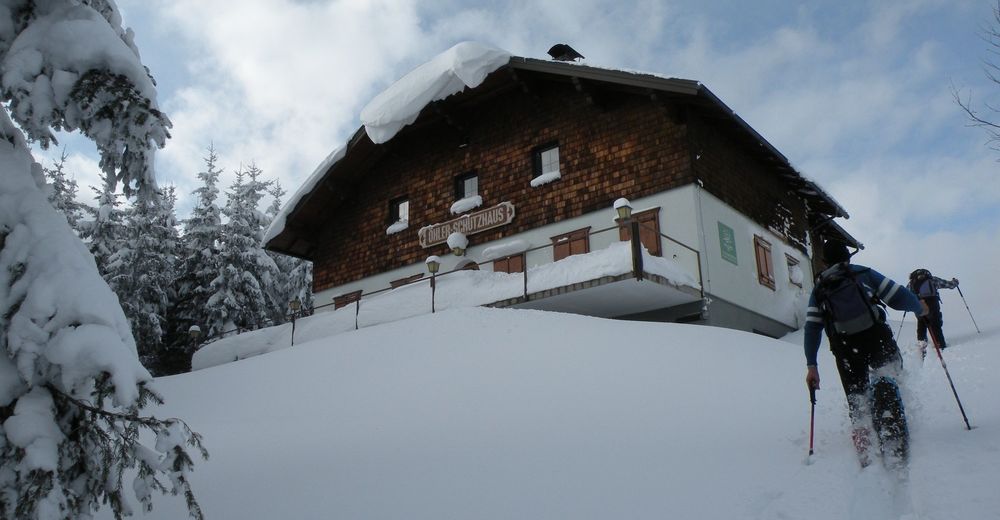
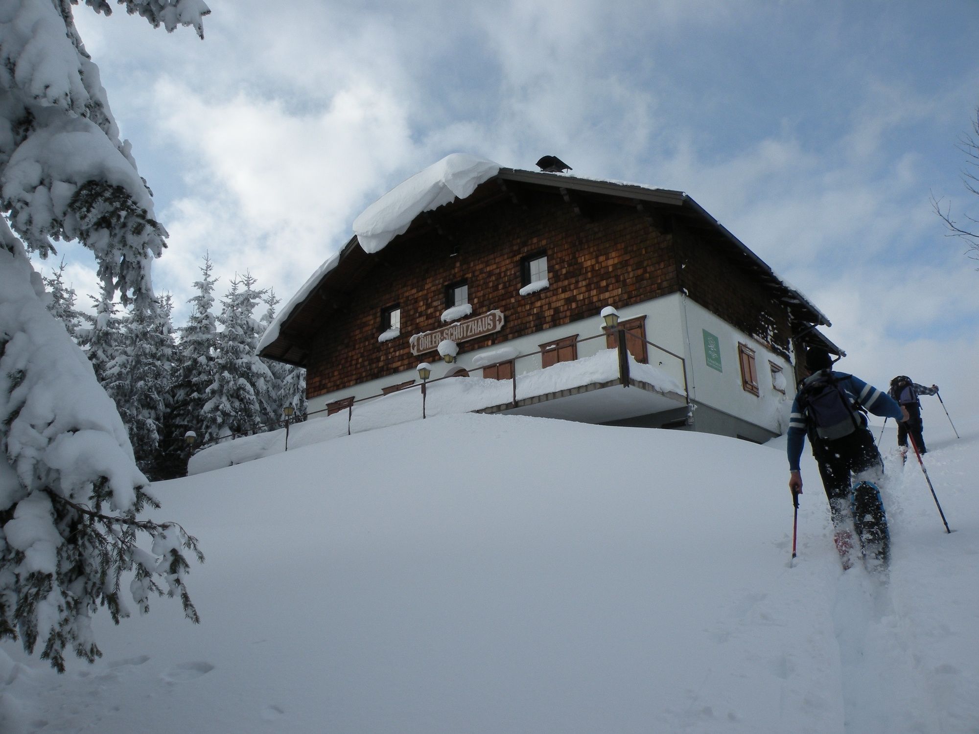
Wonderful snowshoe hike from Puchberg to the Öhler.
- Difficulty
-
difficult
- Rating
-
- Starting point
-
Tourism office Puchberg am Schneeberg
- Route
-
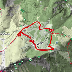
Puchberg am Schneeberg (577 m)0.7 kmPuchberg am Schneeberg (577 m)0.8 kmPuchberg am Schneeberg1.0 kmSierning1.4 kmKaisereben5.5 kmÖhlerschutzhaus8.2 kmKaltes Bründl11.4 kmSchoberbachklamm-Halbhöhle12.1 kmRegenmanndllucke12.2 kmSchoberbachklammhöhle12.4 kmUntere Öhlerhöhle12.5 kmSierning16.7 kmPuchberg am Schneeberg17.2 km
- Best season
-
AugSepOctNovDecJanFebMarAprMayJunJul
- Description
-
Wonderful winter tour through snow-covered forests over the Kaiserebenwiese to the Schoberalm. A visit to the Öhlerschutzhaus is worthwhile, it is known for its excellent cuisine. Please note the opening hours.
- Directions
-
We go from the tourist office in the direction of Schneeberghof and the Spar market. There we turn opposite into the Sierningstraße and follow the road for about 1 km. Then we turn right at the red mark and the ascent begins. We then follow the blue marking over the Kaiserebenwiese to the Öhlerschutzhaus. From there we continue along the red markings to the Schoberalm and then back through the Haltberg valley to the centre of Puchberg.
- Highest point
- 1,039 m
- Endpoint
-
Tourism office Puchberg am Schneeberg
- Height profile
-

- Equipment
-
You need a sporty winter garment (waterproof, windproof and breathable), firm and waterproof winter or hiking boots reaching over your ankle, gloves, a winter hat and sunglasses. A backpack with granola bars and drinks in a thermos for the trip, spare clothes to change, balaclava and a second pair of gloves (mittens), ski goggles and sunscreen.
- Safety instructions
-
Mountain rescue emergency number: 140 EU emergency number: 112
Lawineninfo: http://www.lawinenwarndienst-niederoesterreich.at/
Your hiking experience in the Vienna Alps should be a thoroughly enjoyable and safe one. Therefore, please bear the following in mind: Preparation: When choosing a route, make sure it corresponds to your experience and physical fitness level. Check the weather forecast before you set off. The weather can change surprisingly quickly in the mountains. Always take appropriate equipment with you (e.g. rain protection).
Check whether the cabins and snack stations you intend to visit along the way are open. Inform someone before you set off of your chosen route and when you plan to return.
- Additional information
- Directions
-
Take the A2 to the Wiener Neustadt West exit and then follow the B26 towards Puchberg. In Puchberg follow the signs to the tourist office.
- Public transportation
- Parking
-
Free parking is available in the immediate vicinity of the tourist office.
-

-
AuthorThe tour Öhlerschutzhaus snowshoe hike Puchberg am Schneeberg is used by outdooractive.com provided.