© (C) Wolfgang Wutzl - Wolfgang Wutzl
- Brief description
-
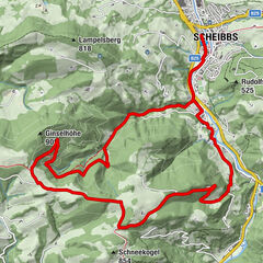
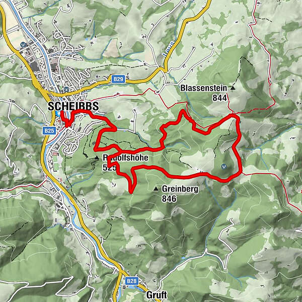
Von Scheibbs auf Asphalt bis zum Blassensteinparkplatz und über einen Forstweg wieder retour ins Tal.
- Difficulty
-
medium
- Rating
-
- Route
-
Scheibbs (331 m)Pfarrkirche0.5 kmScheibbs0.5 kmSchöllgraben0.8 kmSchöllgraben11.6 kmPfarrkirche11.8 kmScheibbs11.9 km
- Best season
-
JanFebMarAprMayJunJulAugSepOctNovDec
- Highest point
- 787 m
- Endpoint
-
Scheibbs, Bahnhof
- Height profile
-

- Author
-
The tour Blassenstein-Strecke is used by outdooractive.com provided.
GPS Downloads


General info
Refreshment stop
A lot of view
Other tours in the regions
-
Mostviertel
151
-
Eisenstraße Niederösterreich
65
-
Scheibbs
19