- Brief description
-
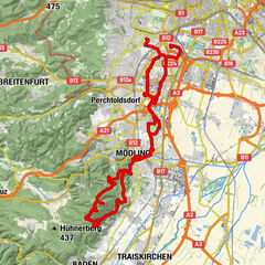
The nature park and Perchtoldsdorfer Heide are the definitive and impressive components of this tour. Extensive panoramic views, the constant alternation between the forest and clearing and the many mountain huts and guest houses along the way add up to a delightful medley of the Vienna Woods’ treats.
- Difficulty
-
easy
- Rating
-
- Route
-
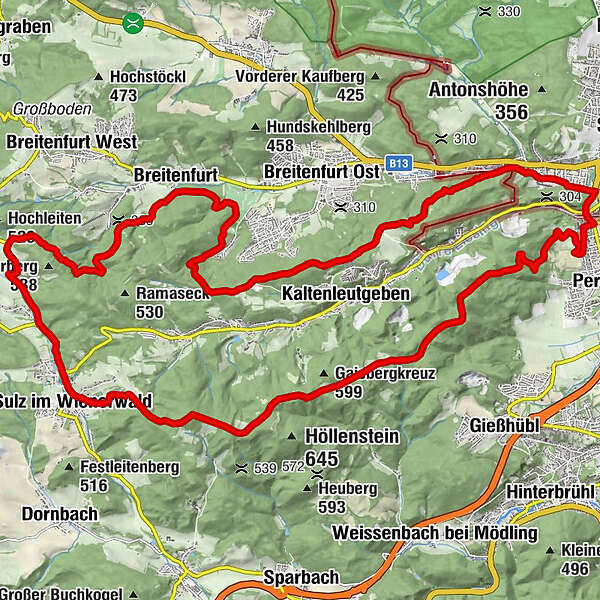
Gasthaus zum Salzstanglwirt auf der Kugelwiese4.6 kmGroßer Sattel (543 m)5.1 kmRastplatz Seewiese6.4 kmHochstraße VI6.8 kmHochstraße VII7.1 kmKreuzsattel (592 m)8.6 kmMaria Namen11.7 kmSulz im Wienerwald11.9 kmStangau12.4 kmWöglerin13.4 kmGeorg's Bründl16.1 kmSteingraben17.1 kmBreitenfurt19.6 kmHelenenquelle23.5 kmLattermaißberg (452 m)24.1 kmWienerquelle26.0 kmWiener Hütte26.4 kmKalksburg30.0 kmJohann Nepomuk Kapelle30.6 kmRodaun30.8 kmBergkirche Rodaun31.0 km
- Best season
-
JanFebMarAprMayJunJulAugSepOctNovDec
- Directions
-
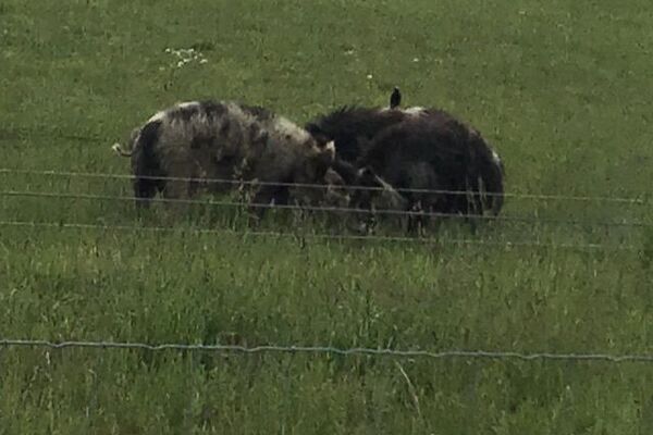
The tour begins with the undisputed highlight, viz. a trip through Perchtoldsdorfer Heide, a steppe on the outskirts of the federal capital and an internationally-renowned ÖkO reserve. The safari through this natural treasure doesn’t take long , but it definitely manages to impress: there are dry grasslands that appear to be Pannonian on both the left and the right, along with sparse vegetation and constant chirping, buzzing and rustling. If the panorama of Vienna reaching up to Kahlenberg and Anninger was not a backdrop, we would think we were in the sleek steppe landscape of Kyrgyzstan. After travelling through the wonderful natural environment of the nature park and passing some very beautiful rest areas (all of which takes about 2.5 to 3 hours), we return to Sonnbergstraße and Berggasse. On account of reasons related to nature protection, it is forbidden to travel using areas other than the road!
- Highest point
- 610 m
- Endpoint
-
Heideparkplatz in Perchtoldsdorf
- Height profile
-

- Tips
-
Trip from the Perchtoldsdorfer Heide to the Kammersteinerhütte and the Josefswarte. You will be rewarded with a great view!
Dry grasslands are extremely rare and strictly protected habitats throughout Europe with unique flora and fauna. It is therefore forbidden to drive on the Heide dry grass off the asphalt road. Please consider!"
Interesting link: Perchtoldsdorfer Heide
There are the following places to stop in the vicinity:
Kammersteinerhütte Teufelsteinhütte Landgasthaus Stockerwirt Postschänke Wiener HütteUpdated on: 13.12.2019
- Public transportation
-
to Rodaun via tram 60 or bus 60A
follow the signposting leading to Heide for ca. 10 minutes
- Parking
-
Heideparkplatz (Berggasse/Lohnsteinstraße) in Perchtoldsdorf!

- Author
-
The tour Parapluie-Strecke is used by outdooractive.com provided.


General info
-
Wienerwald
291
-
Wien und Umgebung
206
-
Kaltenleutgeben
114